Overview
The Out Islands beyond Eleuthera, the Exumas and the Abacos are the Bahamas at its quietest: long empty beaches, flats for bonefishing, reefs and blue holes, a few settlements of a few hundred people, and very little else. This page covers Long Island, Cat Island, San Salvador, Crooked and Acklins, Mayaguana, Inagua, Rum Cay, Ragged Island and the Berry Islands. They are also called the Family Islands, and the two names mean the same thing.
Each island below says what it is for, how people get there, where visitors stay, who it suits and what to bring. The common thread is the trade-off. You give up the choice, the convenience and the safety net of Nassau, and in return you get space. That trade is a good one if you plan for it and a poor one if you arrive expecting a resort.
For the better-known islands see the Exumas, Eleuthera, Abaco and Andros pages. For the whole map, start at the islands overview.
Watch out
Hurricane Melissa (October 2025) crossed Long Island and then San Salvador, and its winds, flooding and power cuts also hit Crooked Island, Cat Island and Rum Cay. We have no confirmed report on how fully each island has recovered, so we describe the islands as they are normally known. Ask your host and airline what is open before you pay for anything.
Choosing an island
Start with what you want to do, then check that you can reach it. The table gives the Ministry of Tourism's airport names, and an island with a Bahamasair flight is usually easier to book than one served only by charter.
| Island | Best for | Airport(s) | Suits |
|---|---|---|---|
| Long Island | Beaches, Dean's Blue Hole, caves, bonefishing | Deadman's Cay, Stella Maris | Couples, anglers, divers, drivers |
| Cat Island | Hiking to Mount Alvernia, pink-sand beaches, kiteboarding | New Bight, Arthur's Town | Walkers, quiet-beach seekers |
| San Salvador | Diving, Columbus history, birding, lakes | San Salvador (Cockburn Town) | Divers, history fans |
| Crooked and Acklins | Bonefishing, birding, Lucayan sites | Colonel Hill (Crooked), Spring Point (Acklins) | Anglers, solitude seekers |
| Mayaguana | Empty beaches, remote fishing | Mayaguana | Very self-sufficient travelers |
| Inagua | Flamingos and other birds, salt works | Matthew Town | Birders, photographers |
| Rum Cay | Diving, a wreck, Conception Island by boat | Port Nelson | Divers, boaters |
| Ragged Island | Deep-sea fishing, the Jumentos Cays | Duncan Town | Anglers, yachties |
| Berry Islands | Big-game fishing, snorkeling, cays | Great Harbour Cay, Chub Cay | Boaters, anglers |
If you are unsure, pick one island and stay put. The flights between the far islands usually run through Nassau, so linking two of them can take a day each way. The flights guide and the getting around guide cover the main routes.
Long Island
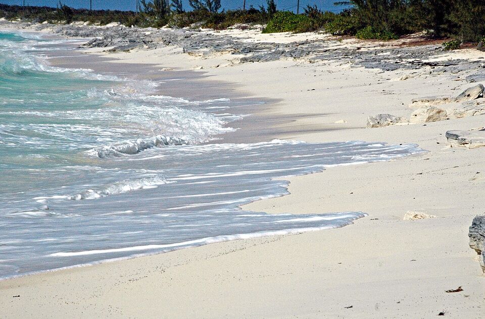
Long Island is about 80 miles (130 km) long and at most about 4 miles (6 km) wide, roughly 165 miles (265 km) southeast of Nassau, and the Tropic of Cancer crosses its northern quarter. The Atlantic side has steep rocky headlands and the sheltered side has broad white beaches. It had 2,887 residents at the 2022 census, and fishing is the main local business.
What it is for
Dean's Blue Hole, west of Clarence Town, drops about 663 ft (202 m) and is among the deepest blue holes known; the Ministry of Tourism calls it the world's second deepest. Cape Santa Maria Beach, at the island's northern tip, is the postcard beach. Add the twin churches at Clarence Town, caves near Hamilton's that are partly open for tours, and bonefishing on the flats. Sailing, snorkeling and diving are also on offer, and the diving and snorkeling guide covers the blue hole.
Getting there and around
Long Island has two airports: Deadman's Cay (mid-island, the busiest) and Stella Maris in the north. Bahamasair and local carriers serve them from Nassau, and some visitors connect from Exuma. A January 2026 news headline reported a temporary shift of Long Island flights to Stella Maris, so confirm which airport your flight uses. Roads run the length of the island on one main route, taxis are limited, and distances are long, so arrange a rental car or a driver before you land. Remember that the Bahamas drives on the left (see the driving guide), and a fuel stop may be a long way off.
Where to stay and who it suits
Stays are small resorts, bonefishing lodges, guesthouses and rental cottages, mostly around Stella Maris in the north and near Deadman's Cay and Clarence Town. We have not confirmed which are open, so check the Ministry of Tourism's hotel listings and ask each property about hurricane repairs. It suits couples, anglers, divers and independent drivers who are happy with a quiet week. Salt Pond hosts the Long Island Regatta each year; confirm the date before you build a trip around it.
Bring: cash, snorkel gear, sun protection, a flashlight and groceries for the first night.
Cat Island
Cat Island has 1,602 residents (2022) and the highest point in the Bahamas, Mount Alvernia, at about 207 ft (63 m). A small stone hermitage built by hand by the Franciscan Father Jerome (born John Hawes) sits on top, reached by a steep rocky path. The tourism site also lists Sidney Poitier's boyhood home in Arthur's Town, Old Bight beach, Port Howe and a long, pink-tinted shoreline popular for kiteboarding and surfing.
Smaller sights include the church Father Jerome built at Old Bight, the settlement of Port Howe, blue holes and the Griffin Bat Cave. We name no places to stay because we could not confirm which are open, so ask each one before you book. Cat Island has two airports, New Bight and Arthur's Town. Flights come from Nassau, and the island is long and spread out, so a rental car or a pre-arranged driver matters more than on a small cay.
It suits walkers, couples and readers who like silence. The island is not for people who want a beach club or an evening scene. Bring: sturdy shoes for the hermitage path, water, a hat, cash and insect repellent.
San Salvador
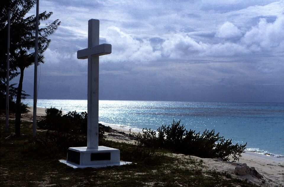
San Salvador is a small island with 824 residents (2022), and the main settlement is Cockburn Town. It is widely thought, though still disputed, to be where Christopher Columbus first landed in the Americas on October 12, 1492. The island was called Watling's Island until 1926. Monuments mark the landing story, and the Dixon Hill lighthouse, about 160 ft (49 m) tall and built in 1887, stands on the east side.
The island is a diving destination first. A narrow shelf drops off quickly, which gives wall dives on the west coast and shallow reefs and a big lagoon at Grahams Harbour on the north side. The west coast faces the Great Bahama Bank and is calmer, while the Atlantic side is rougher. Ask your operator which side is diving that day. Water runs from about 73 to 84°F (23 to 29°C) depending on the place and season. Watling's Blue Hole, Great Lake National Park and the Gerace Research Centre round out the island, and the Cockburn Town fossil reef is a rare visible coral formation.
San Salvador has its own airport at Cockburn Town (Bahamasair serves it). The island lost power and cell service after the October 2025 hurricane, so ask your host about the current state of services. It suits divers, history fans and birders. Bring: your certification card and logbook if you dive, a snorkel set, cash and a power bank.
Crooked Island, Acklins and Long Cay
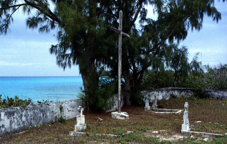
These islands surround a shallow lagoon, and the draw is bonefishing, birdwatching, Turtle Sound, Lucayan sites and the sleepy settlement on Long Cay. Crooked Island's airport is Colonel Hill (Crooked Hill), and Acklins has Spring Point, with Pitts Town Point also listed by the tourism site. The Bight of Acklins is the main district.
This is among the thinnest-served parts of the country. Winds of 85 mph (137 km/h) gusted across Crooked Island in the October 2025 hurricane and the area was under evacuation orders beforehand, so recovery may still be under way. It suits anglers and travelers who do not mind improvising. Bring: everything you need for fishing, spare cash, groceries and a spare phone battery. Book local guides well ahead, because the supply is small.
Mayaguana
Mayaguana is among the most isolated islands in the country: the settlement of Abraham's Bay, empty beaches (Horse Pond Beach and Booby Cay are named on the tourism site), Pirates Well and fishing. Its airport is Mayaguana, and Bahamasair lists it as a destination. There are very few services, so treat it as a self-sufficient trip. It suits experienced Out Island travelers only. Bring: all food for the first days, cash and a clear plan B if a flight is cancelled.
Inagua
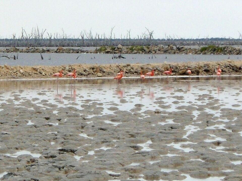
Great Inagua, with Little Inagua beside it, is the southernmost district of the Bahamas, about 55 miles (89 km) from the eastern tip of Cuba. Great Inagua is large (about 55 by 19 miles, or 89 by 31 km) and flat, with 856 residents (2022) and one town, Matthew Town, on the island's only harbor. A big solar salt works is the main employer.
The reason to come is Inagua National Park, run by the Bahamas National Trust. It covers 220,000 acres, was established in 1965 and holds the world's largest breeding colony of West Indian flamingos, which numbers in the tens of thousands. The tourism site also lists the Great Inagua lighthouse, Little Inagua National Park and the Union Creek reserve, known for green sea turtles, and says the island has about 140 other bird species. Breeding colonies are sensitive, so arrange your visit through the Bahamas National Trust (bnt.bs) or your host, not on your own.
Bahamasair serves Matthew Town. Plan the trip as a few nights for birds and quiet, not a beach holiday. It suits birders and photographers. Bring: binoculars, a long lens, a hat, water, sun protection and cash.
Rum Cay and Conception Island
Rum Cay has Port Nelson as its settlement, ancient Lucayan art, white beaches, Hartford Cave and dive sites including the wreck of the HMS Conqueror. A short boat ride away is Conception Island National Park, one of the best-preserved natural areas in the Bahamas. Rum Cay flooded in the October 2025 hurricane and had poor cell service afterward. Southern Air Charter serves Port Nelson from Nassau, and many visitors arrive by their own boats. It suits divers and boaters. Bring: dive gear if you own it, food, fuel plans if you are boating and cash.
Ragged Island and the Jumentos Cays
Ragged Island is a small, remote island with a single settlement, Duncan Town, and a chain of uninhabited cays (the Jumentos) running southeast. The tourism site names deep-sea fishing, with bonefish, barracuda, tuna and kingfish, as the attraction. Duncan Town airport is served by Southern Air Charter from Nassau. Evacuation orders covered the island before the October 2025 storm. It suits anglers and cruising boaters who bring their own supplies. Bring: all supplies, spare cash and flexible dates.
The Berry Islands
The Berry Islands are a chain of about 30 cays and over 100 smaller islets, with about 1,000 residents (2022), most on Great Harbour Cay. The area is known as the "Fish Bowl of the Bahamas" for its marine life. Great Harbour Cay is the largest island at about 8 miles (13 km) long, and Chub Cay is the second largest and has its own airport. A fishing tournament gathers anglers on Great Harbour Cay in May; confirm the date.
Flamingo Air flies from Nassau to Great Harbour Cay, and the two airports are Great Harbour Cay and Chub Cay. Lodging is limited, and one source says there are no hotels, only villas and townhouses for rent, so check what is available and confirm it with the owner. Little Stirrup Cay (a Royal Caribbean private destination, which the cruise line calls CocoCay) and Great Stirrup Cay (Norwegian Cruise Line) are cruise-ship stops and not open to independent visitors; see the cruises guide. It suits boaters and anglers, with the fishing and boating guide for the rules.
Getting there: planes and mailboats
Almost every trip starts at Lynden Pindling International Airport in Nassau (airport guide). Bahamasair flies to Long Island (Deadman's Cay and Stella Maris), San Salvador, Crooked Island, Acklins, Mayaguana and Inagua, and local carriers such as Flamingo Air and Southern Air Charter cover smaller strips. Some routes, such as Exuma to Long Island, avoid Nassau. We have not confirmed current schedules or fares, so check bahamasair.com and the small airlines' own sites. Bahamasair's reservations line is 1-242-702-4140 (US toll-free 1-800-222-4262; Out Islands 1-242-300-8359).
Small-plane flights on the far islands are often only a few times a week, and they cancel for weather or mechanical reasons. Build a spare night into the start and end of your trip, particularly before an international flight home. A US-bound flight from Nassau goes through US preclearance, which needs time, so never book a tight connection (see the flights guide).
The alternative is the mailboat, a freight ship that also carries passengers from Potter's Cay dock in Nassau. It is slow, often overnight or longer to the far south, and the schedule changes with weather and cargo. We have no confirmed schedule or fare, so ask at Potter's Cay or the Ministry of Transport. It suits flexible, patient travelers, and it is a poor choice if you have a fixed return flight. Bahamas Ferries serves only a handful of destinations (see getting around), and we found no passenger ferry to these far islands.
Insider tip
Book the return flight to Nassau for the day before your international flight, not the same day. If a small plane is cancelled you still make the connection, and you avoid paying for a missed ticket.
What remoteness costs you
The far islands have fewer ATMs, fewer shops, thin medical care and a fragile power supply. Plan for these facts instead of hoping around them.
- Cash. ATMs may be absent or empty, and card machines depend on power and signal. Bring more cash than seems sensible, in small bills. US dollars work everywhere, but change is often given in Bahamian money, which is hard to exchange back home. See the money guide.
- Food. Shops are small and stocks run low before the supply boat arrives. Restaurants may close on certain days or take orders only in advance. Bring snacks, and buy groceries in Nassau or Exuma if you are self-catering. Prices are higher, and VAT applies (see the budget guide).
- Medical care. Small islands usually have a clinic rather than a hospital, and serious cases usually mean an air ambulance flight to Nassau or Florida. Buy travel medical insurance with evacuation cover, bring all prescriptions and a first-aid kit, and read the health guide. For an emergency, dial 911 or 919.
- Power and signal. The Bahamas uses 120 V with US-style plugs, but outages are common after storms. Pack a flashlight, a power bank and downloaded maps. Check your carrier's Bahamas rate before you go (see staying connected).
- Water. Many visitors drink bottled or filtered water, especially on the Out Islands. Ask your host.
- Fuel. Gas stations can be few. Ask how fuel is priced and whether your host can arrange it.
How to plan a far Out Island trip
- Pick one island and one reason. Diving, bonefishing, birds or beach time. Match the reason to the table above.
- Choose dates outside the worst of hurricane season. The season runs June 1 to November 30. The Bahamas is busiest from mid-December to April, and the quieter months cost less but bring weather risk (see the hurricanes guide and when to go).
- Book the flights first. Seats on small planes are few, and the airline schedule decides everything else. Then book the room, then the car or transfer.
- Ask your host five things in writing. Is there power and water now? How do I get from the airport? Which meals are served? Do you take cards? Who can guide fishing, diving or hikes?
- Buy insurance. Look for medical evacuation and trip interruption.
- Pack and shop. Use the checklist below, and carry the next 48 hours of food on any island you have not confirmed has a store.
- Re-check a few days before. Airline, weather, and the National Hurricane Center (nhc.noaa.gov) and the Bahamas Department of Meteorology.
What to bring
- Cash in small US bills, enough for the whole stay
- Printed or offline copies of bookings, your host's number and your insurance details
- Groceries for the first night and a bag of snacks
- Prescriptions in original bottles, a first-aid kit and insect repellent
- Reef-friendly sun protection, hat, rash guard and water shoes
- A flashlight or headlamp, a power bank and a small battery fan if you are sensitive to heat
- Binoculars for Inagua and birding, or your fishing and dive kit
- A passport valid for at least six months, since your flights home connect through Nassau (see the entry guide)
Mistakes to avoid
- Arriving without cash or groceries. The most common error. A stranded evening with no open shop is avoidable.
- Assuming restaurants are open. Hours are informal and may change without notice. Call ahead.
- Packing the schedule. A cancelled plane ends a tight itinerary. Leave a buffer day.
- Ignoring boat weather. Mailboats and tour boats do not sail in rough seas.
- Relying on one phone app. Signal can drop. Keep offline maps.
- Treating a protected area as a playground. National parks and bird colonies have rules. Follow your guide's instructions, and see the safety guide.
- Assuming a rental car is waiting. Cars are few and are not always at the airport. Reserve ahead and confirm the pickup.
Different from home
There is no 24-hour pharmacy, delivery or rideshare on these islands. Shops may close on Sundays and holidays, and "island time" is real. Treat any plan that depends on a single shop, a single plane or a single card machine as fragile.
Sample trips
- Four nights
Long Island, slow and independent
Fly Nassau to Stella Maris or Deadman's Cay, pick up a rental car, spend two days on beaches and the Dean's Blue Hole viewpoint, one day on the caves and Clarence Town, one day fishing or snorkeling with a local guide, then fly out with a buffer night in Nassau.
- Five nights
San Salvador, dive and history
Fly in, book a two-tank dive each morning with a licensed operator, spend afternoons at the Columbus monuments, Dixon Hill lighthouse and fossil reef. Allow a day without diving before your flight home.
- Three nights
Inagua, birds first
Fly into Matthew Town, arrange a Bahamas National Trust visit to the flamingo area, add the lighthouse and salt works, then keep the last morning free for weather.
Where to go next
If the far islands sound like too much work, the Exumas and Eleuthera give a quiet-island feel with easier flights and more places to eat. For fishing and diving details by island, see fishing and boating and diving and snorkeling. For all interests at a glance, use the by-interest guide.
Add it to a route in the trip builder, or ask us to plan the hotels, trains and guides for you.