Overview
Ireland is a good place to walk even if you are not a serious hiker. The mountains are modest, most trails are well marked, and a half-day walk can end at a village pub. The scenery is mixed: sea cliffs, mountain lakes, bogs, farmland, monastic ruins and sand beaches. The weather is the part to plan for, because it changes fast and shapes every decision.
This page covers the best walks by region, national parks, cycling and greenways, water sports and wildlife trips, gear, rules about land access, and how to stay safe. If you want a general sense of the island first, see the regions guide. For emergencies, hazards and what to do if something goes wrong, read safety in Ireland as well. Distances and times below are approximate, so confirm with the trail's official site or a current map.
Different from home
Do not expect US-style backcountry permits or ranger stations on most routes. Many trails cross working farmland. There is no general right to roam, so sheep, gates and stiles (steps over a fence or wall) are part of the experience. Distances are in kilometers on signs in the Republic and miles in Northern Ireland.
Best walks by region
Wicklow and Dublin
The Wicklow Way
Ireland's best-known long-distance trail, running south through the Wicklow Mountains, passing Glendalough. Many people walk only a section, and a full walk takes several days with accommodation along the route. Confirm distances on the trail's official site.
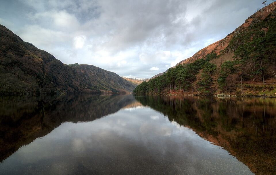
Glendalough
A glacial valley with two lakes, a sixth-century monastic settlement founded by St Kevin and several marked walks. The Visitor Centre costs €5 (about $6) for adults (child or student €3), and paying for parking at its car park includes one free visitor centre admission. It is open 9:30 a.m. to 5 p.m. from October 15 to mid-March (last admission 4:15 p.m.), and closes December 23-29. Dogs must be on a lead.
Bray to Greystones Cliff Walk
A shorter coastal walk south of Dublin that can be reached by the DART train, handy without a car. Check the route's current condition before you go.
Kerry
Killarney National Park
Killarney National Park and Muckross Gardens are free. Walks start from the edge of Killarney town, so you can go without a car. Muckross House charges separately (adult €9, about $10). Ross Castle, in the park, is closed until 2027.
The Kerry Way
A long-distance trail that roughly follows the line of the Ring of Kerry driving route but keeps to quieter tracks and mountain paths. Many walkers do sections rather than the whole loop. See the Ring of Kerry guide for the road route.
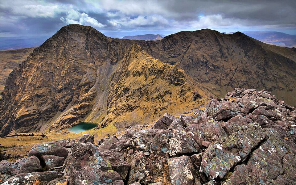
Carrauntoohil
A demanding day, up to about six hours, with steep, eroded and exposed sections. Cloud can arrive without warning. A local mountain guide is strongly advisable unless you are experienced with navigation in poor visibility.
Dingle and the southwest
The Dingle Way
A waymarked trail around the Dingle Peninsula, with coast, beaches and mountain passes. Many walkers do sections from Dingle town, and the Slea Head area is especially popular. Signs in the Gaeltacht may show only Irish names. See the Dingle guide.
Cliff and coast walks in West Cork
West Cork offers coastal walking and short loop trails. See the Cork guide for a base.
Clare, Galway and Connemara
The Burren and Cliffs of Moher
The Burren is a rocky limestone region with rare plants and a UNESCO Global Geopark. The Cliffs of Moher admission includes parking and 800 m of paved paths; parts of the longer Cliffs Coastal Walk have been closed, so check cliffsofmoher.ie. See the Cliffs of Moher guide.
Connemara National Park
About 2,000 hectares (about 4,900 acres) of mountains, bog, heath and woodland, including part of the Twelve Bens. Admission is free. The visitor centre is open Wednesday to Sunday, 9 a.m. to 5:30 p.m. "until further notice", and closed Monday and Tuesday since July 1, 2026 except on bank-holiday Mondays. Park grounds close during orange and red weather warnings.
Inis Mór (Aran Islands)
Easy to explore on foot or by bike. The Rossaveel ferry costs €34 (about $38) return for an adult, and a bike is €15 (about $17) return. See the Aran Islands guide.
The northwest and Northern Ireland
Slieve League
Sea cliffs on the Donegal coast, among the highest in Ireland. Croaghaun on Achill Island is higher, at 688 m (2,257 ft). A clifftop route (sometimes called One Man's Pass) is exposed and not for windy days or anyone nervous of heights; choose lower viewpoints if in doubt.
The Causeway Coast
The Causeway Coast Way runs along the cliffs near the Giant's Causeway. The Causeway Coast Way car park costs £12 (about $16) per vehicle. See the Causeway Coast guide.
National parks and protected areas
The National Parks and Wildlife Service (NPWS) runs Ireland's national parks. As we understand it, they include Killarney, Connemara, Glenveagh in Donegal, the Wicklow Mountains, the Burren and Wild Nephin (Ballycroy) in Mayo, and entry to the parks themselves is free. Visitor centres have their own hours, and these change. Confirm on nationalparks.ie. Connemara's centre has been operating reduced hours in 2026, and a National Parks Bill for Connemara was announced on July 24, 2026.
The Heritage Card from the Office of Public Works (Adult €40, about $45) covers state-run historic sites such as Glendalough's visitor centre. It is useful only if you plan to visit several of them. Online sales to customers in the USA are suspended, so buy it at a fee-paying site on arrival.
Cycling and greenways
Greenways are off-road paths for walkers and cyclists, often on old railway lines or canal towpaths. They suit families and anyone nervous about narrow roads. The Great Western Greenway in County Mayo, running through Mulranny toward Achill, is one of the best known. The Royal Canal Greenway runs west from Dublin. Check each greenway's official site for the current route, surface and any closures, because we could not confirm those details. Bike hire is available in many towns along popular greenways; book in summer.
Cycling on public roads is more demanding. Roads are narrow, traffic keeps left, weather is changeable and some roads have fast traffic and little shoulder. A separate Wild Atlantic Way cycling route of about 1,600 km (about 1,000 miles) is signposted, but the driving route is about 2,500 km, so most people ride a section. Wear bright clothing, use lights and plan short days. Electric bikes help on hills, and many hire shops offer them.
Insider tip
The easiest car-free bike day is on an island or a greenway: take the ferry to Inis Mór with a bike, or hire a bike in a greenway town. Both avoid busy roads and give you an early finish.
Kayaking, surfing and wildlife trips
Water activities are widely available on the coast and on lakes. Kayaking trips run on sheltered waters such as Killarney's lakes and along parts of the south and west coasts, with operators who supply boats, buoyancy aids and a guide. Surf schools operate on the Atlantic coast in places such as Lahinch in County Clare, and offer lessons and wetsuit hire. The Atlantic is cold throughout the year, so you will need a wetsuit even in summer.
Whale and dolphin watching trips run from several west and south coast ports. Sightings depend on season and weather, and no operator can guarantee animals. Book with an operator that follows a code of conduct, and expect sailings to be cancelled when conditions are rough. Check operators' sites for the current season. We have not confirmed prices or dates for any of these activities, so ask each operator.
All water sports carry risk. Use licensed operators, wear the safety equipment, and follow the instructor. Never swim, paddle or surf alone, and pay attention to tides and currents. Read the coastal section of safety in Ireland.
Weather, bog and tides
Ireland's weather is the main factor in outdoor safety. Dublin Airport has recorded rain on about 137 days a year (1991 to 2020 averages), and the west coast is wetter: Valentia Island in County Kerry records about 203 rain days a year, and Galway about 170 (older figures). Mountain weather can differ greatly from valley weather. A dry morning can turn to cloud, wind and rain within an hour.
- Look at the forecast and warnings. Met Éireann (met.ie) issues yellow, orange and red warnings. Parks and sights close when orange or red warnings apply.
- Know the bog. Bog can look solid and be deep. Stay on boardwalks and waymarked paths, and wear waterproof boots.
- Respect tides. A rising tide can cut off beaches, rock platforms and sand flats. Check tide tables.
- Mind the cliffs. Edges can be unfenced and crumbling. Stay back, especially in wind.
- Turn back when cloud descends or you cannot follow the path.
If you are in trouble in the hills, call 112 or 999 and ask for Mountain Rescue. On the shore or at sea, ask for the Coast Guard. Mountain rescue in Ireland is largely run by volunteer teams, called out through 999 or 112; the Department of Transport keeps the list of mountain rescue teams. Tell someone your route and return time before you set out.
Watch out
Do not rely on your phone for navigation in the mountains. Signal is patchy, batteries drain in the cold, and fog makes a screen hard to use. Carry a paper map and a compass, or a downloaded offline map, and know how to use it.
Gear
- Waterproof walking boots with good grip, broken in before the trip.
- A waterproof jacket and waterproof overtrousers. A "showerproof" jacket is not enough.
- Layers: a warm mid-layer, quick-dry shirts and a hat and gloves, even in summer.
- A daypack with a dry bag or rain cover, water, food, a first-aid kit, a headlamp, a whistle and a small repair kit.
- A paper map and compass, or an offline map app, plus a charged phone and a power bank.
- Walking poles, which help on wet or steep ground.
- Insect repellent, a midge net and sunscreen. See health and medical care for ticks and sun advice.
- Cash in euros for small cafes and car parks that do not take cards.
The packing list for your whole trip is in the packing guide.
Guided versus self-guided
For most waymarked trails and short walks, you can go on your own. A guide adds value when route-finding is hard (Carrauntoohil, remote ridges), when weather is poor, or when you want local history, geology and wildlife. Guided group walks cost money, and prices vary, so ask operators. Self-guided walking holidays are another option: a company books your lodging, moves your bags and gives you maps and notes, and you walk at your pace. These need booking well ahead in summer. We could not confirm prices, so compare operators' published itineraries and read what is included.
Volunteer organizations such as Mountain Meitheal, which works on upland paths, help maintain trails. See mountainmeitheal.ie if you want to learn about trail work. Their pages also show why some paths are closed or diverted for repair, so respect signs.
Land access, farms and Leave No Trace
Much of Ireland's countryside is privately owned, and there is no general right to roam. Waymarked trails, national parks and many public rights of way are open, but permission may be needed elsewhere. Look for signs, follow the marked route and do not cross fields that are not signposted.
- Gates and stiles. Close gates behind you and use stiles rather than climbing walls or fences.
- Livestock. Keep your distance from cattle and especially cows with calves. Keep dogs on a lead; this is required at some sites such as Glendalough. In lambing season (spring) leave dogs at home where signs ask.
- Private land and notices. If a sign says "private", "no access" or "trail closed", obey it. Trails may be closed for forestry work or conservation.
- Leave No Trace. Take all litter home, stay on paths, do not pick plants or disturb wildlife, and keep noise low. Do not build fires, and do not camp outside designated sites unless you have permission.
- Parking. Use designated car parks and do not block farm gates. Leave nothing visible in your car (see safety in Ireland).
Winter versus summer
Summer gives long days, about 17 hours of daylight in mid-June, and the best chance of dry walking. It also brings crowds at popular sites, more midges and busier roads. Spring and early autumn are quieter and often good. In winter, days are short, with only about 7.5 hours of daylight in mid-December, paths are wetter and storms are frequent. Some facilities close or reduce hours, so check before you go. Skellig Michael is closed until 2027, and Ross Castle is closed until 2027. Winter walking is fine with proper planning: choose shorter, lower-level routes, start early, carry a headlamp and have a fallback. For month-by-month conditions see when to go.
Hiking without a car
You can walk in Ireland without renting a car, but you must plan around buses and trains. These are the easiest bases:
- Dublin. Wicklow is close: the DART train reaches Bray for the Cliff Walk to Greystones. For Glendalough, check for a scheduled bus or a day tour from Dublin; we could not confirm the timetables or fares. Marlay Park, the start of the Wicklow Way, can be reached by city bus (see tfi.ie).
- Killarney. The national park begins at the edge of town, so you can walk to Muckross and the lakes from town.
- Dingle. Day walks on the Dingle Way can start from the town. Local buses and taxis can bridge sections; check timetables.
- Galway. Take the bus and ferry for the Aran Islands (see the Aran Islands guide), or use a day tour for Connemara.
- Belfast. Day tours and buses reach the Causeway Coast.
Remote trailheads often have no bus. In those cases, a taxi or a guided tour is the practical choice, as is driving. Compare options in getting around Ireland, and read driving in Ireland if you decide to rent.
Save money
Most good walking is free. Park trails, greenways, Killarney National Park and Connemara National Park charge no entry. Save your money for a guide on a hard route, a ferry, and a bike hire day.
Add it to a route in the trip builder, or ask us to plan the hotels, trains and guides for you.