Overview
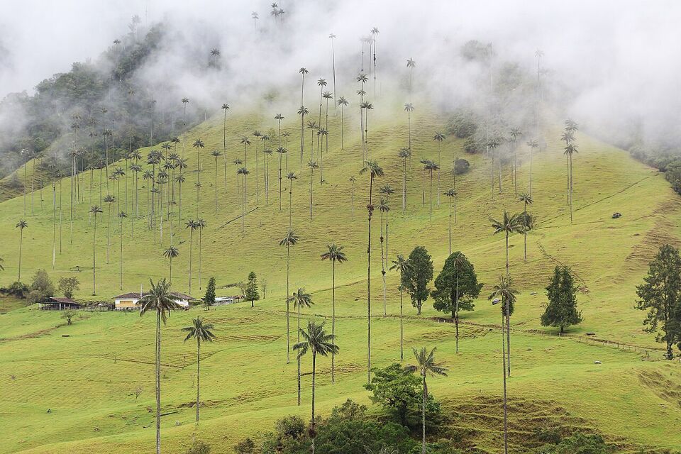
The coffee region (Zona Cafetera or Eje Cafetero, "the coffee axis") is the green belt of the Andes where much of Colombia's coffee grows. For most Americans it comes down to one town and one valley: Salento, and the Valle de Cocora with its tall wax palms. Plan three nights, base yourself in Salento, and add a farm visit and one other town if you can.
The region covers three departments (states): Quindío, Risaralda and Caldas, with their capitals Armenia, Pereira and Manizales. Wikipedia describes the axis as also reaching into parts of Tolima, Valle del Cauca and Antioquia. In 2011 UNESCO listed the "Coffee Cultural Landscape" as a World Heritage site, which includes the historic center of Salento.
The weather here is the opposite of the coast. Think mountain towns with cool mornings, afternoon cloud and frequent rain. Our guide to when to go covers the national picture; this page gives the local one.
Watch out
The most common mistake is staying one night. Getting to Salento takes most of a day from Bogotá or Medellín, the Cocora hike needs an early start, and rain can wipe out a whole morning. With one night you will likely see the valley in cloud, or not at all. Give yourself at least three nights and one spare day.
Which town to base in
The towns are close together, but they feel very different. The table below compares the usual choices. Distances and travel times between towns depend on traffic and the weather, so treat them as rough and ask your hotel.
| Town | Department | Best for | Trade-offs |
|---|---|---|---|
| Salento | Quindío | Cocora, walking, farms nearby, the most choice of stays and tours | Crowded on weekends and holiday Mondays; busy main street |
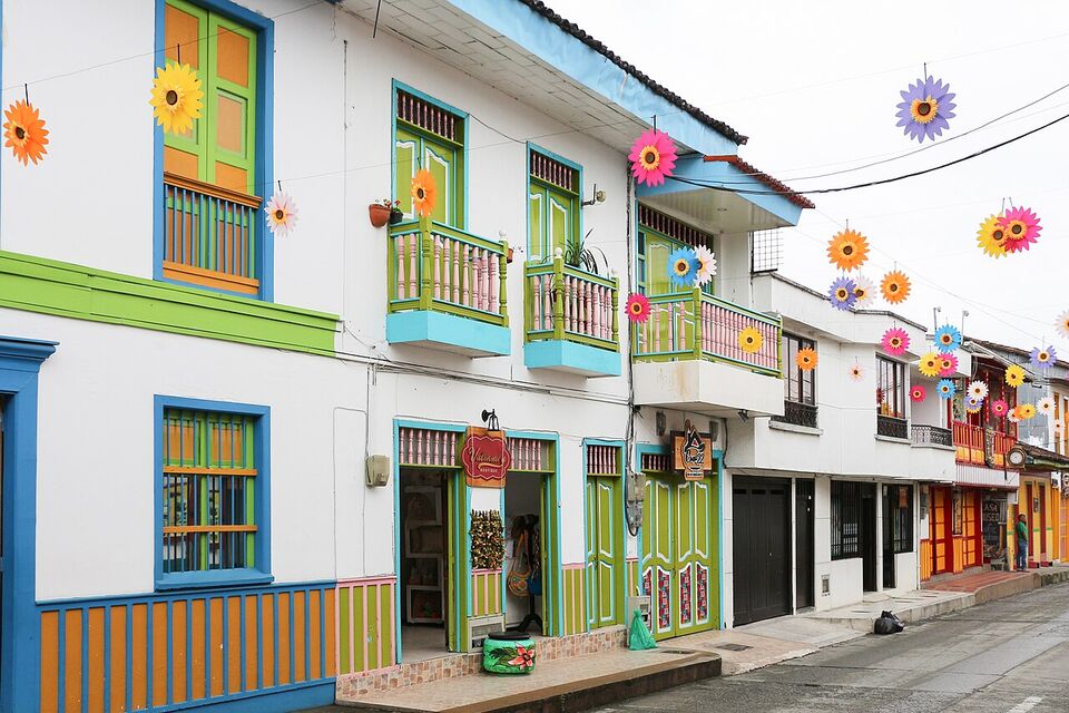
| Filandia | Quindío | Quieter evenings, viewpoints, a small colorful town | Farther from Cocora, so you need a transfer or a jeep and taxi |
| Armenia | Quindío | A city with an airport and bus terminal, useful for arrivals and departures | Little to see; most visitors move on to Salento |
| Pereira | Risaralda | The region's main hub for flights and buses, restaurants, access to thermal-spring areas | A working city, not a village stay |
| Manizales | Caldas | A hillside city at 6,752 ft (2,058 m) with a view of the Nevado del Ruiz, and access to the high Los Nevados park | Cooler and wetter; Wikipedia reports about 229 rain days a year; its airport is often closed by fog |
If you only have time for one base, choose Salento. If you want more than the main street and have a car or a driver, consider splitting your stay: two nights in Salento and one in Filandia, or a night in Pereira before a flight. For a wider look at where to sleep across the country, see where to stay.
Lodging comes in every tier. Simple guesthouses and hostels sit in the $ range, and farm stays and boutique hotels tend to sit in $$. We name no hotels here because rooms, owners and standards change; read recent reviews, check the cancellation terms and ask whether the road to the property is paved.
Getting there by air or road
Most visitors fly into Bogotá or Medellín first (see flights to Colombia), then take a domestic flight or a bus. Wikipedia says Armenia's El Edén airport has daily links to Bogotá, Cartagena and Medellín and Panama City and Fort Lauderdale, but airline schedules change, so check the airlines directly. Pereira and Manizales also have airports; airlines and routes change often, so see domestic flights and check the carriers before you book.
Different from home
Do not count on the Manizales airport. Wikipedia reports that fog often closes it, and its runway is short, with service only from 6 a.m. to 6 p.m. If you are going to Manizales, Pereira's airport is the safer plan for a tight connection.
By road, Salento is about 15 miles (24 km) northeast of Armenia (per Wikipedia). Buses and shared vans link the region's cities, and from Armenia or Pereira you can reach Salento by bus or taxi. Road travel times between Bogotá, Medellín and the coffee region vary a lot with traffic and mountain weather, and we have no official figures, so plan a long day and avoid a tight connection. Landslides can close roads in rainy months; ask the bus company or your hotel before you leave.
A car is optional. In Salento you can walk almost everywhere, and jeeps cover the valley. If you rent a car for farms and small towns, read the notes in getting around about local driving rules and rental terms. Time zone: Colombia Time (UTC-5) all year, with no daylight saving, the same as New York in winter.
Salento: the town
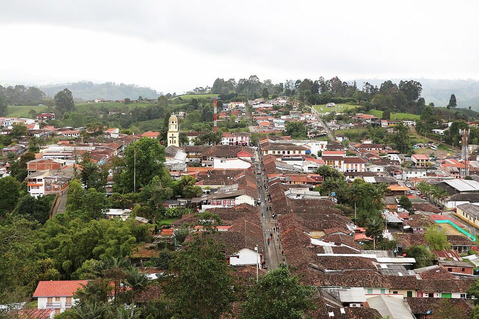
Salento is a small town on a plateau above the Quindío River valley, at 6,217 ft (1,895 m). Wikipedia puts its average annual temperature at about 63°F (17°C), so bring a sweater for evenings. It kept more of its traditional bahareque (wattle-and-daub) architecture than most coffee towns, because the main road to Bogotá was rerouted away from it.
The main street, Carrera 6, known as Calle Real, runs northeast from the town square to a lookout called Alto de la Cruz. You reach it by 250 steps, or by a longer road route. From the top you see the Cocora valley and the peaks of Los Nevados. Restaurants on the square serve freshwater trout (farmed up the Cocora valley) on a patón, a fried green-plantain fritter.
The town's yearly festival runs in the first week of January, around the anniversary of its founding on January 5, so accommodation is tight then. Weekends and holiday Mondays also fill up; the next Monday holidays are November 16, 2026 and, as we compute it, January 11, 2027 (see festivals for the wider calendar). Midweek is quieter and often easier to book.
Spanish helps here more than in the big cities. In tour offices and guesthouses you will find some English, but menus, jeep drivers and farm guides are mostly in Spanish. Our Spanish phrases page covers the basics.
The Valle de Cocora and the hike
The Valle de Cocora sits on the upper Quindío River, between roughly 5,900 and 7,900 ft (1,800 to 2,400 m) according to Wikipedia. It is where most of the Quindío wax palms (palma de cera) still grow. Colombia declared this palm its national tree and symbol by Law 61 of 1985, and felling it is forbidden. The valley lies inside the Los Nevados National Natural Park, whose rules apply.
How to reach it
Willys jeeps (old Jeep-style utility vehicles, called willys) leave the town square in Salento and travel about 7 miles (11 km) up the valley to the settlement of Cocora, where the trails begin. Cars and taxis can also drive up. We could not confirm the current jeep fare or departure rhythm, so ask your hotel the evening before and pay the driver the agreed price. Return jeeps usually run from the same place, but check the last departure so you are not stranded.
Fees and access: check before you go
We could not confirm the current entrance rules or fees for the Cocora trails, or who collects them, from an official 2026 source. Some paths cross private farms and may charge their own fees. Before you go, check parquesnacionales.gov.co and the Salento tourism office, and ask your hotel whether the usual routes are open. Do not pay a stranger on the road for a "permit"; ask for a receipt.
Loop direction, time and mud
The classic walk is a loop of several hours on well-trodden paths. It crosses a stream on narrow bridges, climbs through cloud forest to a viewpoint and a hummingbird reserve, then comes down through pasture dotted with wax palms. Most walkers do the loop in one direction or the other; either works, but ask at the trailhead which way suits the day's weather and whether any section is closed. Distances and times vary by source, so we will not give a single figure. In plain words: allow a long morning, and a full half day if you stop often and take photos.
The valley is humid and rain falls almost daily, according to Wikipedia, which gives an annual mean of about 59°F (15°C), a high near 77°F (25°C) and a low near 54°F (12°C). Temperatures can swing in a day. Paths are muddy for much of the year. Wear shoes with grip, carry a rain jacket and a warm layer, and start early, because clouds usually build later in the day.
Insider tip
Take the first jeep you can and do the loop in the morning. You get clearer views of the palms and finish before afternoon showers. Keep a dry change of socks in a bag for the ride back.
The altitude is moderate: the valley is high enough that you may feel a little breathless on the climbs, but this is much easier than Bogotá, at 8,660 ft (2,640 m). For more on trails across the country, see hiking and nature, and for the birds of the valley see birdwatching.
Weather and the rainy-season warning
The coffee region has two wetter periods and two drier ones, not the single wet season of the coast. The nearest weather table we have is for Armenia, at 1,450 m (4,757 ft), where Wikipedia (from IDEAM data) shows about 2,160 mm (85 in) of rain a year. October and November are among its wetter months (about 254 mm and 313 mm), April is also wet (about 253 mm), and June, July and August are the driest (about 68 to 87 mm). Armenia is lower and warmer than Salento, so expect cooler air in town and in Cocora.
For Cocora itself, Climate-Data.org figures quoted by Wikipedia show October (about 279 mm) and November (about 245 mm) as the wettest months, with April and May also wet, and the lowest rainfall in July and August (about 95 to 99 mm). Even the "dry" months have rain, so treat these figures as odds, not promises.
Watch out
Wet weather brings slippery paths, swollen streams and sometimes landslides on mountain roads. IDEAM, Colombia's weather agency, said on November 12, 2026 that a strong El Niño would last into the first quarter of 2027, with less rain and higher temperatures expected. That may mean drier conditions than the averages suggest, but it does not remove the risk of afternoon storms. Check the forecast and local advice each morning.
If you go in the rainy months, build in a spare day, book refundable rooms, and keep your best coffee-farm visit for the morning, when weather is more reliable. For a view of how seasons work across Colombia, see when to go.
Coffee farm tours: what a good one looks like
A coffee tour on a working farm (finca) is the best reason to leave the main street. Most last about two to three hours, though lengths vary, and cover the plants, picking, processing, drying and a tasting. Many farms near Salento welcome visitors, and tours are often offered in English or Spanish.
Harvest timing varies by farm and by altitude, so ask whether cherries are being picked when you visit. Outside the harvest you can still see the whole process, but you may not pick beans yourself.
Signs of a good tour
- It runs on a farm that actually grows and processes the coffee it shows you, not a display plot.
- Groups are small, so you can ask questions and see each step.
- The guide explains the full path from cherry to cup: picking, pulping, fermenting, washing, drying, milling, roasting and cupping.
- You taste the coffee fresh, and the guide can say how it was grown and processed.
- The price, language, duration and start time are stated up front, with no surprise extras.
- You can buy beans if you want, with no pressure.
Questions to ask before you book
Ask which language the tour is in, how long it lasts, how big the group is, whether it includes a tasting and whether transport is covered. Ask how to get to the farm, since some sit up rough roads, and whether children can join. Message or call a day or two ahead; walk-in visits are hit-and-miss, and busy weekends fill.
We could not confirm current tour prices from an official source, so check the farm's own page or ask your hotel. Our guide to Colombian coffee explains grades, roasts and what to buy at home. Coffee and tea are generally admissible when you return to the United States, but declare all food and plant items to CBP.
Save money
Buy beans at the farm or a roaster in town rather than at an airport shop. Ask for a whole-bean bag with a roast date, and put it in your checked bag wrapped in a sealed bag.
Filandia, Manizales, Pereira and Armenia
Filandia
A smaller, quieter alternative to Salento, with viewpoints over the farmland. It suits travelers who dislike crowds and want a calmer evening. It needs a transfer to reach Cocora, so it works better as a second stop than as the only base.
Manizales
Known as a "world capital of coffee," it sits at 6,752 ft (2,058 m) with a view of the Nevado del Ruiz. It is cooler and wetter than the other bases, with about 229 rain days a year according to Wikipedia. It is the usual start for trips to the high part of the Los Nevados park.
Pereira
A practical stop for flights, buses and restaurants, and a base for thermal-spring areas. Do not expect a village atmosphere. Many travelers pass through on the way to Salento.
Armenia
The departmental capital and the closest city to Salento, with an airport and bus terminal. It is useful for arrivals and departures, but most visitors spend their time in the hills.
The thermal springs near Pereira and Manizales and the high-altitude trips into the Los Nevados park are popular, but we could not confirm current opening hours, fees or permit rules from official sources. See the next section for the park.
Los Nevados trips
Los Nevados National Natural Park covers about 224 square miles (580 km2, or 58,000 hectares) of the Central Cordillera, per Wikipedia, and it includes high volcanic peaks. The Cocora valley lies inside it. From Salento, jeeps also serve trips into the higher park.
We could not confirm the current permits, entry fees, guide requirements or access points for Los Nevados from an official 2026 source. Check parquesnacionales.gov.co and the local park office before you plan a trip. At those altitudes the air is thin, weather turns fast and the cold is real, so go with an authorized guide, bring layers and rain gear, and ask about the volcano's current alert level on the Servicio Geológico Colombiano site. If you have heart or lung problems, ask your doctor about altitude before you commit.
The jeeps and getting around locally
Willys jeeps are the local workhorses. They carry passengers from Salento's square to Cocora and to some farms, and passengers sometimes ride standing on the rear step. Agree on the fare before you climb in, and ask about the return time. In Salento you can walk everywhere. For farms and Filandia you will likely use a taxi, a jeep or a pre-arranged driver.
Ride apps are widely used in Colombia but their legal status is unclear, and we have no sure information about coverage in small towns. Ask your hotel for a trusted driver. The US State Department rates Colombia Level 3: Reconsider Travel (as of November 2026) and lists some areas as Level 4: Do Not Travel; check travel.state.gov for the current list, and read our safety guide. Take normal precautions with phones, bags and night transport, and do not accept drinks or food from strangers. Drug use is illegal in Colombia, and the US advisory warns of drugging and kidnapping.
The Parque Nacional del Café question
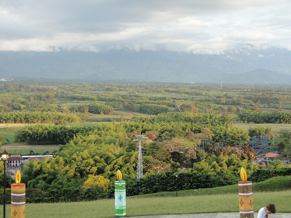
The Parque Nacional del Café is a theme park near Montenegro in Quindío that combines coffee exhibits with rides and a cable car. It is aimed more at families and day-trippers than at coffee-focused travelers. Despite the name, it is a theme park, not one of the national parks run by Parques Nacionales Naturales.
The question is whether it is worth the time. If you have children, or want something easy on a rainy day, it may fit. If you want to learn how coffee is grown, a working farm is more authentic and usually quieter. We could not confirm its current hours, prices or open days, so check its own website before you plan a day around it.
Food in the coffee region
Expect hearty, simple highland food. Trout with patón is the signature plate in Salento. You will also see the bandeja paisa (a platter with beans, rice, pork, chorizo, egg, plantain, avocado and an arepa), arepas (corn cakes) at breakfast and fresh juices of fruit such as lulo and passion fruit. A tinto is a small black coffee, and an aromatica is an herbal tea. See food for a wider guide.
See money for how menu prices are written. Many restaurants add a suggested tip of about 10% that is voluntary; check the bill. Cards are common in the bigger towns, but carry some cash for small shops, jeeps and farms. Many travelers drink bottled or filtered water; ask locally.
Health and what to pack
The CDC recommends malaria prevention for areas of Colombia below 5,600 ft (1,700 m) and says there is no malaria transmission in Bogotá, Cartagena or Medellín. Armenia, at about 4,760 ft (1,450 m), is below that line, while Salento and Manizales are above it, and the CDC page does not name the coffee towns either way, so ask a travel clinic about your route. It also recommends yellow fever vaccination for most of the country, not for trips limited to certain cities or above 7,550 ft (2,300 m). Salento sits below that line. Talk to a travel clinic well before you go, and read health for the full picture, including the CDC's dengue notice.
For packing, bring waterproof shoes with grip, a light rain jacket, a warm layer for evenings, sun protection, insect repellent and a small daypack with a dry bag. Our packing list has more.
A three-night plan
- Day 1
Arrive in Salento
Travel from the airport or terminal, check in, walk Calle Real and climb to Alto de la Cruz at dusk. Eat trout on the square.
- Day 2
Valle de Cocora
Take an early jeep, hike the loop in the morning, and be back for a late lunch. Keep the afternoon free in case rain rolls in.
- Day 3
A coffee farm
Book a morning farm tour and walk the town in the afternoon. If you have a car or driver, add Filandia.
- Day 4
Buffer or move on
Use it to repeat a hike if the weather was poor, add Manizales or Pereira, or head to your next stop. Pair the coffee region with Medellín or Bogotá.
Practical points and next steps
- Book three or more nights, with a spare day for rain.
- Reserve farm tours a day or two ahead, especially for weekends and holiday Mondays.
- Check Cocora and Los Nevados access and fees on official pages the week you go.
- Carry a rain jacket, grippy shoes and some cash.
- Check road conditions after heavy rain before long drives.
For other regions, see regions. If you head north afterward, Santa Marta and Tayrona make a hot, sea-level contrast.
Add it to a route in the trip builder, or ask us to plan the hotels, trains and guides for you.