Overview
Colombia has a hiking range that few countries match, because altitude changes the landscape every few hours. You can walk through cloud forest under tall wax palms in the morning, cross treeless páramo grassland in the afternoon and be on a hot Caribbean trail the next day. The main constraint is not a shortage of trails. It is that many of the best routes involve a park authority, an indigenous community or a licensed guide, and the rules change.
This page covers the most visited hiking and nature areas: the Cocora Valley, Los Nevados National Park, the Sierra Nevada de Santa Marta (including Ciudad Perdida), the Chicamocha Canyon, Caño Cristales, the páramos around Bogotá, Tayrona, the Tatacoa Desert and the Amazon. It explains how to find a guide, how to manage altitude and weather, what to pack and what the safety rules are. For a trip built around birds, see our birdwatching page, and for beach time see the beaches page.
A word on how to read the details below. Park fees, permits, quotas, opening dates and trail closures are time-sensitive, and many are published by the park authority only close to the season. We give the figures we could confirm, label them "reported" where they come from news coverage, and tell you where to check. Nothing here replaces the park's current notice.
Watch out
The US State Department's advisory for Colombia is Level 3: Reconsider Travel (as of November 2026), and some areas carry a higher "Do Not Travel" level, including parts of the border region. The list changes, so check travel.state.gov for the current areas before you book a remote trail, and read the safety page.
Hikes compared
The table gives a rough guide to effort and conditions. Altitudes come from the sources named in our notes; guide requirements and seasons need confirming with the park or operator before you book.
| Area | Effort | Altitude | Guide | Season and notes |
|---|---|---|---|---|
| Cocora Valley (Salento) | Easy to moderate; half day to full day | About 5,900-7,900 ft (1,800-2,400 m), with higher viewpoints | Not usually needed for the main loop; ask locally | Rain falls almost daily; start early |
| Los Nevados National Park | Moderate to hard | Up to Nevado del Ruiz at about 17,457 ft (5,321 m) | Ask the park; guides common | Weather changes fast; check park and volcano notices |
| Ciudad Perdida (Teyuna) | Hard; multi-day, humid, with 1,200 stone steps at the site | Jungle and foothills of the Sierra Nevada | Required; licensed operators only | Usually 4 to 6 days; closed part of the year, so check dates |
| Chicamocha Canyon | Easy to moderate day walks | Canyon and rim; varies | Optional for park paths | Near San Gil and Barichara; hot and dry in the canyon |
| Caño Cristales | Moderate; hot, wet and humid | Lowland tableland | Authorized guide expected; confirm with the park | Colors roughly late July to November; closed part of the year |
| Páramos near Bogotá | Moderate; cold and wet | Above about 9,800 ft (3,000 m) | Often required or advised in parks | Quotas and permits vary by park |
| Tayrona | Easy to moderate; hot, muddy, rocky | Sea level up to about 2,950 ft (900 m) | Certified guide advised for first-timers | Park closures for ceremonies; insurance required |
| Tatacoa Desert | Easy; short walks in heat | Low desert | Optional | Very hot by day; evenings suit stargazing |
| Amazon (Leticia and Amacayacu) | Easy to moderate; humid | Near sea level, about 315 ft (96 m) in Leticia | Required for most jungle walks | Least rain roughly June-September |
Cocora Valley and the coffee region
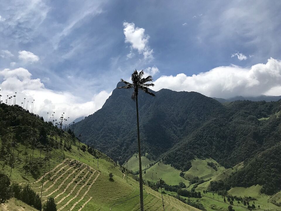
The Cocora Valley (Valle de Cocora) is the most popular day hike in the coffee region, and the usual base is Salento, a small town in the Eje Cafetero. Open Willys jeeps run from the main square up the valley, about 7 miles (11 km). The valley sits in the upper Quindío River basin at roughly 5,900-7,900 ft (1,800-2,400 m), and it is the main home of the Quindío wax palm, the national tree of Colombia, which grows to a great height. Cutting the palm is forbidden under national law. Cocora is also part of the broader Coffee Cultural Landscape that UNESCO listed in 2011. See our coffee region guide for the town and the farms.
The valley's climate is mild and wet. Wikipedia's park entry says rain falls almost daily in the cloud forest, so go early, when skies are clearer, and expect mud. Hummingbirds are a feature of the lower trails, and one reserve in the valley is said to have six to eight hummingbird species, a visitor center and a restaurant. The park's wildlife list includes the mountain tapir, spectacled bear, Andean condor and the yellow-eared parrot, but you are very unlikely to see most of these on a day hike.
We have no confirmed 2026 figures for the jeep fare or the valley entrance fee, so ask at your hotel or in the square and agree the price before you board. Salento fills with visitors on weekends and holidays; if you can, go midweek. Our destinations page places Salento on the map.
Insider tip
Start before 8 a.m. The valley is clearer and quieter early, and you will finish before the afternoon rain. Carry a rain jacket even if the morning is bright.
Los Nevados National Park
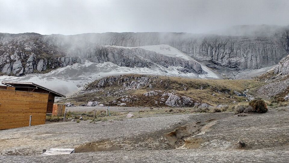
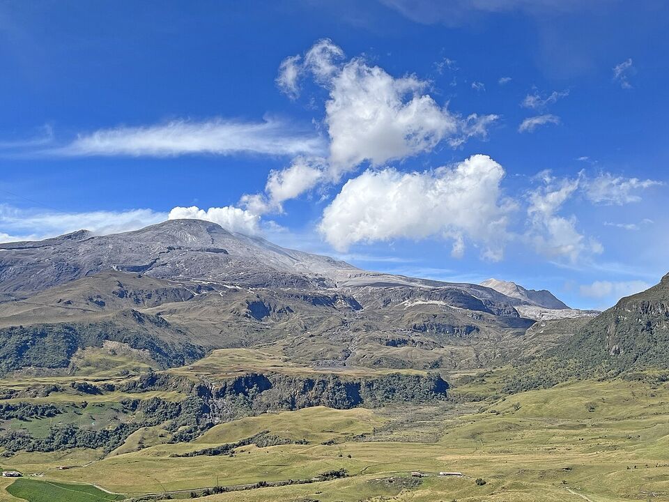
Los Nevados National Natural Park covers the high volcanic peaks of the central Andes, and Salento is one of the entry points. The park includes Nevado del Ruiz, which rises to about 17,457 ft (5,321 m) near Manizales and is an active volcano. At this height, the air is cold and thin, and wind, rain and low cloud are common even in the drier months.
Plan this as a guided, supported trip, not a casual hike. Check three things before you go: the park's current access rules (Parques Nacionales), any volcano alerts for the Nevado del Ruiz, and the weather. We did not find a confirmed 2026 fee for Los Nevados, so check the park's notice. Spend at least one night at moderate altitude, such as in the coffee region, before going high.
Sierra Nevada de Santa Marta and Ciudad Perdida
The Sierra Nevada de Santa Marta is the highest coastal range in the tropics. It reaches about 18,700 ft (5,700 m), just 26 miles (42 km) from the Caribbean coast. The area is home to about 30,000 Indigenous people from the Kogui, Arhuaco, Kankuamo and Wiwa communities, and their territory is a living cultural landscape, not just a park. Access to the highest summits has been very difficult for years, and permission from the communities matters. Do not plan a summit climb as a tourist.
Ciudad Perdida (Teyuna) is the area's best-known walk. The ancient site has 169 terraces carved into the mountainside and is reached by climbing about 1,200 stone steps through dense jungle. The trek is a guided, multi-day route through Indigenous territory, usually four to six days, and it is hot, humid and muddy. Tourist treks restarted in 2005, after the ELN kidnapped eight foreign tourists in 2003, and army patrols are present in the area. Only licensed operators run the trek.
We have no confirmed 2026 price or operator list, and a travel-agency calendar said the trek is closed for part of the year, with one source naming October. Ask the operator for the exact dates and what the price includes, such as food, guides, insurance and park or community fees. Our Ciudad Perdida guide goes through how to choose an operator and what to expect on the trail.
Chicamocha Canyon and Santander
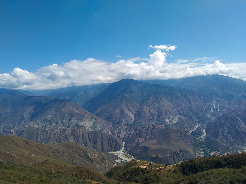
The Chicamocha Canyon in Santander is a deep, dry canyon, and Chicamocha National Park (known locally as PANACHI) lies about an hour from San Gil, with a museum, hiking trails, paragliding and other activities. San Gil has been the region's adventure base since the early 2000s, with rafting, caving, kayaking and hiking, and Barichara is a quiet colonial town nearby with a walking path to the village of Guane. We found no confirmed fees or hours, so check each attraction's own notice.
Canyon heat is a real factor. Carry more water than you think you need, wear sun protection and avoid the middle of the day.
Caño Cristales
Caño Cristales, in the Serranía de la Macarena in Meta, is called the "River of Five Colors" or the "Liquid Rainbow". From late July to November the riverbed shows yellow, green, blue, black and especially red, the last caused by an aquatic plant, Rhyncholacis clavigera. The river's clear water runs over rock pools and falls, and visitors usually fly to the region and then go on a guided visit. The colors are strongest after the rainy period, from late June, and the season winds down by the end of November.
The question most visitors have in November 2026 is whether it is open for the season and who can go in. Our answer is to check, and to expect it to be closing. A travel-agency calendar listed Caño Cristales as closed from November 16 to December 31, 2026, but we could not confirm that against the park's own 2026 notice, and the official visitor guide for La Macarena was not available to us. The season generally runs from roughly July to November, so treat November as the tail end.
On who may enter: the area is a national park and community territory, and visits are controlled. We understand that visitors go only with an authorized local guide and with the permits the operator arranges, and that daily numbers are limited, but we could not confirm the current rules. Confirm them with Parques Nacionales or a registered operator before you pay for flights. A reported 2026 fee for Sierra de la Macarena was about COP 51,500 (about $16), category not stated. Do not try to enter on your own, and ask your guide what you may bring to the water, because the rules exist to protect the river.
Because the river sits in a region with a complicated security history, check the current advisory and your operator's information for the area before you book.
Páramos and the Eastern Andes near Bogotá
A páramo is the high, treeless grassland above the forest line, often with frailejones (Espeletia), plants with thick, furry leaves. According to Wikipedia's climate summary, the treeless páramo grasslands lie above the forested alpine zone, and conditions are glacial, with permanent snow and ice, above about 13,100 ft (4,000 m). Several national parks near Bogotá, such as Chingaza, protect páramo, and Monserrate, the city's hill, tops out at 10,341 ft (3,152 m). The footpath up Monserrate is 1.5 miles (2.4 km) long, rises about 2,000 ft (600 m), and takes between about 50 minutes and three hours, according to Wikipedia. The cable car is the alternative; see our Bogotá sights page.
Reported 2026 fees (category not stated) include about COP 29,000 (about $9) for Chingaza and about COP 28,000 (about $8) for Iguaque, near Villa de Leyva, and about COP 52,500 (about $16) for El Cocuy. Parks like these often use quotas, permits and set days, and some require a guide. We did not confirm any of those rules, so check Parques Nacionales for each park, and book early for popular weekends. Bogotá is at about 8,660 ft (2,640 m), so you are already high before you start. See the Bogotá guide.
Tayrona
Tayrona National Natural Park combines forest trails, rock coves and beaches near Santa Marta. The park covers about 58 square miles (150 sq km) of land, and trails can be hot, muddy and steep in places. Its official page lists the rules as of June 2026: all-risk insurance is required, there is a daily cap of 6,900 visitors, each entrance has its own hours, an environmental talk is mandatory, a certified guide is advised for first-time visitors and trails are advised for children over 12. The El Pueblito trail has been closed to visitors since 2019 at the wish of Indigenous residents, and sacred sites are off limits.
The park also closes for ceremonies: in 2026 on February 1-15, June 1-15 and October 19-November 2, and it was closed for a period by government order in early 2026. A reported 2026 foreigner fee was about COP 81,000 (about $25) in low season and about COP 96,500 (about $29) in high season. Details are on our Santa Marta and Tayrona page.
Tatacoa Desert and the Amazon
The Tatacoa Desert in Huila is a dry, eroded landscape of about 130 square miles (330 sq km) around the town of Villavieja. It is known for fossils and for dark skies, with an observatory nearby. Walks are short and flat, but the daytime heat is intense, so go early or at sunset and carry plenty of water.
The Amazon is the opposite: hot, humid and wet. Leticia, on the Amazon River beside Brazil's Tabatinga and across from Peru's Santa Rosa, is reached by plane from Bogotá or by river, and it has an average temperature of about 79°F (26°C). Rainfall is heavy all year, with the least rain roughly June to September. Jungle walks are guided. A reported 2026 fee for Amacayacu National Park was about COP 27,500 (about $8). The CDC's yellow fever recommendation applies to most of Colombia outside the exempt areas, which does not include the Amazon, so talk to a travel clinic well before you go. See our Amazon guide and the health page.
Guides, permits and parks
Many routes require a guide or strongly benefit from one. A good guide handles permissions, knows the trail, reads the weather, speaks the local language and carries a first-aid kit. How to choose:
- Check the official park site (parquesnacionales.gov.co) for the current list of approved operators and the rules for the park you want.
- Ask whether the operator is registered under Colombia's national tourism registry, and ask for a written itinerary and price.
- Ask what is included: park or community fees, insurance, food, transport and gear.
- For Ciudad Perdida and Caño Cristales, use only operators that the park and the communities recognize.
- Avoid street offers from people who cannot show registration. A cheap price may mean no insurance or an unregistered group.
- Ask about group size, the guide's first-aid training and the emergency plan.
For the paperwork around parks, expect ID checks and sometimes a passport copy. Some remote gates and villages may take cash only, so bring pesos.
Altitude, weather and what to pack
Altitude
Altitude sickness can start above about 8,000 ft (2,400 m): headache, nausea, poor sleep and breathlessness. Bogotá, at about 8,660 ft (2,640 m), is high enough for many people to feel it on arrival. Give yourself a day or two to adjust before a big hike, drink water, go easy on alcohol, walk slowly and descend if symptoms get worse. A severe headache, confusion, trouble walking or breathlessness at rest needs medical help. If you take medication for altitude, ask your doctor before you travel.
Weather
Temperature depends on height. The warm zone below about 3,300 ft (1,000 m) is hot, the temperate zone from about 3,300 to 6,600 ft (1,000 to 2,000 m) is mild, the cold zone from about 6,600 to 9,800 ft (2,000 to 3,000 m) is cool, and the páramo and above are cold. Rain is common in cloud forest year-round. In November 2026, Colombia's weather agency expected a strong El Niño to continue into early 2027, with fewer rains and higher temperatures, so conditions may be drier than usual; check the forecast, and keep rain gear anyway.
Pack
- Layers: a base layer, a warm mid-layer and a waterproof shell
- Broken-in hiking shoes with grip, plus spare socks
- A hat, sunglasses and high-SPF sunscreen; sun is strong at altitude
- Insect repellent for lowland and forest trails
- At least 2 liters of water per person, a filter or purification tablets and snacks
- A headlamp, a whistle and a small first-aid kit with blister care
- A dry bag, a poncho and a day pack with a rain cover
- A charged phone with offline maps, plus pesos in small bills
- Copies of your passport and travel insurance details
Our packing page has more.
Trail etiquette in Indigenous territories
Parts of the Sierra Nevada and other regions are Indigenous territory. The Kogui, Arhuaco, Wiwa and Kankuamo have their own authorities, and some sites are sacred. Treat the rules as binding.
- Stay on the marked route and follow your guide. Do not enter closed or sacred areas, even if the path looks open.
- Ask before photographing people, houses or ceremonies, and respect a refusal.
- Do not take stones, plants or artifacts. Carry out all trash, including peels.
- Dress modestly in communities, and keep voices low near ceremonial sites.
- Pay only through your registered operator, and do not give gifts or money to children.
- Avoid alcohol and drugs on the trail. Tayrona restricts alcohol and psychoactive substances, and drugs are illegal in Colombia.
Safety rules
- Never hike alone. Go with a guide or a group. Remote trails have little phone signal, and rescue can be slow.
- Never hike at night. Start early and plan to be back before dark. Darkness falls quickly near the equator.
- Tell someone your route. Leave your hotel the trail name, your guide's name and your expected return.
- Know the weather. Do not push on in storms, high winds or fog, especially in the páramo and on volcanoes.
- Know your health. Carry your medicines and check the CDC page for vaccines and malaria advice. The CDC recommends prescription malaria prevention for areas below about 5,600 ft (1,700 m), and yellow fever vaccination for most of the country.
- Know who to call. 123 is Colombia's national emergency number, and the US Embassy offers 24-hour help for US citizens at +1-202-501-4444 from abroad.
- Avoid rivers in flood. Flash floods in the rainy season are a hazard.
Hiking insurance matters: check that your travel policy covers medical evacuation and the altitude and activity you plan. The health page covers this, and the interests page shows how nature fits into a longer trip.
Save money
Buy park tickets and tours directly with the park or operator, and compare what is included. Ask about fees for foreign visitors and group discounts. A tour that includes insurance, food and the park fee is often better value than a low price that does not.
Mistakes to avoid
- Starting too late. Morning is clearer, cooler and safer on almost every trail.
- Going high too fast. Fly into Bogotá and head for a páramo the same day, and you may feel it.
- Booking Caño Cristales without checking the season. The river's best colors are limited to part of the year.
- Treating a guided trek as optional. At Ciudad Perdida, it is required.
- Underpacking for rain. Cloud forest and páramo can be wet at any time.
- Relying on a card. Some park gates and small villages take cash only.
Add it to a route in the trip builder, or ask us to plan the hotels, trains and guides for you.