Overview
San Andrés and Providencia are Colombia's Caribbean islands, far out in the sea about 470 miles (750 km) northwest of the mainland and much closer to Nicaragua than to Cartagena. They belong to the department of San Andrés, Providencia and Santa Catalina, whose people include the Raizal, English-speaking and Protestant islanders of African and European descent. The islands are known for the "Sea of Seven Colors", the shifting blues and greens of the water over sand, seagrass and reef.
You can reach them only by air. San Andrés is the larger and easier island, with an airport, a town, hotels and beaches; Providencia is smaller and quieter, and a short flight or boat ride from San Andrés. Most first-time visitors spend a few days on San Andrés and, if they have time and good weather, a night or two on Providencia. We tell you how to reach each, how they differ, what to do and what to watch out for.
This is a beach and water trip, not a city trip. If you want colonial streets and forts, start with Cartagena, which has the nearest big airport on the Caribbean coast, and its boat day trips on Rosario Islands and Barú. San Andrés is the better choice for a week of snorkeling, diving and Caribbean culture.
In our text we write the code before the amount and convert at US$1 = COP 3,300; see money for how island prices are written.
How to get to the islands
There is no road or regular passenger ferry from the mainland, so you fly. San Andrés's airport is Gustavo Rojas Pinilla International Airport (ADZ), on the island's north end, close to the town. We did not confirm current airlines or schedules. The domestic carriers that fly around Colombia are Avianca, LATAM Colombia, JetSMART, Wingo, Clic and SATENA; check each one's site to see which serve San Andrés from your starting city, and book early, because seats fill in the holidays and in the dry season. See our domestic flights guide for how fares and baggage work, and the flights guide for flights from the US.
Most Americans connect through a mainland city: Bogotá, Medellín, Cartagena or Cali are the usual hubs. We could not confirm whether any US airline flies nonstop to San Andrés, so check airline sites for current options. Colombia is on Colombia Time (UTC-5, no daylight saving) all year, the same as New York in winter and one hour behind New York during US summer time.
Entry steps and the tourist card
If you arrive from abroad, you still do the normal Check-Mig online form (between 72 hours and 1 hour before you travel; use only the official site, apps.migracioncolombia.gov.co/pre-registro) and the immigration stamp; see our entry guide. US citizens may stay up to 90 days on arrival, as of November 2026. These are national rules, and the islands have an extra local step.
Visitors to San Andrés have been required to pay for a tourist card (tarjeta de turismo, also called OCCRE), which funds the island's services and controls the number of visitors. Wikipedia, citing a travel-document database, gives COP 105,000 (about $32) for visitors over 6 years old, but the date of that figure is not stated. News headlines in 2026 say the price rose and that a digital card began in May 2026. We read only the headlines, so we cannot give the 2026 amount. Plan for about COP 105,000 (about $32) or more, and confirm the amount for your dates and how to buy it on the department's official site (sanandres.gov.co), with your airline, and with Migración Colombia (migracioncolombia.gov.co). Do this before you travel.
Watch out
Buy the card only from the official site or channel your airline points to. Look-alike sites and street "agents" charge extra or sell nothing. We could not verify the official page, so ask your airline and your hotel which link to use.
Health
The CDC says the yellow fever vaccine is not recommended for travel limited to San Andrés and Providencia, though it recommends it for most of Colombia. The CDC page also lists a yellow fever certificate as an entry requirement for arrivals aged 1 or older, which Migración Colombia's pages do not mention; check with your airline and Colombia's health ministry. Dengue is a Level 1 CDC notice (updated November 10, 2026), so use insect repellent; see our health guide.
San Andrés and Providencia compared
| San Andrés | Providencia (with Santa Catalina) | |
|---|---|---|
| Size and feel | About 8 miles (13 km) long and 2 miles (3 km) wide; the largest island of the group; busy, with a town, shops and hotels | Smaller and quieter, roughly 50 miles (80 km) northeast of San Andrés (sources differ); Santa Catalina lies right next to it |
| How to arrive | Direct flights from mainland cities to ADZ | By small plane or boat from San Andrés (check schedules and what services are running) |
| Beaches | Many: a town beach, Rocky Cay, San Luis, Cocoplum Bay and cays | Fewer, quieter beaches, and a better sense of the islands before mass tourism |
| Snorkeling and diving | Good: reefs, shallow cays and wall dives | Reef and coral; often described as more remote and less visited |
| Hotels and food | Wide range, from hostels to resorts; restaurants and shops | Small guesthouses and a few hotels; fewer restaurants; ask what is open |
| Getting around | Ring road of about 19 miles (30 km); golf carts, scooters, taxis, buses | A small ring road; scooters, taxis and walking; limited transport |
| Prices | Higher than the mainland | Higher still in many cases; goods come in by sea and air |
| Best for | First-time visitors, families, a week of water activities | Travelers who want quiet and can handle limited services |
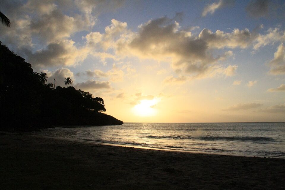
The two islands are part of the same department, but they feel different. San Andrés has tourist infrastructure and some crowds, particularly in the high season. Providencia has far fewer visitors and a slower rhythm, and the effects of hurricanes still shape how it works.
The Sea of Seven Colors, Johnny Cay and the beaches
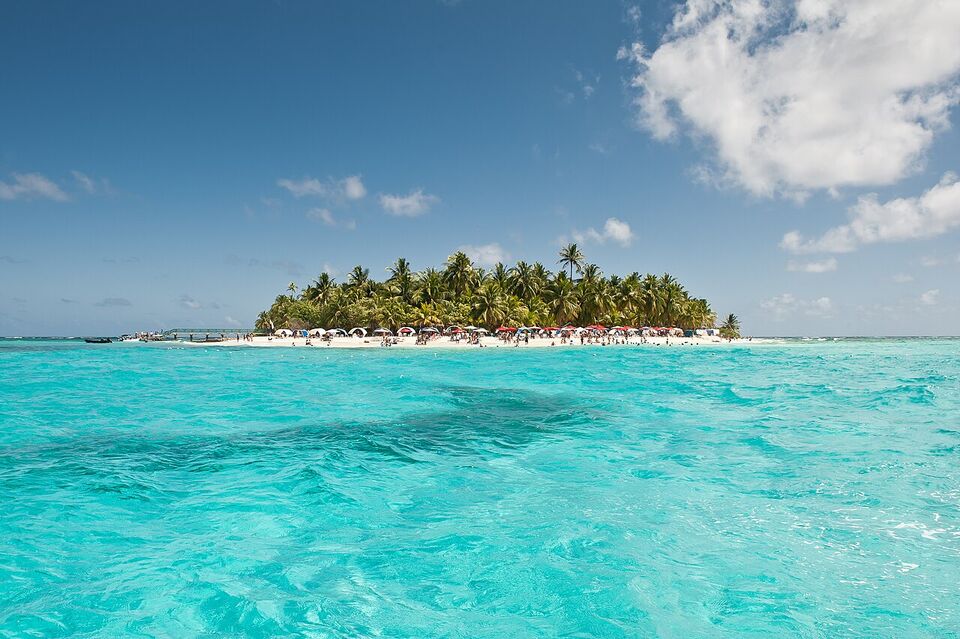
The "Sea of Seven Colors" is how islanders and the national tourism site describe the water around San Andrés, which changes from pale turquoise over sand to deep blue over reef. You see it best from the hill at La Loma, or from a boat on a clear day.
Johnny Cay
A small coral islet about 1 mile (1.5 km) north of San Andrés Town, with white sand and coconut palms. It is the most visited place in the archipelago and a natural park since 2001. The sea there has currents that can be risky for swimming, so heed the lifeguards and flags. A park or boat fee may apply; check before you go.
Acuario (Aquarium) Cay and Haynes Cay
Small cays off the east coast. The water is shallow and calm, and snorkeling is popular. Boats combine them with Johnny Cay in one trip. Check what the price includes and ask for life jackets.
San Luis
A small town on the east coast with a 2-mile (3 km) stretch of white sand and traditional wooden houses. The water is generally calm, and snorkeling is popular here.
La Piscinita
A natural pool in the coral rock on the west of the island, with calm water and plenty of fish. It is small, so go early.
Hoyo Soplador
A blowhole where seawater shoots up to about 65 feet (20 meters) through a hole in the coral rock. It happens only at certain times of year, when tide and wind line up, so it may be calm when you visit.
Rocky Cay and the town beach
The town beach is next to hotels, restaurants and the main shopping streets. Rocky Cay Beach is on the north side. Both are lively and crowded in the high season.
The water is not the same everywhere. The north has beaches, the west has few or none, and the east has calmer water. We could not confirm lifeguard cover or entry fees at each beach, so ask your hotel which are staffed and which have strong currents that day.
Raizal culture and language
The Raizal are the native islanders, descendants of the African and European settlers who arrived from the 1600s, when English Puritans settled here, followed by enslaved Africans brought from other English-held islands. Today the Raizal are mostly Protestant (Baptist churches are the most common), and many speak San Andrés-Providencia Creole, an English-based language. English, Spanish and the Creole are the three official languages of the department.
The culture is Afro-Caribbean, with a strong English-speaking and Baptist tradition, not the Latin Caribbean of the mainland. Visitors will hear island music, including calypso, soca and reggae, and church music. The Baptist church at La Loma, built in 1847, is a landmark, and the Casa Museo Isleña (Islander House Museum) explains island customs. Ask the tourism office about local festivals during your dates.
Mainland Colombians now make up about two-thirds of the population of San Andrés, according to Wikipedia, so Spanish is the day-to-day language in the tourist areas, and English is common in tourist businesses. For polite conversation, use "good morning" in whichever language you hear first, and follow the islander in the room. See etiquette and Spanish phrases for the basics.
Islander food shows the same roots. Look for fish, crab and seafood cooked with coconut milk, for example the stew called rondón (also spelled "rundown"), and for coconut bread and sweets. Ask locals which restaurants they use. Prices are higher than on the mainland.
Scuba and snorkeling
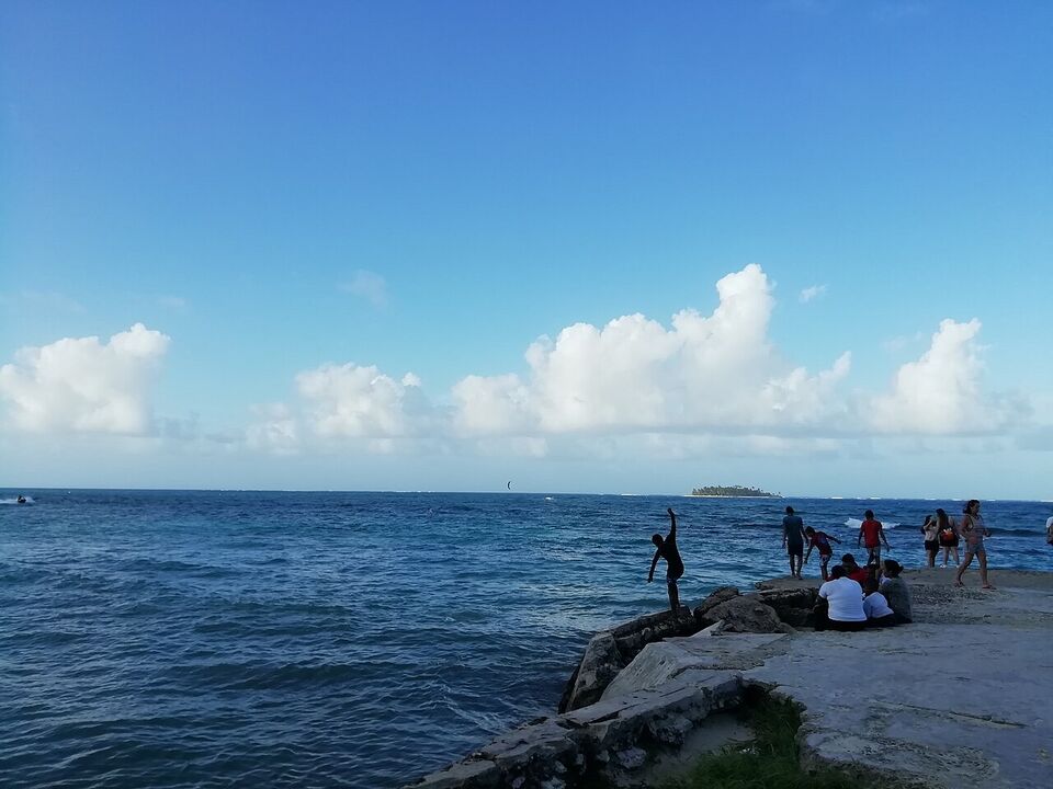
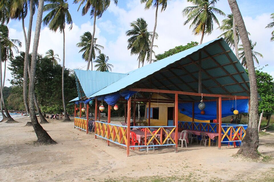
San Andrés and Providencia are among Colombia's best-known dive areas. The archipelago and the surrounding sea form the Seaflower Biosphere Reserve, which UNESCO designated in 2000 and which covers about 10% of the Caribbean Sea. Water depth at dive sites ranges from about 10 to 100 feet (3 to 30 meters), with visibility of about 30 to 100 feet (10 to 30 meters), and sites include walls, coral formations and plateaus.
Diving lessons and trips are offered by several dive shops. Choose a certified operator, ask to see the instructors' certifications, and check the equipment and safety briefing. If you are a certified diver, bring your card. See our diving guide for the national picture. For snorkelers, the shallow cays, La Piscinita and the east coast are good starting points. We could not confirm prices, so ask for the total and what is included.
Respect the reef. Do not touch or stand on coral, use mineral sunscreen, and do not take shells, coral or sea creatures. Take care with the sun: the islands are only 12 to 13 degrees north of the equator, and the glare off the water is intense.
Getting around: golf carts, scooters and taxis
San Andrés has a ring road of about 19 miles (30 km) around the island, and the island is flat enough to circle in a day. The usual choices are these.
- Golf carts: popular with couples and families, sold by the hour or the day. They are slow and open, and they sometimes lack seat belts or lights.
- Scooters and motorbikes: cheap and flexible, but the biggest cause of tourist injuries. Wear a helmet, check your travel insurance covers it, and do not ride after drinking.
- Taxis: fares are negotiated or listed by zone. Ask the price before you get in. Hotels can give you a rough guide.
- Buses and shared transport: run along the main road and are cheap, but timetables are informal.
- Bicycles and walking: good in the town and nearby beaches.
Rental prices vary by season and shop. We could not confirm 2026 prices, so compare two or three, check the vehicle, take photos of any damage before you sign, and ask what happens if it breaks down. In Providencia, there are fewer rentals, so reserve ahead. Our getting around guide covers car rental and driving elsewhere in Colombia.
Insider tip
Rent the golf cart or scooter for a single day, not the whole stay. Most beaches, the town and the dive shops are close together, and a taxi or a day tour for the rest is often cheaper and safer than a week of rental.
Prices, money and what to expect
Prices on the islands are higher than on the mainland, for food, hotels, tours and rentals, because most goods are brought in by air or sea and the islands are a major tourist destination. San Andrés was declared a duty-free zone in 1954, which is why you will see shops selling electronics, perfume and liquor, but we could not confirm what discounts or allowances apply to visitors, and prices are not always lower than at home. Check carefully before you buy, and keep receipts.
Plan to pay in pesos. Cards are common in hotels, restaurants and dive shops in San Andrés Town, but carry some cash for smaller places, tips, beaches, taxis and Providencia, where services are fewer and card machines can be unreliable. Many restaurants add a suggested tip (propina) of about 10%, which is voluntary; check your bill. See our money guide for the rate and cash tips.
Save money
Book the flight and the first night early, compare "all-inclusive" packages with a la carte prices, and eat a main meal at lunch. Some resorts quote prices in US dollars; if so, ask what exchange rate they use and whether paying in pesos is cheaper.
Weather, hurricane season and recovery
The islands have a tropical climate with an average daily high of about 84 to 86°F (29 to 30°C) all year and humidity around 80%. The rainy season runs from May to January, with the wettest month on average being October. February to April is the driest stretch, with March the driest of all (about 1 inch, or 24 mm, on average). Trade winds blow from the north from late October until mid-January and bring rougher seas. A strong El Niño is expected to continue into early 2027, according to IDEAM, and it can mean less rain than normal.
The Atlantic hurricane season runs from June 1 to November 30. San Andrés and Providencia are in the western Caribbean, and Providencia was badly damaged by Hurricane Iota in November 2020, as widely reported (the sources we read do not cover it). Providencia has been rebuilding since, and the state of services varies, so do not assume anything is open.
Watch out
Ask what is open on Providencia before you book: the hotel, the dive shop, the restaurants, and the transport from San Andrés. A hotel's website may be out of date. Email or message the property, ask when it reopened and what services it offers, and keep your plans flexible. Check that your travel insurance covers weather cancellations and storm delays.
If you travel in the hurricane season, buy refundable or changeable tickets, follow the national weather service and local authorities, and know how your hotel handles storm warnings. Check Colombia's weather institute (ideam.gov.co) and your airline for alerts. The US Embassy site also lists natural-disaster alerts. See when to go for a country-wide comparison.
Safety and the Nicaragua border context
The US State Department's advisory for Colombia is Level 3: Reconsider Travel (as of November 2026), and its list of areas at the higher Level 4 should be read at travel.state.gov. Tourist islands have their own risks, mostly petty theft, scams and road and water accidents. Keep valuables out of sight, do not leave belongings on beaches while you swim, and use registered taxis. Do not buy or use drugs, which are illegal; see our safety guide for the national picture. For sea safety, use registered boat and dive operators, and wear life jackets on tours.
As a one-line background, the islands lie close to Nicaragua, and the International Court of Justice recognized Colombia's sovereignty over San Andrés, Providencia and Santa Catalina in 2007, while the maritime boundary has been a separate matter between the two countries. It has no effect on a normal visit.
Add it to a route in the trip builder, or ask us to plan the hotels, trains and guides for you.