Overview: Colombia in six regions
Colombia is a big country with very different parts, and the easiest way to make sense of it is by region. Colombia's official tourism site names the Caribbean, the Pacific, the Andean region, the Orinoquía (the plains), the Amazon and the islands of San Andrés, Providencia and Santa Catalina. Our guide covers all of them, but not equally: most American visits focus on the Andean cities, the coffee region and the Caribbean coast.
Here is the plain-English version. The Caribbean coast in the north is hot, humid and beachy, with colonial Cartagena and the Santa Marta area. The Andean cities (Bogotá, Medellín, Cali and smaller towns such as Villa de Leyva) sit in the mountains and are cooler or milder. The coffee region is a green stretch of the Andes with farms, small towns and palm-filled valleys. The Pacific coast is a remote, rainy, forested shore. The Amazon in the far south is a river and jungle region reached by air. The plains in the east are grasslands and rivers with few visitors.
Use this page to decide which regions suit you and how many to combine. Each block below links to the detail pages, and the comparison table helps you choose bases. For the practical bits, see our trip planner, when to go and getting around pages.
Different from home
Colombia has no single "weather season" the way the US does. Altitude sets the temperature, and the rainy and dry seasons differ by region. A trip that combines Bogotá, Medellín and Cartagena means three climates in one week, so pack for cool nights and hot days.
The map in plain English
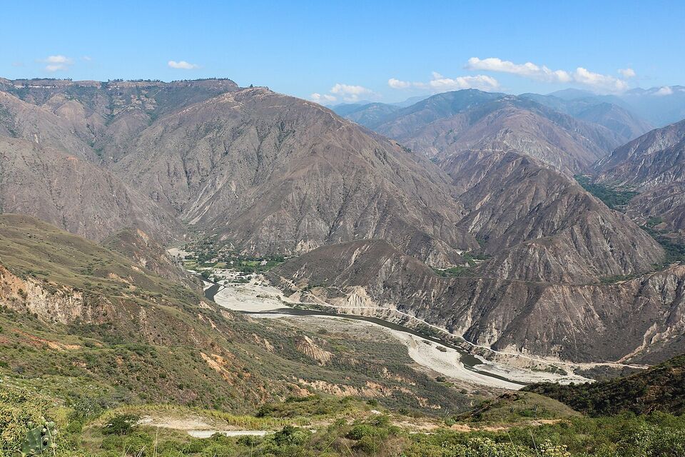
Colombia sits at the top of South America, with coasts on both the Caribbean Sea and the Pacific Ocean. The Andes split into three ranges that run north from the south of the country and divide it into valleys and plateaus. East of the mountains lies a huge lowland of plains and jungle, which makes up over half the country's territory but holds less than 6% of its people, according to our reference source. Most of the population and most visitor attractions are in the Andes and on the Caribbean coast; the Caribbean coast alone is home to about 22% of Colombians.
Colombia drives on the right, uses the peso and runs on Colombia Time (UTC-5) all year, with no daylight saving. That is the same as New York in winter and one hour behind New York during US summer time. Spanish is the national language, and English is common mainly in tourist businesses in the big cities.
Caribbean coast
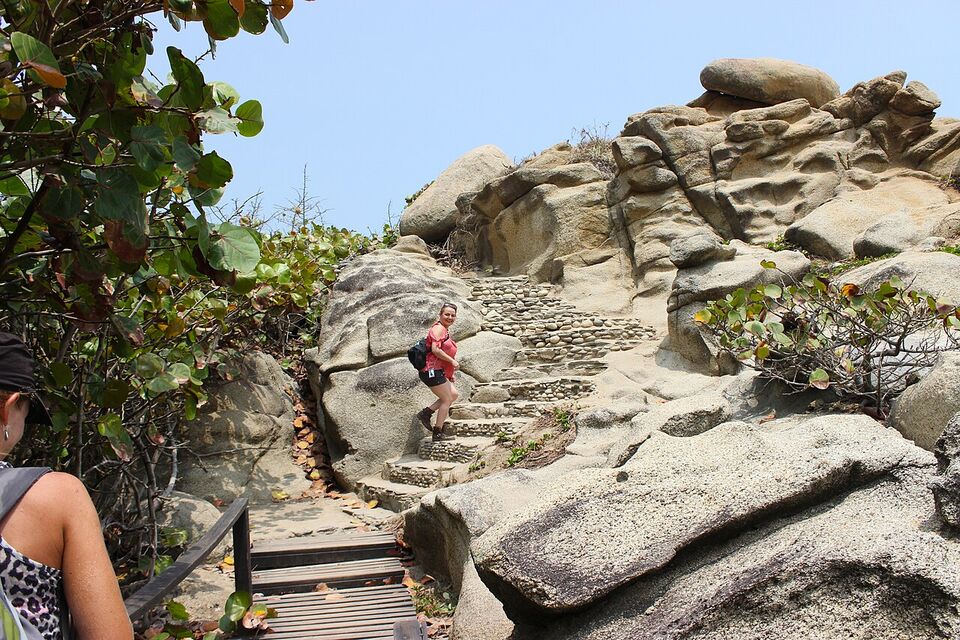
Cartagena's walled city, the Rosario Islands, Santa Marta, Tayrona and the Sierra Nevada. Suits beach lovers, history fans and anyone who wants heat. See Cartagena, Rosario Islands, Santa Marta and Tayrona, Ciudad Perdida and beaches.
Andean cities
Bogotá, Medellín, Cali and colonial towns such as Villa de Leyva. Suits city and museum lovers and first-time visitors. See Bogotá, Medellín, Cali, Guatapé and Villa de Leyva.
Coffee region
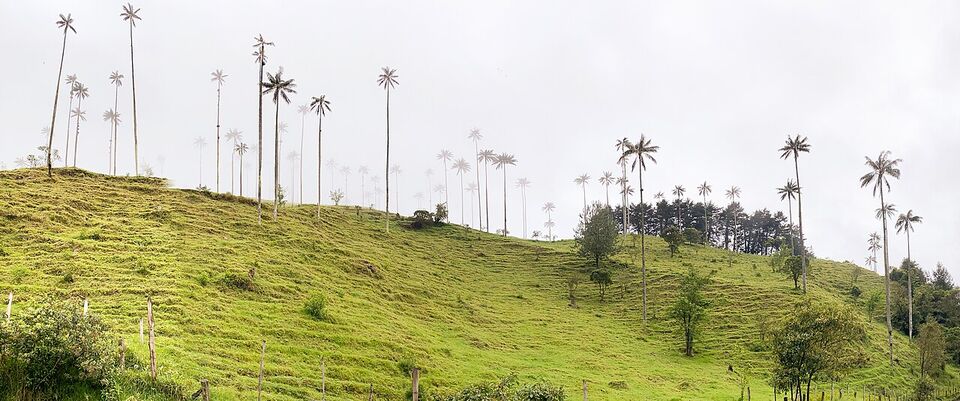
The Zona Cafetera or Eje Cafetero, with farm stays, small towns and the Cocora Valley. Suits slow travel, walkers and coffee fans. See the coffee region and coffee pages.
Pacific coast
A thinly visited shore of rainforest and river mouths, often reached by small plane and boat. Suits experienced, adventurous travelers who plan with a local operator. See diving, birdwatching and hiking and nature.
The Amazon
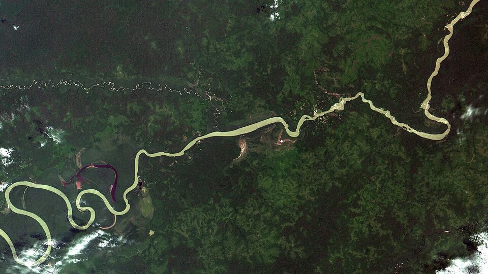
Leticia and the river borders with Brazil and Peru. Suits nature lovers who accept long travel and humid heat. See the Amazon page.
The plains and islands
The Llanos are cattle country with rivers; the Caribbean islands of San Andrés and Providencia are a separate trip by air. See San Andrés.
Region by region: what each is for
Caribbean coast
This is the hot north. Cartagena's walled city (the Ciudad Amurallada) and the Getsemaní neighborhood are the usual centerpiece, with boat trips to the Rosario Islands and the nearby Barú peninsula. To the east, Santa Marta is the base for Parque Tayrona and the Sierra Nevada, and for the multi-day trek to Ciudad Perdida (Teyuna). Further along, the desert of La Guajira peninsula is for travelers who want remote landscapes and are willing to plan with local operators.
Typical weather: Cartagena averages highs near 89°F (32°C) and lows near 78°F (25°C) in November, and the dry season runs December to April. Santa Marta is similar and a little drier. Barranquilla's Carnival is on February 6-9, 2027. It suits beach and history travelers who accept heat and humidity, and it needs more care with sun, hydration and nightlife safety than the cooler Andes.
Andean cities
Bogotá, the capital, is at about 8,660 ft (2,640 m): cool, grey and full of museums, markets and restaurants. Medellín is lower at 4,905 ft (1,495 m), with a mild climate, a metro with cable cars and the nearby lake town of Guatapé. Cali, at 3,340 ft (1,018 m), is warmer and the center of the country's salsa tradition, and the colonial town of Popayán is at 5,770 ft (1,760 m). Villa de Leyva is a quiet colonial town about 7,050 ft (2,150 m) up in Boyacá.
Typical weather: Bogotá highs near 67°F (19°C) and lows near 48°F (9°C) in November; Medellín near 81°F (27°C) and 64°F (18°C); Cali near 85°F (29°C) and 66°F (19°C). Bogotá is the place for altitude care. See Bogotá and Bogotá things to do.
Coffee region
The coffee region (Zona Cafetera or Eje Cafetero) covers parts of Quindío, Risaralda and Caldas, with the cities of Armenia, Pereira and Manizales and the town of Salento. Salento is part of the UNESCO Coffee Cultural Landscape (listed 2011), and Willys jeeps run from its town square 11 km up the Cocora Valley, known for its tall wax palms. Armenia sits at about 4,760 ft (1,450 m) and Salento higher, at 6,217 ft (1,895 m), so it is cooler than Armenia.
Typical weather: Armenia averages highs near 77°F (25°C) and lows near 61°F (16°C) in November, with the driest months from June to August. Rain can arrive any day, so pack a rain jacket. It suits slow travelers, hikers and farm-stay visitors. See the coffee region page.
Pacific coast
The Pacific coast has a tropical rainforest climate that is hot, humid and heavily rainy. It is thinly visited, with limited roads, and many trips involve a small plane or a boat. The remote island of Malpelo, about 310 miles (500 km) west of the mainland, is a UNESCO site and a diving destination. Cali is the nearest big city to the southern Pacific side of the country, but parts of the Pacific lowlands lie in departments that appear in the US advisory's most serious category (see below), so research the specific area and operator before you plan anything beyond Cali itself.
The Amazon
Leticia, on the Amazon River, is next to Brazil's Tabatinga and across the river from Peru's Santa Rosa. It is reached by plane from Bogotá or by river, not by road. It is hot and humid year-round (November highs near 88°F, or 31°C, lows near 73°F, or 23°C, and about 22 rain days), with less rain from June to September. The CDC's yellow fever recommendation applies here, so see our health page and the Amazon page.
The plains
East of the Andes lie the Llanos (the Orinoquía), a region of savanna and rivers that sees few foreign visitors. The best-known stop is Caño Cristales in the Serranía de la Macarena, a river whose bed turns red and other colors from about the end of July through November. Access is reported to need licensed operators and park permits, and one travel blog lists the river as closed from November 16 to December 31, 2026, so check the park authority's current dates before you plan. Plains departments such as Arauca are on the reported Level 4 list, so research each destination carefully.
Islands and other stops
San Andrés and Providencia in the Caribbean are reached by plane; San Andrés rains from May to January, and the CDC says the yellow fever vaccine is not recommended there. Away from the main loop are the Tatacoa Desert (a dry tropical forest in Huila), San Agustín (a UNESCO archaeological park since 1995), Barichara and San Gil, and Popayán, famous for its Holy Week processions. Holy Week in 2027 runs from Holy Thursday on March 25 to Easter on March 28.
Comparing the main bases
This table compares the usual bases by height, November weather, time needed and effort. "Effort" combines transport, altitude, heat and the planning each place needs. Weather is average highs and lows for November from official weather-station data; El Niño is expected to make the coming months drier and warmer than average.
| Base | Region | Height | November weather | Time needed | Effort |
|---|---|---|---|---|---|
| Bogotá | Andes | 8,660 ft (2,640 m) | 67°F / 48°F (19°C / 9°C), rainy | 2 to 3 days | Medium: altitude and size |
| Villa de Leyva | Andes (Boyacá) | 7,050 ft (2,150 m) | 72°F / 52°F (22°C / 11°C), rainy | 1 to 2 nights | Low to medium: a long ride from Bogotá |
| Medellín | Andes | 4,905 ft (1,495 m) | 81°F / 64°F (27°C / 18°C), rainy | 3 to 4 days | Medium: hills, nightlife safety |
| Cali | Andes (valley) | 3,340 ft (1,018 m) | 85°F / 66°F (29°C / 19°C) | 2 to 3 days | Medium: research outside the city |
| Coffee region (Salento) | Coffee region | 6,217 ft (1,895 m) | Cooler than Armenia (77°F / 61°F) | 2 to 4 days | Medium: hikes and jeeps |
| Cartagena | Caribbean | Sea level | 89°F / 78°F (32°C / 25°C) | 3 to 4 days | Medium: heat, sun, safety |
| Santa Marta and Tayrona | Caribbean | Near sea level | 90°F / 75°F (32°C / 24°C) | 3 to 5 days | High: park rules, closures, insurance |
| San Andrés | Islands | Sea level | Rainy season to January | 3 to 4 days | Medium: flight and tourist card |
| Leticia | Amazon | 315 ft (96 m) | 88°F / 73°F (31°C / 23°C), very humid | 3 to 4 days | High: flights, tours, health prep |
The "time needed" column is our planning guide, not an official figure. It assumes you arrive by air and want a real visit, not a quick stop. See Medellín, Cartagena, Cali and San Andrés for detail.
Which regions do most Americans visit?
We do not have visitor statistics by region, but the flights show the pattern. US airlines list direct routes to Bogotá (American from Dallas/Fort Worth and Miami, Delta from Atlanta, United from Houston, Avianca and LATAM from several cities), to Medellín (American, Avianca, JetBlue, United and, from December 10, 2026, Frontier) and to Cartagena (American, Delta, JetBlue, Avianca, and new Frontier and United routes from December 2026). Schedules change, so check with the airline; our flights page has the detail.
It follows that most first trips are built around those three cities, plus the coffee region and the Santa Marta and Tayrona area. San Andrés is a common beach add-on and the Amazon a smaller specialist trip. Other places, such as Cali, the Pacific coast, La Guajira, Caño Cristales and the Llanos, see fewer Americans and take more planning.
Linking regions into a route
The Andes slow every road, so most travelers link regions by short domestic flights. Domestic carriers include Avianca, LATAM Colombia, JetSMART, Wingo, Clic and SATENA, but schedules and fares change often, and we do not quote them; see domestic flights. A sensible rule is to fly into one city and out of another to avoid backtracking. Here are three sample shapes, each using two or three bases:
- One week
Bogotá and Cartagena
Three days in Bogotá for museums and altitude adjustment, then a flight to the coast for three or four days in Cartagena, with a boat trip to the Rosario Islands if the budget allows. It is simple, with two flights and two climates.
- Ten days
Medellín, coffee region and Cartagena
Fly into Medellín for three days in the city and Guatapé, then take a road or air hop to the coffee region for three days in Salento and the Cocora Valley, then fly to Cartagena for three days of history and beach. Fly out of Cartagena.
- Two weeks
Add Bogotá and Santa Marta
Start in Bogotá (three days, with an optional night in Villa de Leyva), continue to Medellín and the coffee region, and finish on the coast with Cartagena and Santa Marta or Tayrona. Skip any stop that does not fit rather than rushing.
Leave a buffer day before a long flight home, since weather, strikes and holiday crowds can delay flights. Long weekends are crowded: Monday holidays include November 16, 2026, and the 2027 dates we compute are January 11, March 22, May 10, May 31, June 7, July 5, July 12, August 16, October 18, November 1 and November 15 (confirm on the official calendar). Our trip planner and trip builder help you build a route, and budget covers costs.
Areas that need extra research
The US State Department's advisory for Colombia is Level 3: Reconsider Travel (as of November 2026), "due to crime, terrorism, civil unrest, kidnapping, and natural disasters. Some areas have an increased risk." It was reissued on March 31, 2026. The advisory also names areas as Level 4: Do Not Travel. We cannot read the official page from our tools, so we give the list as secondary reports of April 2026 stated it, and we ask you to check the current version yourself: which departments are on the Do Not Travel list today?
The reports named Arauca; Cauca (except Popayán); Valle del Cauca (except Cali); Norte de Santander; and areas within 10 km (5 miles) of the border with Venezuela. One report said "five departments" but named four, so the list may be incomplete. Read the full, current advisory on travel.state.gov before you book anything off the main routes, and again within a week of departure. The advisory text also mentions drugging, extortion, kidnapping and armed break-ins.
Beyond the formal list, some destinations need extra research even when they are not named:
- Ciudad Perdida (Teyuna). A guided multi-day trek in Indigenous territory, run by licensed operators. Prices, days and the closure calendar change, so confirm everything with the operator. See the Ciudad Perdida page.
- Tayrona. Entry needs an insurance policy and has a daily visitor limit, and the park closes at set times each year for Indigenous ceremonies (the 2026 dates included October 19 to November 2). Check the park authority's notices before you go. See Santa Marta and Tayrona.
- La Guajira, Caño Cristales and the Pacific coast. Remote areas where roads, permits and operators matter. Plan with a licensed operator and check the advisory for the department.
- Nightlife areas in the big cities. A US Embassy security alert of January 10, 2024 reported eight suspicious deaths of US citizens in Medellín between November and December 31, 2023 and warned of criminals using dating apps to lure victims. See safety and Is Colombia safe?
Watch out
Do not buy or use illegal drugs and do not seek out paid sex; both carry legal and personal risks, and the advisory warns of drugging and robbery. Take registered taxis or apps at night, keep drinks in sight and meet app contacts only in busy public places. If you need help, dial 123 in Colombia or call the US Embassy at (+57) (601) 275-2000; US citizens can reach help at +1-202-501-4444 from abroad.
Altitude and heat: plan for both
Colombia's climate is set by height more than by the calendar. In the warm zone near sea level (up to about 3,300 ft, or 1,000 m), temperatures are often above 75°F (24°C) and can be much higher. In the temperate zone (about 3,300 to 6,500 ft, or 1,000 to 2,000 m) it is mild, and above that the cold zone (to about 9,800 ft, or 3,000 m), which includes Bogotá, is cool. Above 9,800 ft (3,000 m) are the high páramo grasslands and the glaciers.
Two practical results follow. First, altitude affects your body: Bogotá, Villa de Leyva, Salento and high trails can cause breathlessness, headaches or poor sleep for a day or two, so avoid a hard schedule on arrival. Second, the heat of Cartagena, Santa Marta, Cali and Leticia needs different care: shade, water, light clothing and sunscreen. Our packing page helps with layers for both ends. For health points, see the health page: the CDC does not recommend the yellow fever vaccine for trips limited to Bogotá, Medellín, Cartagena, Cali or Barranquilla, or to areas above 7,550 ft (2,300 m), but does for much of the rest of the country, and it issued a Level 2 notice on October 16, 2026.
Dual climates also affect pace. A plan that goes from Cartagena's heat straight to Bogotá's cold is easy by plane but hard on clothes and your body. Go from altitude down to sea level rather than the reverse if you are sensitive to altitude, and give yourself a gentle first day in Bogotá.
Common mistakes
- Trying to see everything. Colombia is large and its mountains slow the roads. Choose two or three bases for a first week to ten days and add more on a later trip.
- Ignoring altitude and heat differences. Pack layers for Bogotá and light, breathable clothes for the coast, and plan a gentle first day in the Andes.
- Treating "Colombia" as one climate. Always check the weather for the place and the month, not the country.
- Booking remote trips late. Tayrona, Ciudad Perdida and Caño Cristales have permits, caps and closures. Book early and verify dates.
- Skipping the advisory. Read travel.state.gov for the current list of areas and check each department before you add a side trip.
- Underbooking around holidays. Monday holidays and the December and Easter weeks fill hotels and flights.
Before you go, confirm destination information on Colombia's official tourism site, colombia.travel, and the park authority's pages for national parks. Our entry rules page covers the Check-MIG form and the documents you need to bring.
Add it to a route in the trip builder, or ask us to plan the hotels, trains and guides for you.