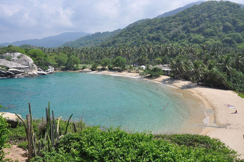
Overview
Santa Marta is the base for the northern Caribbean coast: a hot, relaxed port city next to Parque Tayrona, the Sierra Nevada mountains and the jungle trail to Ciudad Perdida. For most Americans, the sensible plan is to sleep in or near Santa Marta, spend one or two days in Tayrona and add a night in the hills at Minca or on the beach at Palomino.
Tayrona is the main reason to come, but it is not a simple beach day. It has entry rules, mandatory insurance, a daily visitor cap, rest periods when it closes, and beaches where swimming is forbidden for good reasons. This page explains how to choose a base, how the entrances and trails work, and what to check before you pay.
Santa Marta is on the Caribbean coast at sea level, so expect heat and humidity all year. Wikipedia's climate data for the city give average highs of about 90°F (32°C) in November and 91-93°F (33-34°C) from December to April. Colombia Time (UTC-5) applies all year, with no daylight saving. If you are choosing between coastal bases, compare this page with Cartagena, and for the island options see beaches.
Watch out
The most common mistake is swimming where signs forbid it. Several Tayrona beaches have strong currents. The park says to bathe only at authorized sites and only until 6 p.m. If a beach has a sign, a flag or a guard telling you not to swim, do not swim, however calm it looks.
Choosing a base
You can reach Tayrona from several places. The right base depends on how much you want a city, mountains or a quiet beach town.
| Base | Best for | Trade-offs |
|---|---|---|
| Santa Marta (city) | Restaurants, the airport and bus terminal, easy park and trek bookings, the historic center | Hot and busy; the city beaches are not the reason to come |
| El Rodadero | Beach resorts and apartments, families | A resort strip, a little away from the old town |
| Taganga | A small fishing village with a bay, diving and boat trips | Basic and rough around the edges; take care at night |
| Minca | Cooler air, birds and cloud forest in the Sierra Nevada foothills | Farther from the coast; roads can be rough in rain |
| Palomino | A quiet beach and river town in La Guajira, east of the park | Strong currents at the beach; a long way from the park gates; cash is useful |
| Inside or beside the park | Waking up at the beach; sunrise walks | Basic facilities, limited food and closed during rest periods |
Wikipedia describes Taganga as the southern edge of the park area and Rodadero as part of the city of Santa Marta. We could not confirm current hotel or hostel standards, so we name no places. For all-around advice on choosing a stay, see where to stay.
Santa Marta itself
Santa Marta is the capital of Magdalena department, with the Simón Bolívar airport at sea level. The old center has a cathedral that Wikipedia calls one of the city's oldest buildings, and the Quinta de San Pedro Alejandrino, the estate where Simón Bolívar died, sits nearby. A day or half day in the center is enough. We could not confirm current opening hours or ticket prices for city sights.
For flights and buses, check the airlines and the bus terminal directly. Flight and bus times between Cartagena, Bogotá, Medellín and Santa Marta change; see flights, domestic flights and getting around.
Minca and Palomino
Minca is a hill village in the Sierra Nevada foothills, a cooler escape from the coastal heat, popular for birdwatching and waterfalls. Our birdwatching guide covers the birds of the region. Palomino lies east along the coast and is known for a river that reaches the sea. We could not confirm bus times or fares to either, so ask your hotel for the current options and book a registered taxi or shuttle.
How Tayrona works
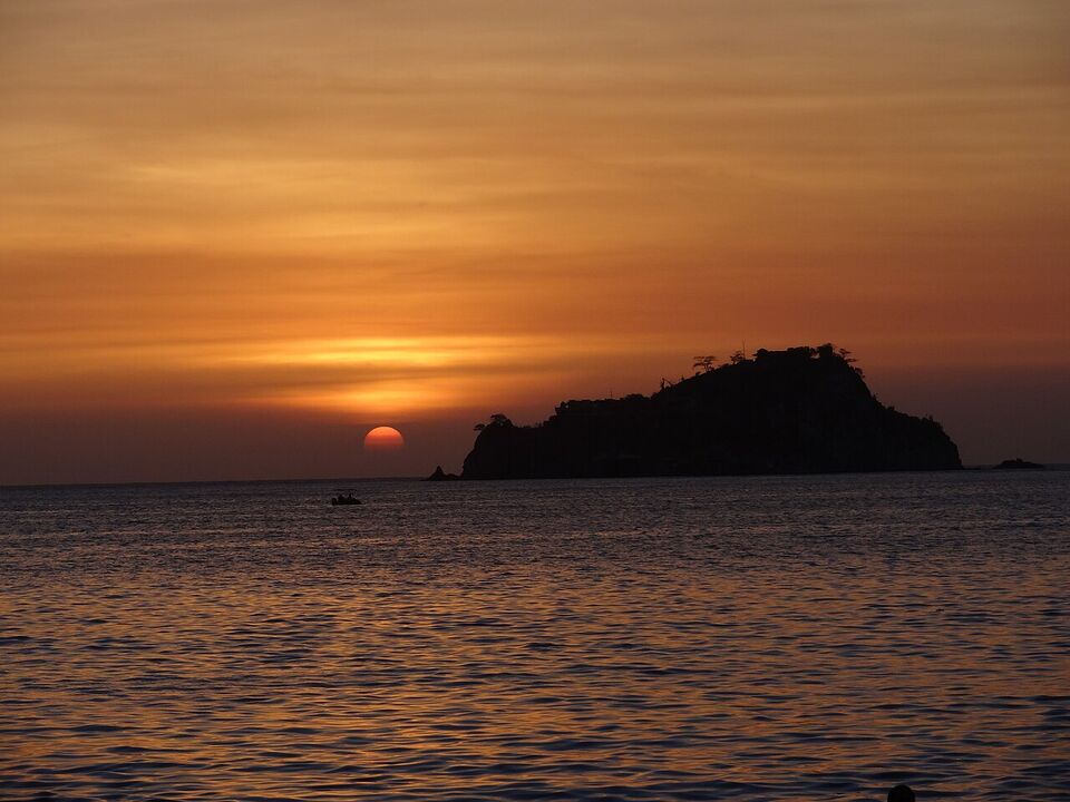
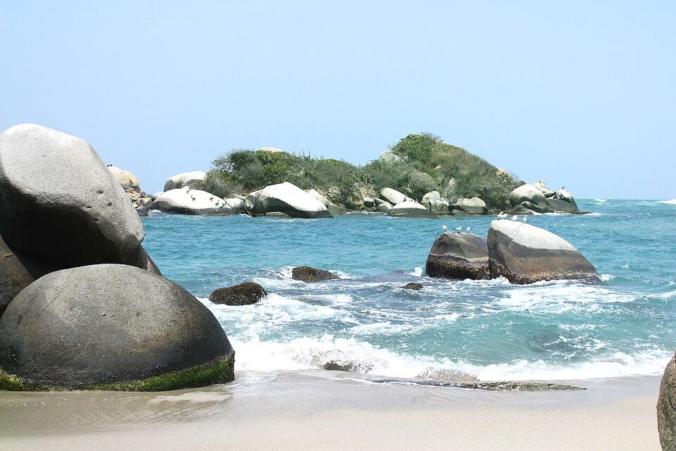
Parque Nacional Natural Tayrona covers about 58 square miles (150 km2) of land and about 12 square miles (30 km2) of sea, about 21 miles (34 km) from the center of Santa Marta, according to Wikipedia. It was the second most visited national park in Colombia in 2022, with 545,760 visitors. The land rises from sea level to about 900 m (2,950 ft), with dry forest, mangrove and beaches between rocky headlands.
The park's official page (Parques Nacionales Naturales) sets out the rules. A visitor must buy an all-risk insurance policy (a póliza) to enter and stay. The daily limit is 6,900 visitors, and each sector or entrance has its own hours. An environmental talk is mandatory. The page advises first-time visitors to go with a certified guide and recommends the trails for children over 12. We could not confirm how the insurance is bought or what it costs.
What is restricted
- Plastic bags, single-use plastics and polystyrene (icopor)
- Musical devices and speakers
- Pets and surfboards
- Alcohol and psychoactive substances
- Weapons, campfires and cigarette butts
You must carry out your own trash, including fruit peels and seeds. Parking in camping zones is banned, and when the parking lots are full, cars are not admitted, only people on foot. Drugs are illegal in Colombia, and the US advisory warns travelers about the risks; do not carry or use them in the park.
Entrances, hikes and beaches by effort
The park has several entrances, and each has its own hours, so read the official page for the one you plan to use. The sectors people mention most are El Zaino (the main gate on the highway), Calabazo, Palangana, Neguanje and Bahía Concha. Names, hours and which gates are open change, so check the official page.
The table below ranks places by effort. Walking times and swimming notes are rough reports from visitors, not official figures, and mud, heat and your pace change them. We could not confirm them from an official source, so ask at the gate and obey the posted signs.
| Place | How you get there | Effort | Swimming |
|---|---|---|---|
| Bahía Concha | Road or boat to a separate sector | Very easy, a short walk from the entrance | Commonly described as suitable; check signs |
| Playa Cristal and the Palangana side | Gate at Palangana, short walk | Easy | Check with the guards; conditions vary |
| Cañaveral and Arrecifes | Walk in from El Zaino | Moderate: about an hour or two on foot | Strong currents at Arrecifes; the park and signs say where not to swim |
| La Piscina and La Arenilla | Continue on the main trail | Moderate to hard in heat and mud | La Piscina is described as sheltered; La Arenilla has dangerous currents |
| Cabo San Juan | Longer walk from El Zaino, or a boat from Taganga or Santa Marta | Hard on foot (hours), easier by boat | One of the more popular swimming areas, per Wikipedia; still check signs |
The trail between the beaches follows forested paths with some roots, boulders and boardwalks. It is hot and humid: the park's own climate data show mean highs around 87°F (30°C) and humidity of about 87%. Start early, drink often and carry more water than you think you need.
By boat
Boats run to some beaches from Taganga and Santa Marta. The park says to make sure any boat has life jackets and to wear one throughout the trip. Sea conditions can change quickly, and boats can be cancelled in rough weather. We could not confirm which landings are currently open or what the boats cost. Use a licensed operator and ask which beach the boat lands at and what time the last return leaves.
Insider tip
Go on a weekday, arrive when the gate opens and walk the longer trail early, when it is coolest. Beaches are quieter before late morning, and you avoid the hottest hours on the trail.
Questions to settle before you go
Several facts change often and we could not settle them from an official source. Check them on parquesnacionales.gov.co and the official booking page the week you travel.
Are there closures in 2026-27?
The park has traditionally closed for rest periods tied to indigenous ceremonies. News reports of 2026 put them at February 1-15, June 1-15 and October 19-November 2. The 2026 periods have passed, and 2027 dates were not published when we checked in November 2026. The park also closed by government order in February 2026 and reopened in March with police presence and some restrictions, according to news headlines. Hotels and day tours can close during these periods too. Do not book flights or nonrefundable stays until you have seen the current official notice.
What is the foreign-visitor fee?
Reports of January 2026 put the entry price for foreign non-residents at about COP 81,000 (about $25) in low season, about COP 96,500 (about $29) in high season and about COP 43,500 (about $13) for the Bahía Concha sector. The reports did not give season dates, and they were not the official resolution. Insurance is required, and prices may change in 2027. Check before you go.
Is the entrance reservation-only?
The park says to book ahead and sets a cap of 6,900 visitors a day, but we could not confirm whether every entrance requires an advance reservation or whether you can buy at the gate. In February 2026, Kogui communities reopened the El Zaino sector and collected a charge themselves, so who sells tickets and how has varied. Use the official booking channel and keep a receipt.
What do the indigenous communities ask?
The park sits on land of the Sierra Nevada peoples. The official page says there are sacred sites of the four indigenous peoples of the Sierra Nevada inside the park, that they are marked, and that entry to them is prohibited. The El Pueblito trail has been closed to visitors since 2019 at the wishes of indigenous residents. Respect closures, signs and requests from guides, and ask before photographing people.
Inside the park or outside it
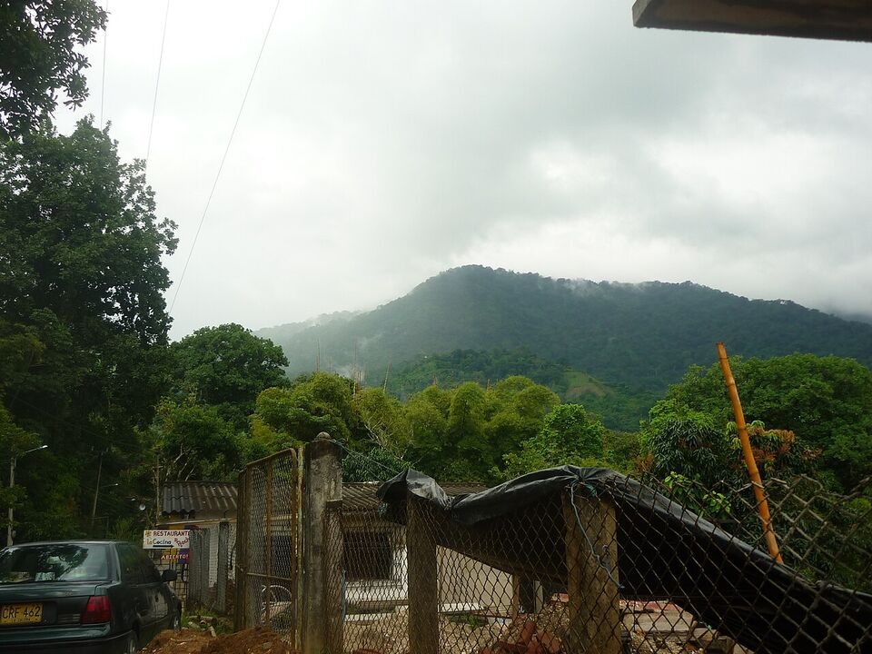
Staying inside means hammocks, tents or basic cabins on a few beaches, and an early start on the trails. Services are simple, and meals are limited. We could not confirm current in-park prices or how to book them, and the park closes during rest periods, so ask the operator for a written confirmation and a refund policy.
Staying outside means Santa Marta, Taganga, Minca or a beach hotel near the entrance. You travel each morning, but you keep a real bed, air conditioning and a choice of food. For most first visits we suggest outside, with one night inside only if you want sunrise at the beach and accept simple conditions. Hotel tiers range from $ hostels to $$ beach hotels; check recent reviews and cancellation terms.
If you do book through a tour, ask what is included: the entry fee, the insurance, the guide, transport and meals. Do not buy park tickets from someone on the road; use the official channel.
Sea conditions, heat and the wet season
Santa Marta has a dry season from December to April and a wet season from May to November, with September and October the wettest. In the park's own climate table, October averages about 266 mm (10.5 in) of rain and November about 212 mm (8.3 in), against about 29-34 mm (1.2-1.3 in) in January to March. IDEAM said on November 12, 2026 that a strong El Niño would continue into early 2027, with less rain and higher temperatures expected, so the coming months may be drier than the averages.
Dry months are best for walking, but the heat is strong: Santa Marta's highs reach 91-93°F (33-34°C) from January to April. In the wet season, trails get muddy, rivers rise and boats can be cancelled. The sea can be rough on exposed beaches in any month. Check the daily conditions with the park or your boat operator.
Jellyfish (aguamalas) can be present in the Caribbean, and the park notes this. Do not touch any you find on the beach. For more on coastal weather and beach choices, see when to go.
What to bring
The park's own list is practical: light cotton clothing, a swimsuit, long sleeves and trousers against insects and branches, sturdy walking shoes that protect the ankles, water shoes for the beaches, a hat, sunglasses and a light rain jacket. Add biodegradable sunscreen, reusable bottles and containers, and a way to carry out trash.
- Passport or a copy, and your travel health insurance details
- At least two liters of water for a long trail day
- Cash in small notes for food, boats and tips
- Insect repellent and a dry bag for your phone
- A headlamp if you will stay overnight
Tayrona does not demand a yellow fever certificate at the gate (per the park page), but vaccination is recommended. The CDC recommends the vaccine for most of Colombia and has a Level 2 yellow fever notice (October 16, 2026), and recommends malaria prevention below 5,600 ft (1,700 m) outside the cities named in its page. This coast is below that line. Talk to a travel clinic early and read health. More gear is on the packing list.
Safety and practical points
The US State Department rates Colombia Level 3: Reconsider Travel (as of November 2026) and lists areas at Level 4: Do Not Travel. In the secondary reports we read, Magdalena is not among them, but check travel.state.gov for the full current list. Its text warns of drugging, extortion, kidnapping and armed break-ins. Use registered taxis or booked transfers, keep phones and cash out of sight, and do not leave drinks unattended. See the safety guide.
See money for how prices are written. Many restaurants add a suggested 10% tip that is voluntary; check the bill. Cash is useful in small places such as Palomino, Minca and park gates. Many travelers drink bottled or filtered water; ask locally. You may also need the entry rules and money pages.
A three- to four-night plan
- Day 1
Arrive in Santa Marta
Walk the center in the evening, eat early and sleep well. Confirm the park's status and your tickets.
- Day 2
Tayrona
Reach the gate at opening, walk to the beaches you can reach comfortably and leave in good time before dark. Swim only where signs allow.
- Day 3
Minca or a rest day
Take a trip into the hills for cooler air and birds, or rest in town. If you plan the trek to Ciudad Perdida, see our Ciudad Perdida guide and book it before you arrive.
- Day 4
Palomino or onward
Spend a beach day at Palomino or head to your next stop, such as Cartagena or the coffee region.
Next steps
- Check the park's current status and any closure notice for your dates
- Buy insurance and tickets only through the official channel
- Book Santa Marta rooms early for holiday weeks; next holiday Monday is November 16, 2026
- Pack for heat, mud and water
For other regions, see regions.
Add it to a route in the trip builder, or ask us to plan the hotels, trains and guides for you.