Overview
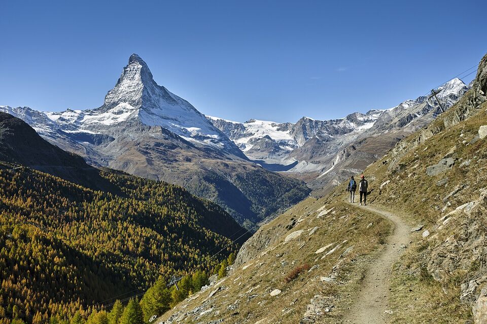
Switzerland is one of the easiest countries in which to hike as a visitor. The trails are marked with signs that anyone can follow, public transport reaches most trailheads, and lifts will take you above the tree line so you can walk downhill. Hiking is also where visitors get into trouble, mostly through three mistakes: starting late, carrying the wrong shoes, and not checking the weather above the valley.
This page is for American visitors planning day hikes. It explains the trail signs, how to choose a trail by difficulty and altitude, famous easy and moderate walks, when the snow leaves, how to use public transport to a trailhead, how mountain huts work, what to carry, and what to do with children. It is not a guide for climbing or glacier travel. For the excursions that start from lifts, see Mountain Excursions, and for base towns, see Interlaken and the Jungfrau Region, Zermatt and Lugano and Ticino.
Reading the trail signs
Swiss hiking trails have a national system of signposts and paint marks. The pattern is consistent across the country, but we could not check it against an official trail-network page for this edition, so treat the colors below as what to look for and confirm them on the national trail website before a serious route.
| Marking | What it usually means | What to expect |
|---|---|---|
| Yellow signposts and yellow diamonds | An ordinary hiking trail (Wanderweg) | Wide, well-kept paths; suitable for most fit walkers in normal footwear for the terrain |
| White-red-white stripes | A mountain trail (Bergwanderweg) | Steeper, narrower, sometimes exposed; sturdy boots and a head for heights |
| White-blue-white stripes | An alpine route | For experienced mountain walkers: possible glacier or rock sections, no handrails; not for a casual day |
Two habits will serve you well. First, Swiss signposts show a place name and a walking time in hours and minutes, not a distance. The times are set for an average fit adult walking without long stops, so plan on adding time for photographs, lunch and children. Second, a yellow sign does not guarantee a gentle walk. A yellow trail can still be long, hot or steep, so read the time and the height gain, not the color alone.
Many walking routes also appear on SwitzerlandMobility (SchweizMobil), the national network of marked routes for walking, cycling and other activities. Its website and app list closures and detours. We could not read the page this year, so open it yourself for the latest route status before you go.
How to pick a trail
Start with the questions that matter most to a visitor: how long will it take, how much do you climb, how high does it go, and how do you get back? A trail that looks short on a map can be long in time because of the climb.
- Time and climb. Look at the signed time and the total ascent. A 3-hour walk with a big climb is harder than a flat 4-hour walk.
- Altitude. Above about 8,000 ft (2,400 m), expect thinner air, cold wind and later snow. Many popular lift stations are well above that, so walk slowly and carry warm layers.
- Up or down. Lifts let you ride up and walk down, which saves energy and knees. Check that the lift runs late enough to get you back if you change your mind.
- Exposure. Sections with drops, ropes or ladders are not for people with a fear of heights or for small children.
- Season. A trail that is fine in August can be icy in October. Ask the local tourist office or the lift operator about the current state.
- Daylight. In mid-November there are about 9 hours between sunrise and sunset in central Switzerland, and about 8.5 hours in mid-December (calculated figures, not an official source). In the shade of a deep valley, it gets dark sooner.
The Packing page has the clothing list that goes with this.
Famous easy and moderate day hikes
These are widely known routes. We did not confirm distances or times on official trail pages, so treat any time here as a rough guide and read the signpost. Lift status in autumn is listed where we have it, and the operators decide, not us.
Lauterbrunnen to Mürren
A climb up the valley wall to Mürren, with the Eiger, Mönch and Jungfrau across the valley. Many walkers ride the cableway from Lauterbrunnen to Grütschalp and then follow the level path to Mürren. See the Interlaken page for bases and the cableway.
Eiger Trail
A path along the foot of the Eiger north face, starting from Eigergletscher station at 7,612 ft (2,320 m). You reach it by the Eiger Express and the Jungfrau Railway. It is mostly downhill, but it is exposed to weather and rock, and the access lift closes for maintenance (a closure guide listed the Eiger Express shut November 9-20, 2026).
First to Bachalpsee
From the First top station at 7,106 ft (2,166 m), a well-kept trail reaches the Bachalpsee lake at 7,431 ft (2,265 m) in under an hour, and the operator quotes about two hours for the round trip. The cable car starts from CHF 38 (about $45) and the First lift was listed as closed to November 27, 2026, so confirm before you plan an autumn visit.
Oeschinensee
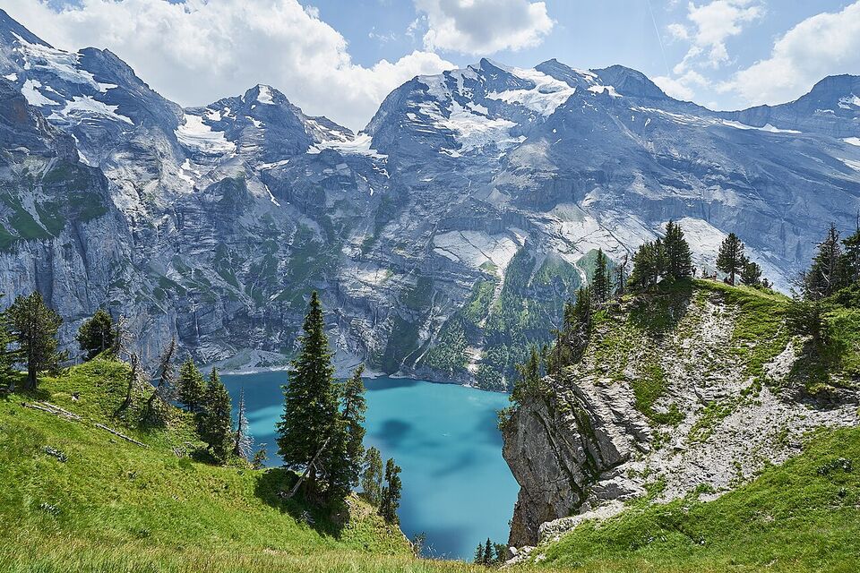
An alpine lake above Kandersteg, reached by gondola and a short walk, then a lakeshore path. A closure guide listed the gondola as running only to November 9, 2026, so it is probably shut for the season; check the operator. We could not confirm whether any reservation system applies in 2026, so check before you go.
Gorner Gorge (Gornerschlucht)
A gorge walk near Zermatt on wooden walkways. Its opening is seasonal, and we found no 2026 dates, so check with Zermatt tourism. For wider views, the Gornergrat railway (from CHF 102, about $120) leads to trails above the Gorner Glacier.
Lake Lugano trails
Lugano is milder than the northern Alps, with an average November high of 53°F (12°C), so lakeside and hillside paths work when high trails are closed. A closure guide shows Monte San Salvatore closed November 9 to December 4, 2026. See Lugano and Ticino.
Rigi and Stoos have ridge paths that suit the same pattern: ride up (both are free with a Swiss Travel Pass), walk along the crest, and ride down a different way. Check the lift status for each, because both have scheduled maintenance breaks.
Insider tip
On a short autumn day, use the lift to go up and walk down, and pick a route that ends at a station or bus stop. Write down the last departure of the lift and the last bus, and set a turn-around time at the start. If you pass your turn-around time, go back.
Snow, seasons and trail closures
Snow decides when high trails open. In spring and early summer, snow can remain on north-facing slopes and at passes after the valleys are green, and a trail that looks clear on a lower photo may be covered higher up. Melting snow also makes steep patches slippery and creates stream crossings. Most walkers find the safest high-mountain season in the middle of summer and early autumn, but we cannot give opening dates for 2027, because they depend on that winter's snow. The Swiss avalanche institute SLF, which runs the national avalanche bulletin, published an article in November 2026 on how the hot summer of 2026 may affect the winter. We have not read it, so do not infer a snow forecast.
Road passes follow the same rhythm. On our November 14, 2026 snapshot, passes such as Furka, Susten, Grimsel, Klausen and the Gotthard pass road were already closed for the winter, while the Bernina, Julier and Simplon were open. If your hike starts at a pass, check the road status as well as the trail. The Driving page has more.
In autumn and winter, many mountain trails are for experienced people only. Lower marked winter trails, groomed snowy paths and snowshoe routes exist around many resorts. The Jungfrau region lists a Winter Hiking and Sledging Pass from CHF 61 (about $73) for November 21, 2026 to April 25, 2027. Winter trails still need warm layers, good grip and attention to avalanche warnings, so use the resort's marked winter routes and the SLF bulletin, and ask locally.
Spring is the other awkward season. Lifts that close for revision in April and May leave high trails inaccessible, and huts are often shut until late spring or early summer. See When to Go to Switzerland for the season overview and Switzerland in November for the late-year picture.
Weather and when to turn back
Mountain weather changes faster than valley weather. Check the forecast for the altitude of your route, not just the town where you sleep. MeteoSwiss, the federal weather service, has local forecasts and natural-hazard bulletins on its website and in its app. Install the app and check the forecast the evening before and again at breakfast. Look at the lift operator's webcam as well.
- Start early. Thunderstorms often build in the afternoon in summer, so aim to be off exposed ridges and summits by early afternoon.
- Turn back at the first distant thunder or when towers of dark cloud build. Do not wait to see if it passes.
- Avoid ridges, summits, open slopes, lone trees and metal cable handrails during a storm. Move downhill to a hut, a building or the tree line.
- Turn back if fog hides the markings, if the wind makes balance hard, or if rain makes the rock slick.
- Set a turn-around time before you leave and keep to it, even if you have not reached the goal.
- Tell someone where you are going and when you will return.
Cold is a risk even on sunny days. At altitude, temperatures can fall below freezing in any month, and wind and rain make it worse. The Jungfraujoch weather station, at 3,580 m, records an average July high of about 38°F (3°C), so a summer walk at that height needs winter gloves. The Safety page covers more on emergency contacts, and the Health page covers ticks, altitude and travel insurance.
What to carry
- Boots or sturdy trail shoes with grip. Sneakers and smooth soles are the most common mistake on wet or steep paths.
- Layers: a base layer, a warm mid layer, and a waterproof jacket. Add a hat and gloves for anything above the tree line.
- Water, at least 1.5 liters per person for a half-day hike, plus snacks. Many villages have public drinking fountains, but do not count on water on the trail.
- Sun protection: sunglasses, a hat and strong sun cream, because UV is stronger at altitude.
- A paper map or offline map, a charged phone and a power bank. Reception can fail in valleys.
- A small first-aid kit, blister plasters, a headlamp for an unplanned late return, and a thin emergency blanket.
- Cash in francs for huts and small farm cafes, and your ID.
- Walking poles if you have knee problems, which help on long descents.
Using public transport to trailheads
Switzerland's rail, bus, boat and lift network is the reason you can hike without a car. The SBB app and the timetable site show how to reach a trailhead, and PostBus (PostAuto) buses run to many villages and passes. Plan the return as carefully as the outward trip: the last bus or lift can leave earlier than you expect, especially in autumn and winter, and some mountain buses run only on certain days.
A Swiss Travel Pass covers trains, buses and boats across the network, and gives free or discounted rides on many lifts, as described on the Swiss Travel Pass page. A Half Fare Card at CHF 150 (about $180) for a month halves most fares. The Trains and Transit in Switzerland page explains tickets. Always check that the lift or railway you need is running on your date, and see the mountain closure table on the Mountain Excursions page.
Save money
A walk down from a lift can cost less than a walk up and down with lift tickets both ways. Ask for a single (one-way) ticket or a partial route, and pick a trail that ends at a village with a train station so you do not need a second lift ticket.
Mountain huts
Huts range from simple shelters to restaurants with beds. Many are run by the Swiss Alpine Club (SAC), whose site is sac-cas.ch. We did not check hut rules for 2026, so verify each hut's season, booking requirement and payment on its own page or the SAC site. Our advice is general.
- Book. Huts usually require or strongly advise a reservation in summer, including for meals. Book ahead and tell the hut if you cannot arrive, so nobody starts a search for you.
- Arrive on time. Dinner is often at a fixed time, usually early evening. Plan to arrive before it.
- Carry cash. Many huts do not take cards. Bring francs.
- Take off boots at the door. Huts usually provide slippers or ask you to bring light shoes, and boots go in a boot room.
- Carry a sleeping-bag liner. Blankets are provided in many huts, but sheets or liners often are not. Check what the hut supplies.
- Keep quiet at night. Lights out and silence are usual from around 10 p.m., and people leave very early in the morning, so pack the night before.
- Pack out your trash and use water sparingly, as huts often have limited water and electricity.
The Etiquette page covers other customs, including greetings on the trail. In Switzerland, passing walkers usually say hello.
Mistakes Americans make
- Starting late. A 10 a.m. start for a long route leaves no margin for afternoon storms or a missed last lift. Start early, especially in autumn when daylight is short.
- Wrong shoes. City sneakers on a wet or steep path cause many accidents. Wear shoes with real tread.
- Trusting valley weather. Sun in town does not mean sun at 8,000 ft. Check the forecast for altitude and the webcam.
- Judging by distance. Swiss signs give time, and the climb matters more than the miles.
- Assuming the lift runs. Lifts close for maintenance, wind and season. Verify status that morning on the operator's site.
- Underestimating cold and altitude. Pack a jacket even in summer. Walk slowly and drink water.
- Leaving the trail. Shortcuts cause erosion and falls. Close gates behind you, keep dogs on a leash near livestock and give cows plenty of space, especially with calves.
- Skipping insurance. A helicopter rescue can be expensive. See the next section.
Watch out
Do not rely on a blog's trail description for current conditions. Trails close after storms, rockfall or snow, and the lift you need may be in maintenance. Check the lift operator and SwitzerlandMobility the morning you go, and ask at the tourist office if a route looks doubtful.
Emergencies, rescue and insurance
For emergencies in Switzerland, call 112 (the European emergency number, which works here), 144 for an ambulance, 117 for police, 118 for fire, or 1414 for Rega, the Swiss air-rescue service. From outside Switzerland, Rega's number is +41 333 333 333. For a mountain emergency, call 1414 or 112. Give your position and say what happened.
Rega says an average helicopter mission costs around CHF 4,500 (about $5,350), and complex searches can cost far more. Rega also sells a patronage for CHF 40 (about $48) for adults, valid to May 15, 2027 for payments made in late 2026, with children and young people free. Patronage may help with mountain-rescue costs in Switzerland, but it does not replace travel insurance, and Rega says worldwide repatriation flights are for patrons living in Switzerland or Liechtenstein, or Swiss nationals abroad. Buy a travel insurance policy that explicitly covers mountain rescue and medical evacuation, and read the exclusions for hiking at altitude. The Health page has more on insurance and ticks.
Hiking with children
Switzerland is good for family walks, as long as you pick the right ones. A few principles help.
- Choose lift-assisted routes. Riding up and walking down saves small legs. First to Bachalpsee has a short trail to a lake, and the First area has a playground at Bort, according to the operator.
- Keep the time short. Plan about half the signed time you would manage alone, and add stops for snacks.
- Avoid exposure. Skip routes with drops, ladders or cables unless you know the children are comfortable.
- Use the pass. Children 6 to 15 travel free on public transport with a parent who holds a Swiss Travel Pass and the free Swiss Family Card. Lift tickets are priced separately, so ask each operator.
- Carry extra layers and food. Children cool fast and tire fast.
- Dogs and strollers. Many gondolas take dogs for a fee and some routes suit strollers, but trails with steps do not. Ask the operator.
The Families page has more on traveling with children.
Add it to a route in the trip builder, or ask us to plan the hotels, trains and guides for you.