Overview
The Indian Himalayas are not one trip but three, and they suit different travelers. Himachal Pradesh has hill towns, pine forests and valleys within reach of Delhi. Ladakh is a high, dry mountain desert with Buddhist monasteries, and it demands care about altitude and access. Darjeeling, in the east, is a tea-growing hill station with a famous narrow-gauge railway and views of Kangchenjunga on clear days.
Most people have time for one or two of them. Pick based on the season you will travel and what you want from the trip: a gentle break from the plains, a serious high-altitude journey, or tea and trains. Do not try to combine all three in one trip, since they lie hundreds of miles apart and need separate flights.
All three are reached through the plains, and you will usually start in Delhi or Kolkata. This guide explains how the three compare, how to get to each, how to handle altitude and cold, what the road and landslide risks mean for your plans, and a sample route for each. For other regions, see the regions overview.
Different from home
Mountain roads in India are narrow, shared with trucks and buses, and prone to landslides in the monsoon. India drives on the left, and journeys of 100 miles can take most of a day. Treat every drive time as a rough guide, and keep a spare day in your plan.
Comparing the three trips
| Himachal (Shimla, Manali, Dharamshala) | Ladakh (Leh) | Darjeeling | |
|---|---|---|---|
| Altitude | Dharamshala 4,780 ft (1,457 m); Manali 6,730 ft (2,050 m); Shimla 7,795 ft (2,376 m) | Leh 11,562 ft (3,524 m); passes much higher | About 6,709 ft (2,045 m); Ghum station 7,410 ft (2,260 m) |
| Best season | Roughly March to June and September to November; snow in winter; heavy rain June to September | Summer, roughly June to September; winter is extremely cold | Roughly October to November and March to May; monsoon June to September |
| Main access | Road and rail from Delhi and Chandigarh; small airport near Dharamshala | Flights to Leh; seasonal roads from Manali and Srinagar | Fly to Bagdogra or take a train to New Jalpaiguri, then drive |
| Flights or road | Road and rail are easy; flights save time between hill towns | Fly in; use the road only with extra days and checks | Fly to Bagdogra; the drive up takes a few hours |
| Cold | Cold nights in winter; snow in Shimla and Manali | Freezing in winter; cool nights even in summer | Cool all year; cold and damp in winter |
| Landslide risk | High in the monsoon | Road closures from snow and landslides | High in the monsoon; the railway has been damaged before |
| Time needed | 7 to 9 days for three towns | 8 to 10 days with acclimatization | 4 to 5 days |
| Permits | Some border areas need permits for foreigners; check before you go | Check, for border-region areas | Check before you go; Sikkim needs a Protected Area Permit |
Season advice here is general: the figures come from monthly climate averages, and we could not confirm opening dates for any road or pass. Check conditions with the operator or the state tourism site before you commit.
Himachal: Shimla, Manali and the toy train
Shimla and the Kalka-Shimla railway
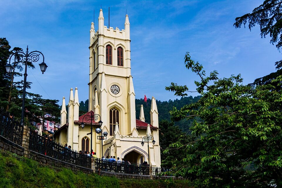
Shimla, at 7,795 ft (2,376 m), was the British summer capital, and it is still the capital of Himachal Pradesh. The center is built on a ridge: The Ridge, a pedestrian square, the Mall Road, Christ Church and the Viceregal Lodge are the main sights. Summer highs (May to July) average about 70 to 75°F (21 to 24°C), and winter highs (December to February) about 49 to 53°F (9 to 12°C). Snow in recent years has tended to come in January or early February.
The classic way up is the Kalka-Shimla railway, a narrow-gauge line (2 ft 6 in, 762 mm) built between 1898 and 1903. It is about 60 miles (96.6 km) long, has 18 stations, and climbs through the hills past pine forest and small stations. It is part of the UNESCO-listed Mountain Railways of India. Kalka is on the Delhi-Kalka line, so you can take a plains train from Delhi and change. The ride is slow, so plan most of a day. We could not confirm current timetables, fares or the services that run, so check with IRCTC and see the trains guide. If you want the same scenery faster, go by road from Chandigarh.
Manali and the Kullu Valley
Manali sits at 6,730 ft (2,050 m) at the head of the Kullu Valley, about 340 miles (550 km) from Delhi and 175 miles (282 km) from Chandigarh by road. It is a base for walks, rafting on the Beas River, the Hadimba Temple (a wooden shrine from the 16th century) and Solang Valley, about 9 miles (14 km) north. Snow comes between December and early March. In July and August, the monsoon brings the most rain.
Manali is also the gateway to Lahaul and Spiti and to Leh. Rohtang Pass, at 13,050 ft (3,979 m) and about 32 miles (51 km) from Manali, is the old high crossing; the Atal Tunnel now runs under it on the Manali-Leh highway. Road and tunnel conditions change, so check them locally. A road from Shimla to Manali is about 170 miles (270 km) and takes a long day.
Dharamshala and McLeod Ganj
Dharamshala is a town in the Kangra Valley at 4,780 ft (1,457 m), below the snow-streaked Dhauladhar range. Upper Dharamshala is McLeod Ganj (6,831 ft or 2,082 m), the home of the 14th Dalai Lama and the Tibetan government in exile since 1960. It is a place of monasteries, Tibetan cafes and shops, and trails into the hills, including the popular hike to Triund. The Library of Tibetan Works and Archives opened there in 1970.
Treat the monasteries as places of worship: dress modestly, take off your shoes where asked, and ask before taking photographs of monks or people. See etiquette for more.
Dharamshala is one of the wettest places in the state. From June to mid-September it gets heavy monsoon rain, up to about 120 inches (3,000 mm) in a season, and July and August see 22 or 23 rain days each. October and November are very dry, and the winter months are cool and clear. The nearest airport, Kangra (Gaggal), is about 7 miles (12 km) south of the town, and the nearest big railhead is Pathankot, about 56 miles (90 km) away. You can also visit from Amritsar by road.
Ladakh: Leh, altitude and access
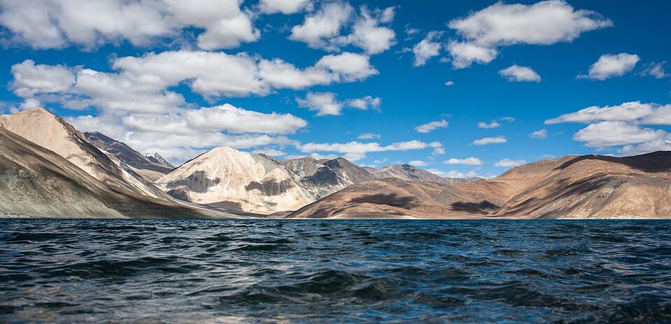
Ladakh, in the far north, is a high-altitude desert of bare mountains, rivers, blue lakes and Buddhist monasteries. Leh, its capital, lies at 11,562 ft (3,524 m) on the Indus River, with the nine-story Leh Palace from the 17th century above the old town. Other highlights are Shanti Stupa, the monasteries at Hemis and Thiksey, the Nubra Valley and Pangong Lake. Zanskar is farther out and takes longer to reach.
Getting there
Fly. Leh's airport has daily flights from Delhi on Air India, SpiceJet and IndiGo (check current schedules), and the flight is short. The roads are seasonal: the Srinagar-Leh highway is 270 miles (434 km), and the Leh-Manali highway is 266 miles (428 km). Both are often blocked by snow in winter, and they close after landslides at other times. The Zoji La pass on the Srinagar road is closed in winter, and a tunnel there is under construction.
The State Department's advisory (Level 2, as of November 2026) lists Jammu and Kashmir as Do Not Travel, except for the eastern Ladakh region and its capital Leh. The Srinagar road starts in Jammu and Kashmir, and we suggest Americans read the advisory text on travel.state.gov before planning anything but a flight to Leh or the Manali road. Check road and pass status with the Border Roads Organisation, the Ladakh and Himachal tourism sites and your driver.
The short season matters. Many guesthouses, camps and restaurants shut in winter, and the roads are open only part of the year. We could not confirm opening dates, so ask your hotel for the dates for your year. Leh's average January high is about 35°F (1.5°C) and the low is about 8°F (-13°C). In June the high is about 76°F (24°C), and in July it is 83°F (28.5°C).
Altitude sickness
Altitude sickness is the main medical risk in Ladakh, and it can affect fit travelers. At Leh the air holds noticeably less oxygen than at sea level, and your body needs days to adjust. Mild symptoms are headache, nausea, poor sleep and tiredness; serious ones are confusion, breathlessness at rest and loss of balance, and they need a descent and a doctor.
- Fly in and do almost nothing on the first day. Rest, walk slowly, and sleep.
- Drink water often, and skip alcohol for the first days.
- Go up gradually. Spend your first nights in Leh before heading higher, to Nubra or Pangong.
- Talk to your doctor at least a month before the trip about preventive medicine and about any heart, lung or other conditions. The CDC advises seeing a doctor a month before travel.
- Do not ignore symptoms. If they worsen, go down. Do not climb higher with a headache.
- Buy insurance that covers medical evacuation. The CDC advises it for remote travel.
Permits
The Indian government requires special permits for some border and protected areas, and the e-Visa is not valid in protected, restricted or cantonment areas without prior permission. Some valleys and lakes in Ladakh that visitors like have required permits for foreigners in the past. The rules change, and we could not confirm the 2026 requirements. Check the Leh district website, leh.nic.in, and ask a licensed local operator which areas need permits and how they are issued. Carry your passport and visa copies, and allow time to arrange it.
Watch out
Do not fly into Leh and then go to a high pass or a lake on the same day. This is the most common mistake in Ladakh. Keep day one empty, day two light, and add altitude slowly. Weather and road closures can also strand you, so leave a spare day before an international flight.
Darjeeling: tea, trains and Kangchenjunga
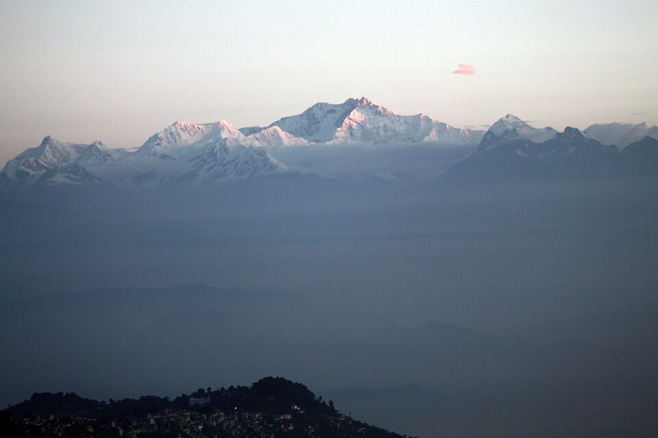
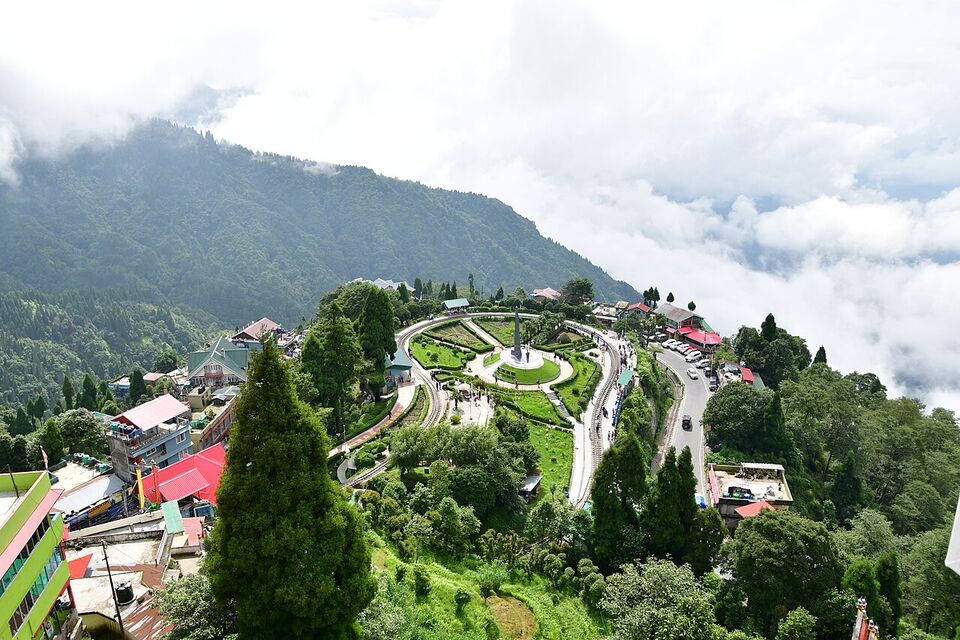
Darjeeling is a hill town in West Bengal at about 6,709 ft (2,045 m), where British officials built a summer retreat in the 1830s. Tea was first tried there in 1840, and Darjeeling tea won geographical-indication status in 2005. The town looks across to Kangchenjunga, the world's third-highest mountain at 28,169 ft (8,586 m). Most people there speak Nepali, and Bengali is also an official language, so signs and menus can differ from the Hindi-speaking north.
The toy train
The Darjeeling Himalayan Railway is a 2 ft (610 mm) gauge line, about 55 miles (88 km) long, built between 1879 and 1881 from New Jalpaiguri to Darjeeling. It is a UNESCO World Heritage Site (1999). Reference sources list daily tourist trains from Darjeeling to Ghum, which at 7,410 ft (2,260 m) is India's highest railway station, and a steam-hauled "Red Panda" service from Darjeeling to Kurseong. The full run is very slow, and many visitors ride only the short Darjeeling-Ghum stretch. We could not confirm 2026 fares, times or whether services are running, so check with the railway and your hotel. The line has been damaged by landslides in the past.
Views, tea and monasteries
Kangchenjunga is only visible on clear days, so it is a matter of luck and season. Autumn (October and November) and spring are generally clearest, and the monsoon months (June to September) bring 18 to 23 rain days a month and heavy cloud. Darjeeling averages about 63°F (17.2°C) at its November high and 43°F (6.2°C) at the low, with under one rain day that month. In January, the high is about 52°F (11.1°C) and the low 35°F (1.7°C).
Tea estates near town offer tours and tastings; ask your hotel which are open and book in advance. In town, the Japanese-built Peace Pagoda (1992), the Ghoom Monastery about 5 miles (8 km) away, and the Tibetan Refugee Self-Help Centre, where crafts are made and sold, make a good half day.
Getting there
Fly to Bagdogra, which is on the e-Visa entry list, or take a train to New Jalpaiguri near Siliguri. From there, a car or shared jeep climbs the Hill Cart Road to Darjeeling, a drive of a few hours in good conditions. Add buffer time for traffic and landslides. If you want to extend the trip into Sikkim, check the permit rules on the official Sikkim tourism site, since Protected Area Permits apply there.
Flights, roads and landslides
In the mountains, a short flight usually saves a long, uncertain road trip. Fly to Leh. Use Gaggal for Dharamshala if a seat is available, and Bagdogra for Darjeeling. Use the road for shorter hops and when scenery matters, and give yourself margin.
- Monsoon (roughly June to September): landslides and washouts close hill roads, especially in Himachal and the Darjeeling hills. Single-lane traffic and long delays are common.
- Winter: snow closes high passes, including the roads to Leh, and fog affects flights in north India.
- Always: check road status with the local tourism office, your driver or the Border Roads Organisation, and ask for a daily update. Never book a same-day connection after a mountain drive.
For driving in India, hire a car with a driver and avoid night driving. The CDC also advises sitting in the back seat and wearing a seatbelt. See getting around for general advice, and when to go for seasons.
Sample plans
Himachal in 8 days
- Day 1
Delhi to Shimla
Take a train to Kalka and the toy train up, or go by road from Chandigarh. Arrive in time for a walk on The Ridge.
- Day 2
Shimla
Walk the Mall Road and see Christ Church and the Viceregal Lodge. Keep the afternoon free.
- Day 3
Shimla to Manali
A long road day of about 170 miles (270 km). Leave early and expect delays.
- Day 4-5
Manali
Visit Hadimba Temple and Solang Valley, and walk or raft by the Beas River.
- Day 6
Manali to McLeod Ganj
Another long drive; allow most of the day.
- Day 7
McLeod Ganj
Visit the Dalai Lama's temple complex and Namgyal Monastery area, the Tibetan library, or take the hike to Triund.
- Day 8
Home or onward
Fly from Gaggal or go by road to Pathankot and take a train; check connections.
Ladakh in 8 days
- Day 1
Fly to Leh and rest
Check in, drink water, and do nothing else.
- Day 2
Leh, slowly
Short walks in the old town and a visit to Leh Palace. Return to rest at midday.
- Day 3
Monasteries in the Indus Valley
Thiksey and Hemis monasteries, lower than the high passes.
- Day 4-5
Nubra Valley
Cross a high pass north of Leh, with permits checked in advance. Stay one night.
- Day 6-7
Pangong Lake and back
An overnight at the lake, with permits checked in advance, then return to Leh.
- Day 8
Spare day and flight out
Keep a day free for weather or delays before you leave.
Darjeeling in 5 days
- Day 1
Bagdogra to Darjeeling
Fly in, drive up, and rest.
- Day 2
Town and toy train
Ride the short Darjeeling-Ghum stretch if running, and visit Ghoom Monastery.
- Day 3
Tea and views
Tea estate visit and the Tibetan Refugee Self-Help Centre; stay out for clear weather.
- Day 4
Spare day
Use it for weather, a walk or a second view of the mountains.
- Day 5
Back to Bagdogra
Allow plenty of time for the drive and the flight.
Common mistakes
- Flying straight to Leh and doing too much on day one. Rest first, and add activity gradually.
- Treating the roads as open all year. The Leh roads are seasonal, and hill roads close after landslides.
- Packing too little for cold. Even in summer, nights at altitude are cold. Bring layers, a warm hat and gloves.
- Cramming three hill towns into four days. Mountain drives are slow. Give each stop at least two nights.
- Visiting Himachal or Darjeeling in the monsoon without flexibility. Landslides can cut off roads.
- Skipping medical evacuation insurance. It matters most in remote areas.
- Counting on the toy train. Treat it as a bonus, not the core of the trip.
- Ignoring permit questions. Ask early, and use official sites.
For safety information, see safety and health. For the visa and entry steps, see entry. In an emergency, call 112, and the US Embassy New Delhi can be reached at +91-11-2419-8000. For tourism information, see Himachal Pradesh Tourism and West Bengal Tourism.
Add it to a route in the trip builder, or ask us to plan the hotels, trains and guides for you.