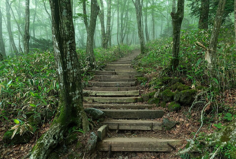
Overview: hiking as a national pastime
South Korea is a country of mountains, and walking in them is part of ordinary life. On a fall weekend, subway cars toward the city's northern peaks fill with people in colorful jackets, boots and trekking poles, and the trails are as social as they are physical. Seoul has a national park within its borders, and most regions have a peak that locals climb on holidays. The mountains are also part of the culture: temples sit on their slopes, fortress walls follow their ridges, and many peaks have a place in myth.
For a visitor, that means two things. First, the trails are well marked and busy, with stairs, ropes and handrails on the steepest sections, so you do not need a guide for most day hikes. Second, the mountains are not a casual stroll: weather changes fast, trails close for fire and repairs, and a "short" hike can be steep. This page covers the culture, the main areas, trail types, seasons, safety, gear, etiquette and the mistakes to avoid, with a table of hikes by difficulty, time and access.
If you are building a trip, the by-interest page shows how hiking fits with other themes, and the guides to Sokcho and Seoraksan and Jeju cover two of the biggest hiking destinations in detail.
Hiking culture and what to wear
Koreans take hiking seriously, and the clothing shows it. Many hikers, including older walkers, wear technical jackets, hiking pants, boots and gloves, even on a short city mountain. Do not be surprised to see bright colors, matching sets and a lot of gear on a trail that rises only a few hundred meters. The hiking shop is a fixture of Korean cities, and outdoor brands are sold in major shopping districts.
The mood on the trail is friendly. People greet each other as they pass, snack stops are communal, and a bench with a view quickly fills with groups sharing food. It is common to see hikers share fruit, rice cakes and rice wine, and to have an older hiker offer you a snack. Accept with a small bow and a thank-you; it is polite, and it is a good way to meet people. You are not expected to bring gifts or to speak Korean, though a few words help (see our Korean phrases page).
What to wear for a day hike is straightforward: sturdy shoes with a good grip (granite is slippery when wet), quick-dry layers, a windproof shell, a hat and gloves outside summer, and trousers rather than shorts on rocky or brushy trails. Jeans are heavy and cold when wet, and sandals and fashion sneakers are a poor choice on stairs and wet rock. You will not stand out in simple outdoor clothing, but if you want to match the crowd, buy locally.
The main hiking areas
Bukhansan and Seoul
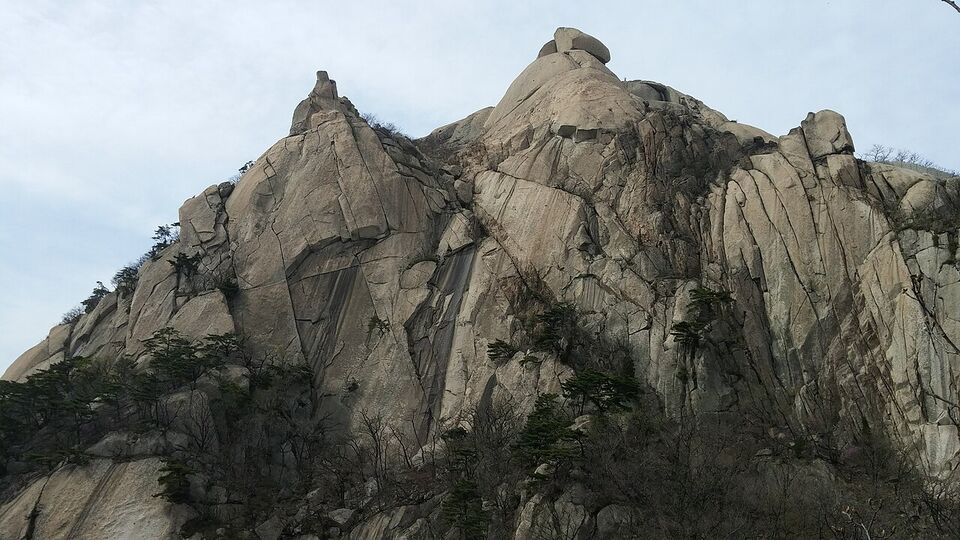
Bukhansan National Park sits on the northern edge of the city, and its three main peaks are Baegundae at 2,744 ft (836.5 m), Insubong at 2,659 ft (810.5 m) and Mangyeongdae at 2,582 ft (787 m). It is a granite mountain with about 5 million hikers a year, which makes it busy. Other Seoul-area peaks include Dobongsan and Suraksan, and Namsan and Inwangsan make shorter city walks.
Seoraksan
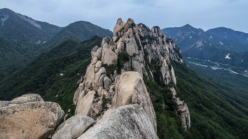
The third-highest mountain in South Korea, Daecheongbong stands at 5,604 ft (1,708 m). The park near Sokcho has easy valley walks, a cable car, a staircase up Ulsanbawi and long routes for experts. See Sokcho and Seoraksan for trail times.
Hallasan
Hallasan is the highest mountain in South Korea at 6,388 ft (1,947 m). Five trails climb it, and two lead to the summit crater rim. It needs planning, reservations and an early start.
Jirisan
Jirisan is the second-tallest mountain in the country and the tallest on the mainland, at 6,283 ft (1,915 m). It is a broad range of ridges and valleys with temples, and it is known for long routes that take more than a day. Plan on shelters and early booking.
Naejangsan
A mountain park known mainly for its fall foliage and a popular autumn weekend trip. It is a good alternative to the crowds at Seoraksan, but we could not confirm its trail details, fees or color dates, so check the park service before you go.
Hallasan, Jirisan and Seoraksan are the three tallest mountains in South Korea. For a first trip, Bukhansan is the easiest to reach, and Seoraksan has the best mix of short and long routes. Hallasan is the most specific, because it is on an island and the summit needs planning and reservations.
Trail types you will meet
Korean mountain paths come in a few recognizable types, and knowing them helps you pick a day.
- Granite ridges and domes. Bukhansan and Seoraksan are granite, with bare rock, steps cut into stone and iron handrails or ropes on steep sections. Dry granite grips well, but wet granite and ice are slippery. Allow extra time on descents.
- Staircases. Many popular routes are mostly stairs, built of timber, stone or metal. Ulsanbawi in Seoraksan has over 800 steps. Stairs are tough on knees and thighs, so poles help.
- Fortress walls. Seoul's City Wall follows the ridges of Bugaksan, Naksan, Namsan and Inwangsan, and other fortress trails, such as Namhansanseong near Seoul, give a history walk with views. Some sections have security or opening-hours rules, so check before you go.
- Temple approaches. Many trails start at a temple, and some national park routes pass several. They are gentler and a good choice in poor weather. See our temples page for etiquette.
- Volcanic trails. On Jeju, Hallasan is a volcano, with forest at the base, open slopes above and a crater lake at the top. Sections are long, and weather above the clouds can differ greatly from the coast.
- Coastal and lakeside walks. Not every walk is a climb. The Jeju Olle trails and east coast paths are gentle options; see Gangneung and the East Coast.
Table: hikes by difficulty, time and access
Times are for an average walker, round trip, and are estimates unless noted. Lengths for Hallasan come from public references. Always check the park service's page for current trail status.
| Hike | Difficulty | Typical time | Distance or height | How to reach |
|---|---|---|---|---|
| Namsan loop (Seoul) | Easy | 1 to 2 hours | City hill, paved and stairs | Subway and a short walk |
| Seoul City Wall (Inwangsan or Naksan section) | Easy to moderate | 2 to 4 hours | Wall path with stairs | Subway; check section rules |
| Biryong Falls (Seoraksan) | Easy to moderate | About 2 hours | About 40 minutes each way | Express bus to Sokcho, then city bus |
| Bukhansan, Baegundae | Hard | 4 to 6 hours | 2,744 ft (836.5 m) summit | Subway or light rail, then walk to a visitor center |
| Ulsanbawi (Seoraksan) | Moderate to hard | 3.5 to 4 hours | Over 800 steps | Express bus to Sokcho, then city bus |
| Hallasan, Yeongsil (to the upper trail) | Moderate | 3 to 4 hours | 3.7 km (2.3 miles) trail | Rental car, bus or taxi on Jeju; check access |
| Hallasan, Eorimok | Moderate | 3 to 4 hours | 4.7 km (2.9 miles) trail | Bus or taxi from Jeju City |
| Hallasan summit, Seongpanak | Hard | 8 to 10 hours | 9.6 km (6 miles) each way | Bus or taxi; reservation rules to be checked |
| Hallasan summit, Gwaneumsa | Hard | 8 to 10 hours | 8.7 km (5.4 miles) each way | Bus or taxi; reservation needed for the summit section |
| Seoraksan, Daecheongbong | Very hard | Overnight or a very long day | 5,604 ft (1,708 m) | Bus to Sokcho or Osaek; check shelters |
| Jirisan, ridge routes | Very hard | Overnight or multi-day | 6,283 ft (1,915 m) | Bus or train to the south; plan with the park service |
Distance for Hallasan trails is the one-way length listed for each route. A good day on Hallasan is a long one; leave early, check the turnaround time posted at the trailhead and be ready to turn back.
Hallasan: reservations and the summit
Hallasan has five trails: Gwaneumsa (8.7 km, about 5.4 miles), Eorimok (4.7 km, about 2.9 miles), Seongpanak (9.6 km, about 6 miles), Yeongsil (3.7 km, about 2.3 miles) and Donnaeko (9.1 km, about 5.7 miles). Only Gwaneumsa and Seongpanak lead to the summit at Baengnokdam.
On the Gwaneumsa trail, the section from Samgakbong to the Baengnokdam summit was closed from August 1, 2026 for rockfall barrier work and deck replacement, and it reopened on September 24, 2026. Reservations reopened on September 21, 2026 at 9 a.m. through the Hallasan Trail Reservation System website, run by the Jeju World Heritage Headquarters. Check the Seongpanak reservation rule and any fees on the official Hallasan National Park page (visithalla.jeju.go.kr) before you go. Slots can fill, especially in fall and on weekends, so reserve as soon as your dates are firm.
Watch out
Do not arrive at Hallasan without a reservation and expect to walk up. Reservation rules, turnaround times and closures change, and the official pages are the only reliable source. Our Jeju guide explains how to reach the trailheads, which are best reached by rental car or taxi.
Seasons: color, azaleas and snow
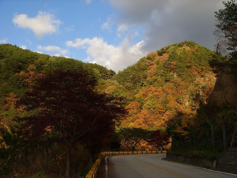
Fall is the most popular season. Color begins on the high peaks in late September or early October and moves down over the following weeks; in Seoul and the lowlands it generally runs from late October to mid-November. Dates vary year to year, so use the Korea Meteorological Administration and the Korea Tourism Organization for forecasts. Weekends in October are the most crowded days on the trails, and the best strategy is a weekday and an early start. By mid-November the color has usually passed on the high peaks and is ending in Seoul, so a November trip is more about clear air, bare branches and quiet trails.
Spring brings azaleas and cherry blossom on the lower slopes, usually in April and May, but yellow dust and fine dust can reduce visibility on some days (check airkorea.or.kr). It is also the season of fire-prevention closures: many high-altitude national park trails close for roughly two to three months, so the high routes may not be open for early spring. Always check the dates of the closure for the year you travel.
Summer is green but hot and wet. The rainy season (jangma) falls around late June and July, trails can be slippery, streams rise fast and typhoons usually pass in late summer, especially in August. Early starts avoid the afternoon heat and thunderstorms. Winter is cold and dry in Seoul, with snow on the high peaks of Gangwon and on Hallasan. Winter hiking can be beautiful, but it needs ice cleats or crampons, warm layers and a margin for short daylight. Our seasons guide and when to go page give the wider picture, and the skiing page covers snow sports.
Safety: weather, closures, fire bans and the headlamp
Korean mountains are rarely remote, but the weather turns fast. A warm, sunny base can hide wind, fog and freezing temperatures on the summit, and rain makes granite and wooden stairs slippery. Check the forecast on weather.go.kr for the mountain area rather than the nearest city, and set a turnaround time. If the weather worsens, descend.
- Trail closures. Sections close for fire prevention, rockfall, repairs, storms and ice. Signs and barriers mean closed. Do not go around them; penalties can apply and rescue is harder.
- Fire-season bans. In dry months, cooking, open flames and sometimes smoking are banned, and some trails close entirely. Camping is allowed only in designated sites and shelters.
- A headlamp. Carry one on every hike, even a day hike, in case you finish later than planned. In fall and winter, the sun sets early, and the descent over rock and stairs in the dark is dangerous without a light.
- Entry cutoffs. Some national park trails set a latest time to start the ascent, and they enforce it. Check the posted time at the trailhead.
- Emergency numbers. Call 119 for rescue and ambulance and 112 for police. The 1330 Korea Travel Helpline helps in English. Note the numbered location marker on the nearest trail post and give it to the dispatcher, if you can.
- Insurance. Check that your travel insurance covers hiking, and see our health page and safety guide.
The Korea Tourism Organization posted a "Hiking in Korean National Parks: Safety Guide and Equipment Rental" item on November 4, 2026 at english.visitkorea.or.kr; it is a good place to check before you go.
Gear tips and apps
You can rent some gear in Korea, and the Korea Tourism Organization mentions equipment rental, but options and prices vary, so ask at your hotel or the park visitor center. If you buy gear, outdoor stores in Seoul sell familiar and local brands at a wide range of prices.
- Footwear: boots or trail shoes with a grippy sole. Break them in before you travel.
- Layers: a wicking base layer, a fleece or light down jacket and a windproof, waterproof shell. The summit can be much colder than the base, and wind adds to it.
- Poles: trekking poles protect knees on stairs and descents. Check airline rules for packing them in carry-on bags.
- Water and food: carry more water than you think you need, plus snacks. Convenience stores near trailheads sell rice balls, drinks and bananas. Seoul treats its tap water to drinking standards, but many locals drink filtered or bottled water.
- Headlamp, whistle, small first-aid kit, rain cover and a power bank.
- Cash and a card. Cards work in most places, but huts and trailhead stalls may prefer cash.
- Apps: Naver Map and KakaoMap are the standard map apps in Korea and show many trails and bus stops; Google Maps works for transit but gives little or no walking or driving directions in Korea (as of November 2026; check before you go). Download the offline map for the park. Our packing page has a full list.
Cell coverage is good in most popular areas, but can fade in valleys and on long routes, so download maps and save the park's phone number before you start. Bring a plug adapter and a power bank, since phone batteries drain quickly in the cold.
Etiquette on the trail
- Greetings. A nod and a quick "annyeonghaseyo" (hello) as you pass is normal on quieter trails. On crowded ones, a smile is enough.
- Uphill hikers. Step aside for people climbing when descending, and wait at narrow stairs and ropes.
- Sharing and rice wine. It is common for groups to share food at the summit, and makgeolli (rice wine) is a familiar sight. If you are offered a drink, you can accept, take a small sip or decline politely. Alcohol is not recommended on steep descents, and rules on drinking and cooking in parks vary, so follow signs.
- Litter. Carry out everything you bring in. Many trails have few or no bins.
- Noise. Some hikers play music on speakers; do not be that person. Use earphones or keep the volume down.
- Temples. Be quiet and respectful on temple grounds, and take off your hat. Read the posted rules.
- Wildlife and plants. Do not pick plants or feed animals, and stay on marked paths.
For the wider rules of behavior, our etiquette guide covers greetings, dining and drinking.
Mistakes to avoid
- Starting too late. A midday start on a long route ends after dark. Start at dawn and carry a headlamp.
- Going onto closed trails. Closures are for safety and fire prevention. Check knps.or.kr and visithalla.jeju.go.kr.
- Not reserving Hallasan. The Gwaneumsa summit section needs an advance reservation, and Seongpanak rules should be checked; sort this out first, then plan the rest.
- Underestimating the stairs. A short trail can be steep. Bring poles and rest.
- Dressing for the city. Cotton jeans, thin sneakers and a light jacket are a poor combination on a cold summit.
- Relying on one map app. Save an offline map and the trail map from the park entrance.
- Hiking during holidays and peak fall weekends. Trails and buses are packed. Use weekdays.
- Booking a flight right after a summit day. Give yourself a buffer; weather can delay a descent or close a trail.
- Forgetting entry rules. US citizens are exempt from K-ETA through December 31, 2026. For travel from January 1, 2027, check k-eta.go.kr before you book (see entry requirements).
Insider tip
For a gentle first mountain, take the subway to a city park trail on a weekday morning, then return for lunch in town. If you like it, move on to Bukhansan, and save the long summits for a day when the forecast is clear.
Different from home
In the US, many national park trails are quiet and you may hike for hours alone. In Korea, popular trails are busy, well marked and lined with handrails, and hikers expect a social, shared experience. The flip side is that trails close more often for fire and safety, and rules are enforced more strictly than you may expect.
Add it to a route in the trip builder, or ask us to plan the hotels, trains and guides for you.