Overview: why Jeju is different
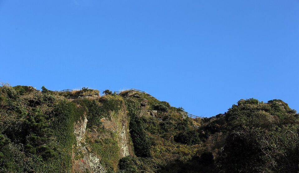
Jeju is South Korea's largest island, about 51 miles (83 km) off the southern coast, and it feels like a separate country from the mainland. The island is a volcano. Hallasan rises 6,388 ft (1,947 m) from the middle, black basalt shapes the coast, and the weather is milder than in Seoul. Most Americans come for the scenery and the slow pace: walking trails by the sea, craters you can climb at sunrise, and seafood that comes out of the water a few yards from the restaurant.
The island is about 45 miles (73 km) from east to west and 19 miles (31 km) from north to south, so it is small enough to cross in a couple of hours by road but large enough that where you sleep matters. It has a subtropical climate, with cool winters, hot and rainy summers and a windy reputation. The island is a favorite with Korean honeymooners and families, and domestic flights to it are among the busiest in the world, so it is lively in holiday periods.
This page covers the geology, the coast, the walking trails, the food, how to get there and around, which side of the island to base yourself on, and a plan for three to four days. If you are still deciding where to go in Korea, start with South Korea's destinations. If you are building a first trip, the planning page shows where Jeju fits.
The volcanic landscape
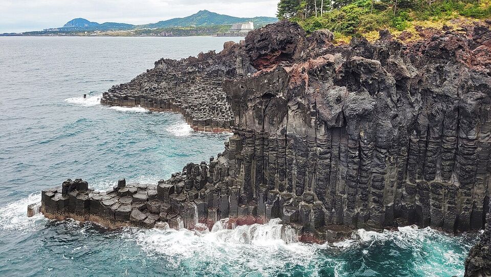
Jeju was built by volcanic eruptions that began about two million years ago, and the island is mostly basalt. UNESCO lists the Jeju Volcanic Island and Lava Tubes as a natural World Heritage Site. The listing includes Hallasan, the sunrise crater Seongsan Ilchulbong and the Geomunoreum lava tube system, which includes Manjanggul. Around the slopes sit about 360 oreum, small volcanic cones that you can climb in an hour or less, many of them with views over the island and the sea.
Hallasan
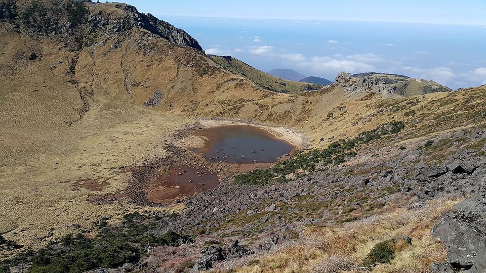
A shield volcano that is the highest mountain in South Korea. The summit crater lake is called Baengnokdam. Five trails climb it, and the lower trails reward you with forest, meadow and views without the summit effort. See the Hallasan section below for reservations and closures.
Seongsan Ilchulbong
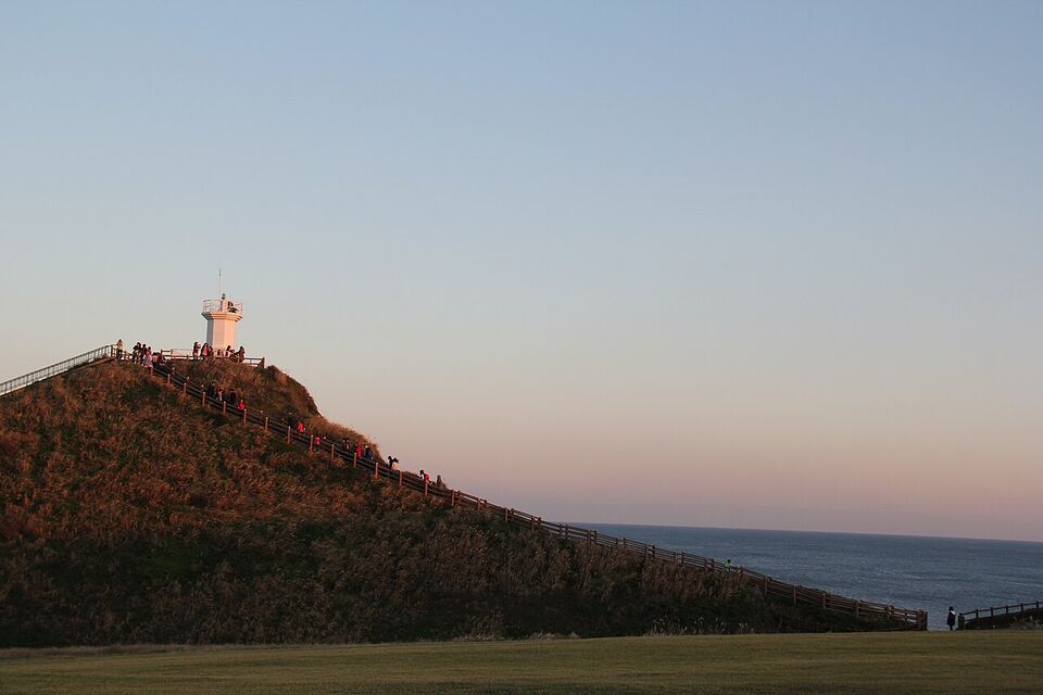
The name means "sunrise peak". It is a volcanic cone about 600 ft (182 m) high on the east coast, with a bowl-shaped crater at the top and sea cliffs on one side. It is a UNESCO site, and a popular place to watch the sunrise. Check opening hours and the sunrise rules on the official Jeju tourism site before you plan an early start.
Manjanggul lava tube
A lava tube about 5.5 miles (8.9 km) long, one of the longest in the world. Visitors enter by one entrance and can walk about 0.6 mile (1 km) in; the rest is closed. Inside you can see the largest known lava column, about 25 ft (7.6 m) high. It is cool inside year-round, so bring a jacket in summer.
Seogwipo coast
The south shore has columnar basalt cliffs at Jusangjeolli, waterfalls such as Jeongbang and Cheonjiyeon near Seogwipo, and short, easy walks. It tends to be a little warmer than Jeju City on the north coast in winter.
Check whether each sight is open on the day you go. Lava tubes, craters and cliff paths close in storms, and sometimes for maintenance. The official Jeju tourism site (VisitJeju) lists current notices, and the tourist information line is 064-740-6000 from inside Korea.
Hallasan: trails, reservations and closures
Hallasan is the one climb on Jeju that needs real planning. It is a national park, and the summit routes have controlled access. There are five trails, each with its own character.
| Trail | Length | Reaches the summit? | Notes |
|---|---|---|---|
| Gwaneumsa | 5.4 miles (8.7 km) | Yes | Starts on the north side; the section from Samgakbong to the summit needs an advance online reservation |
| Seongpanak | 6 miles (9.6 km) | Yes | The long, gradual route from the east side; check the current reservation and turnaround rules |
| Eorimok | 2.9 miles (4.7 km) | No | Shorter route to the upper slopes and meadows |
| Yeongsil | 2.3 miles (3.7 km) | No | Short, steep route to the high rock formations on the southwest |
| Donnaeko | 5.7 miles (9.1 km) | No | Forest trail on the south side; check its status before you go |
Only Gwaneumsa and Seongpanak lead to the summit. The Gwaneumsa section from Samgakbong to the Baengnokdam summit was closed from August 1, 2026 for rockfall barriers and replacement of the wooden decks. It reopened on September 24, 2026, and advance reservations on the Hallasan Trail Reservation System website started on September 21. That is the most current rule we found. Reservation systems, quotas and start times can change, so check the Hallasan National Park site (knps.or.kr) and the Jeju tourism site before you book flights around the climb.
Plan a full day for a summit hike: start early, ask the park for the current turnaround times, carry water, food, layers and a headlamp in shoulder seasons. The summit can be cold, windy and foggy even when the coast is warm. Trails can close at short notice for weather, snow or ice in winter. In winter, the upper trails may require crampons or other traction gear; ask the park office rather than assuming.
Watch out
Do not plan your whole Jeju schedule around a summit day. Reservations can be full, and wind or fog can close trails. Keep one flexible day, and have a lower-trail plan (Eorimok, Yeongsil) or a coastal walk in your pocket.
Coast, beaches and the Olle trails
The Jeju coast is the other half of the island's appeal. There are white and black sand beaches, rocky coves, tide pools and cliffs. The west coast has long, shallow beaches such as Hyeopjae and the Aewol cafe strip. The northeast has Gimnyeong and Hamdeok. The south has Jungmun and the cliffs near Seogwipo. Water is cold outside summer, and swimming season on the main beaches is mainly July and August. Check the beach's own notices, because jellyfish, rip currents and rough surf can close sections.
The Olle trails
Olle is a Jeju word for a narrow lane leading from the street to a house gate. The Jeju Olle trails are a network of marked walking routes around the coast and through the inland villages. Waymarks are blue and orange ribbons and arrows. Each route is a day walk, and you can do a piece of any one of them without committing to the whole route. The easiest way to try Olle is to pick a section near your base and walk a few hours of it, using a map from the Jeju Olle foundation or the VisitJeju site. Check the route's current status before you go, since sections change or close after storms.
Haenyeo, the diving women
Jeju is famous for its haenyeo ("sea women"), women who dive without breathing equipment to harvest shellfish, seaweed, octopus and sea urchin. UNESCO added the tradition to its Intangible Cultural Heritage list in 2016. A dive can reach about 66 ft (20 m), and a diver holds her breath for roughly one to three minutes. The divers are aging: almost 90% are over 60, and the tradition is getting smaller each year.
You can see haenyeo at work in some fishing villages, buy fresh seafood from them at small stands near the water, or visit a haenyeo museum. Treat it as a living job, not a show. Do not photograph divers without asking, keep back from the water's edge where they work, and eat at places that buy from the local cooperative. Performances and tours exist, but check with the Jeju tourism office or the museum before you travel, since schedules change with weather and season.
What to eat on Jeju
Jeju food is based on the island's seafood, pork and citrus. You will find tangerines everywhere. The fall and winter harvest fills roadside stands and gift shops, and you can buy boxes to ship. Jeju also grows a large knobby citrus called hallabong. Chocolates, teas and juices made from these fruits are common souvenirs. Check the airline's rules for carrying fruit home to the US, and see the CBP guidance on fruit before you pack any.
- Black pork (heukdwaeji): a Jeju breed, grilled at the table and eaten in lettuce wraps. It is the island's best-known meal for groups of two or more.
- Abalone porridge (jeonbok-juk) and grilled abalone: the haenyeo's catch, often served in a stone bowl.
- Fish stews and sashimi: cutlassfish, mackerel and sea bream are common. Many restaurants near the harbors serve a set of raw fish and sides.
- Noodles and snacks: gogi-guksu is a pork noodle soup; tangerine-flavored sweets and cafe drinks are everywhere.
Cards are widely accepted, but carry a little cash for roadside fruit stands and small stalls. For more on dishes and how to order, see the Korean food guide. Tipping is not customary in Korea.
How to get to Jeju
Most visitors fly. The Jeju to Seoul-Gimpo route carried over 13.7 million passengers in 2023, which made it the busiest air route in the world. Flights are about an hour and run all day. Airlines also connect Jeju with Busan (Gimhae) and other Korean cities. From the US, you fly to Seoul-Incheon first and then take a domestic flight, usually from Gimpo, which is on the AREX airport rail line and the Seoul subway. See the flights page and the Incheon airport page for the airport transfer, and plan a long layover or a separate ticket carefully.
- Domestic flights: Korean Air, Asiana (flights become Korean Air flights from December 17, 2026), Jeju Air, Jin Air, T'way, Air Busan, Air Seoul and others serve Jeju. Fares vary a lot by date, so compare them and book early for holidays and weekends. We have no confirmed fare range for 2026, so check the airline sites.
- From Busan: Flights run from Gimhae airport. Check the schedule on the airline site.
- Car ferries: Ferries carry passengers and vehicles to Jeju from several mainland ports on the south and west coasts. They are slow, usually several hours or overnight, and schedules and fares change, so check with the operator. They suit travelers who want to bring their own car, which is rare for visitors.
Different from home
A domestic flight in Korea works like a bus ride: security, a quick boarding, and a short flight with limited service. Carry your passport as photo ID, since a US driver's license may not be accepted at the check-in desk. Check the airline's ID rule.
Muan International Airport in the southwest is closed to commercial flights until late 2027, so it is not an option for Jeju trips. Jeju and Busan use other airports.
There is also a long-running plan for a second airport on the island's southeast coast, near Seongsan. It has been delayed, so do not plan around it.
Getting around: rental car, bus or taxi tour
Public transit on Jeju is better than most visitors expect, but it is still thinner than in Seoul. The sights are spread along the coast and in the interior, and buses can take much longer than a car on the same trip. Think about it in terms of how much freedom you want.
| Option | Best for | Trade-offs |
|---|---|---|
| Rental car | Couples, families and anyone who wants to stop at coast viewpoints and cafes | You need the right license, and parking can be tight at popular spots. Fuel, tolls and insurance add to the cost. |
| Public bus | Budget travelers and single-base trips along one route | Slower, with transfers. Check the route numbers and that your transit card works. |
| Taxi tour | Travelers who do not drive and want a guided day | You pay by the day or the route. Ask what is included, and agree the price in advance. |
| Ordinary taxi and ride-hail | Short hops and airport transfers | Fares add up on long trips. Drivers may not speak English, so have the address in Korean on your phone. |
Renting a car as an American
Korea drives on the right, as in the US. Bring your US driver's license and an International Driving Permit (IDP) from AAA or AATA, and confirm the requirement with the rental company before you book. Rental firms set their own age and experience rules, and they may ask for the IDP at pickup. As of November 2026, Google Maps works for transit in Korea but gives little or no walking and driving directions, so most visitors use Naver Map or KakaoMap, both with English (check before you go). Many rental cars have a built-in navigator that you can switch to English. See the driving page for road rules, tolls and parking, and the getting-around page for how buses, trains and taxis work in Korea.
Insider tip
Book your rental car before you fly, especially for weekends, holidays and the fall season. Pick up and return it at the airport to avoid a transfer. If you do not want to drive, base yourself in Jeju City or Seogwipo and use taxi tours for the far corners of the island.
Where to stay: north, south, east or west
Choose a base by the type of trip you want. You will be in the car or on the bus more than you expect, so pick a side and plan day trips around it, and avoid changing hotels every night.
| Base | Good for | Notes |
|---|---|---|
| North (Jeju City) | First trip, short stay, airport access, restaurants and shopping | The biggest town, near the airport. Has the most hotels, markets and city comforts, and the least scenery. |
| South (Seogwipo and Jungmun) | Waterfalls, cliffs, resorts and warmer winter weather | Quieter than the north. Larger resorts cluster near Jungmun. About an hour from the airport by road. |
| East (Seongsan and Gimnyeong) | Sunrise, Seongsan Ilchulbong, Manjanggul and the northeast beaches | A small-town feel with guesthouses and a few hotels. Few late-night options. |
| West (Aewol and Hallim) | Sunsets, beaches and cafes | Popular for relaxing. Places are spread out, so a car helps. |
Hotels and pensions range from $ guesthouses to $$$ resorts. Prices rise in July and August, on holiday weekends, and in fall when the weather is best, and Korea has been seeing record numbers of visitors in 2026, so book early. See the where to stay page for how Korean lodging works, including the types of room and bedding.
When to go and what the weather does
Jeju has four seasons, and each has trade-offs. Spring brings canola flowers and mild air. Summer is hot and humid with heavy rain, and typhoons are most likely from July to September, peaking in August, hitting Jeju and the south coast most often. Fall is clear and comfortable. Winter is cool, with strong winds, and snow on Hallasan. For reference, Jeju City averages a high of 61.5°F (16.4°C) and a low of 50.7°F (10.4°C) in November, and a high of 47.5°F (8.6°C) and a low of 38.7°F (3.7°C) in January, with about 12 rainy days in January.
- April-June: comfortable, with long days. Busy on weekends and holidays.
- July-August: beach season, but hot, wet and crowded. Typhoon risk begins to rise.
- September-November: clear days, mild weather, and tangerine harvest in the fall. Typhoon risk drops by October.
- December-March: mild compared with Seoul, but windy. Fewer crowds. Check flight, ferry and trail conditions.
For a month-by-month view, see when to go and the seasons page. For forecasts, use the Korea Meteorological Administration (kma.go.kr), and check the Korea Tourism Organization for blossom and flower dates, which move from year to year.
A plan for three to four days
This plan assumes you rent a car and stay in two places, one on each side of the island, so you drive less each day. It works with a taxi tour if you swap the driving for a guided day. If your flight arrives late on Day 1, shift everything one day.
- Day 1
Arrive and settle in Jeju City
Pick up the car, check in and walk a market or the harbor for a first meal of black pork or fish. Keep the first evening light, especially if you flew in from the US the same week.
- Day 2
East side: crater, caves and coast
Climb Seongsan Ilchulbong in the morning. Visit Manjanggul on the way or on the way back. Add a coastal walk or an Olle section near Seongsan or Gimnyeong. Check the cave's hours and the crater's closing rules on the official site.
- Day 3
Hallasan or the south coast
If you have a reservation and the weather is clear, take a Hallasan trail. If not, take a lower trail such as Eorimok or Yeongsil, or drive the south coast to the waterfalls and cliffs at Seogwipo and Jungmun. Sleep in Seogwipo or move west.
- Day 4
West coast and departure
Spend the morning on a west coast beach or a cafe, visit a haenyeo village or museum, then drive to the airport. Allow extra time for the car return and security, and leave room in case of wind or fog delays.
With only three days, skip the west or the south and keep two bases. With five days, add a second Olle walk, a small island such as Udo off the east coast (check the ferry schedule), or a slow day at a beach.
Mistakes to avoid on Jeju
Watch out
Flights and ferries get canceled in bad weather. Strong wind, fog and typhoons can cancel flights and ferries, especially in summer and winter. Do not schedule an international departure for the same day as your return from Jeju. Leave a buffer of a night, or at least several hours, and check your airline's rebooking rules.
- Forgetting the summit rules. Hallasan summit access can need a reservation, and trails can close for repairs, weather or ice. Check before you book hotels around the climb.
- Trying to see the whole island in two days. The island is bigger than it looks on a map. Pick one or two sides.
- Booking the rental car late. Cars sell out on weekends, holidays and in fall. Book ahead and confirm that your US license and IDP are enough.
- Leaving the airport without a plan for fuel and parking. Get a navigation app set up before you drive, and ask the rental desk how toll and parking fees work.
- Swimming off-season or beyond the flags. Currents and cold water are real hazards. Follow the lifeguards and local notices.
- Treating haenyeo as a photo stop. See above. Be respectful.
For emergencies in Korea, dial 112 for police and 119 for fire and ambulance. The 1330 Korea Travel Helpline gives English-language help 24 hours a day. See the safety page and the entry page for the latest on entry rules, and the hiking page for how Korean trail systems work.
Add it to a route in the trip builder, or ask us to plan the hotels, trains and guides for you.