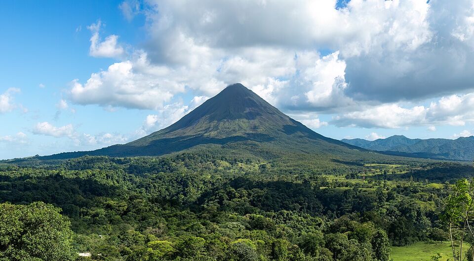
How Costa Rica divides up
Costa Rica is small on a map and large on the road. A mountain range runs down its middle, so almost every trip between regions means climbing, descending and slowing down for trucks. The practical way to plan is to treat each region as a base of two to four nights and the drives between them as part of the day.
This guide groups the country into eight regions: San José and the Central Valley, the Arenal area around La Fortuna, Monteverde, Guanacaste, the Nicoya Peninsula, the Central and South Pacific (Manuel Antonio, Uvita and Dominical), the Osa Peninsula and the Caribbean coast with Tortuguero. The map above shows where each sits. Below you will find who each region suits, how long it takes to reach each from the two airports, how the seasons differ, and ways to combine regions in a week or two.
Two things shape every itinerary. First, the seasons run opposite on the two coasts for part of the year, so the "best time" depends on where you are going. Second, a handful of national park rules changed in 2026 (volcano visitor limits, closed trails, online-only tickets), and we flag them where they affect a region.
The regions compared
Use this table to narrow the field, then open the regional page. "Drive" times are averages for the road without stops, taken from a tourism drive-time table. They are a starting point, not a promise.
| Region | Known for | Best suits | From SJO (average drive) | From LIR (average drive) |
|---|---|---|---|---|
| San José and the Central Valley | Museums, markets, volcano craters, coffee farms | Arrival and departure days, culture, short day trips | Poás, Irazú and Sarchí about 1 hour; Turrialba about 2 hours | About 3 hours to San José |
| Arenal and La Fortuna | Volcano views, hot springs, waterfall, hanging bridges | First-timers, families, active travelers | About 2.5 hours | About 3.25 hours |
| Monteverde | Cloud forest reserves, night walks, canopy tours | Birders, hikers, nature-first travelers | About 3.5 hours (the last stretch is steep and slow) | About 2.5 hours |
| Guanacaste | Dry climate, wide beaches, resorts, Rincón de la Vieja | Beach weeks, resorts, families, dry-season sun | About 3 hours to Liberia; Tamarindo about 4.5 hours | Tamarindo about 1 hour |
| Nicoya Peninsula | Surf towns, yoga, small beaches, long dirt roads | Surfers, longer stays, quiet beach time | Nosara about 5 hours; Sámara about 4 hours; Santa Teresa about 5 hours | Sámara about 2.75 hours |
| Central and South Pacific | Manuel Antonio park, Uvita, Dominical, whale watching, surf | Beach and wildlife in one place, couples, families | Manuel Antonio about 3 hours; Dominical about 4 hours; Uvita about 5 hours | Manuel Antonio about 5 hours |
| Osa Peninsula | Corcovado, Drake Bay, remote lodges | Wildlife-focused travelers who accept effort and cost | A long day by road; many people fly | A long day; most go via SJO or by air |
| Caribbean coast | Tortuguero canals, Cahuita, Puerto Viejo, Afro-Caribbean food and culture | Wildlife, a different feel from the Pacific, travelers who want rain-forest coast | Limón about 3 hours; Cahuita about 4 hours; Puerto Viejo about 4.5 hours | Not practical; fly or drive via San José |
Río Celeste and Tenorio Volcano National Park sit between Arenal and Guanacaste, which makes them an easy stop when you cross between those regions. See our Río Celeste guide.
Region by region: who it suits
San José and the Central Valley
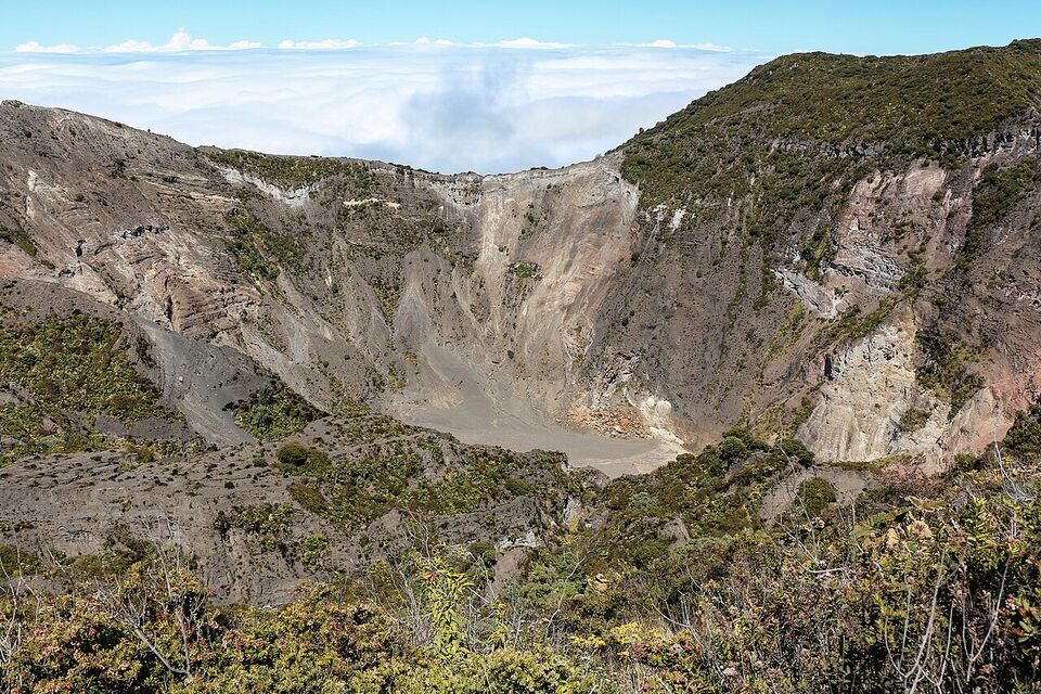
Most trips start and end here, so use it. The capital has the gold museum and the National Theatre, and the valley around it holds Poás, Irazú, coffee farms and the oxcart town of Sarchí. It suits travelers with a spare day on arrival or departure. See San José and the Central Valley.
Arenal and La Fortuna
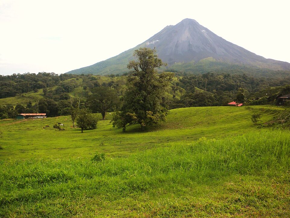
The classic first stop: the town of La Fortuna sits below Arenal Volcano, with a waterfall, hot springs and plenty of tours. Families and first-timers like it because the logistics are easy and the activities are close together. See Arenal.
Monteverde
A mountain town at high elevation, cool and often misty. It rewards a guided walk or a night walk more than a beach-style holiday. Reserve entries are timed, so book ahead. See Monteverde.
Guanacaste and Tamarindo
The driest part of the country, with the most reliable dry-season beach weather and the closest airport to the sand. It suits a beach-focused week, resort stays and surf lessons. See Guanacaste and Tamarindo.
Nicoya Peninsula
Nosara, Sámara, Santa Teresa and Montezuma are quieter and more spread out than Tamarindo. Roads into some towns are rough, and the ferry from Puntarenas is an alternative to the long drive. See Nicoya Peninsula.
Manuel Antonio, Uvita and Dominical
Manuel Antonio puts a small, popular national park next to hotels and restaurants. South of it, Uvita and Dominical are quieter, with Marino Ballena National Park and surf. See Manuel Antonio and Uvita and Dominical.
Osa Peninsula
The most remote and wildlife-rich corner, and the most expensive per day. Every visitor to Corcovado must go with a certified guide, and capacity rules have been changing, so plan this with a lodge or agency. See Osa Peninsula.
Caribbean coast and Tortuguero
A different Costa Rica: slower, wetter, with its own food and music. Tortuguero is reached by boat or small plane, and the southern coast (Cahuita, Puerto Viejo) by road. See Caribbean coast and Tortuguero.
Getting there: the two airports
Costa Rica has two international airports that matter for visitors. Juan Santamaría International Airport (SJO) is about 12 miles (20 km) northwest of downtown San José, in Alajuela province. Daniel Oduber Quirós International Airport (LIR) is about 7 miles (11 km) west-southwest of the city of Liberia. Liberia handles flights only from 6 a.m. to 9 p.m. as of November 2026, so a late arrival or an early departure may force a different plan.
Pick the airport by the first and last regions, not by price alone. SJO is the better gateway for the Central Valley, Arenal, Manuel Antonio, the south and the Caribbean. LIR is the better gateway for Guanacaste and the northern Nicoya beaches, and it is also close to Rincón de la Vieja and, by road, to Monteverde.
Insider tip
Consider flying into one airport and out of the other (an "open-jaw" ticket). Arriving at SJO and leaving from LIR after a loop through Arenal, Monteverde and the beaches saves a full day of backtracking. If you rent a car, ask the rental company about one-way drop-off fees before you book. Our flights and airports page covers the airlines and new routes for winter 2026-27.
Drive times at a glance
These are average drive times without stops, from the same tourism table. Roads can be slow behind trucks, narrow in the mountains and affected by rain, so add up to an hour on any leg and avoid planning a connection tight to a flight or tour. Costa Rica has no daylight saving time, so the day length barely changes through the year and darkness comes early, around the same hour in every season.
| Route | Average drive | Note |
|---|---|---|
| San José to Arenal (La Fortuna) | About 2.5 hours | Paved; mountain road with curves |
| San José to Monteverde | About 3.5 hours | Last part is steep and winding |
| Arenal to Monteverde | About 3 hours by road; about 3 hours by boat and shuttle | The boat-and-shuttle route crosses Lake Arenal |
| San José to Manuel Antonio | About 3 hours | Traffic builds on weekends |
| Manuel Antonio to Dominical | About 1 hour | Coastal highway |
| San José to Uvita | About 5 hours | Long day; stop for lunch |
| Manuel Antonio to Puerto Jiménez (Osa) | About 5.5 hours | Many travelers fly instead |
| San José to Liberia | About 3 hours | Highway to the north |
| Liberia to Tamarindo | About 1 hour | Paved |
| San José to Nosara | About 5 hours | The last 5 to 10 km into the beach area are unpaved |
| San José to Puerto Viejo de Talamanca | About 4.5 hours | Via Limón on the Caribbean side |
| San José to Sixaola (Panama border) | About 5.5 hours | Long, flat, rainy |
Tortuguero is the exception: there are no roads. You drive roughly 2.5 to 3 hours from San José to the La Pavona boat dock, then take a boat for roughly 1 to 1.5 hours, or fly on a small plane. Confirm times with your lodge. Domestic airline Sansa also flies to Drake Bay, Puerto Jiménez, Quepos, Tamarindo, La Fortuna and other towns, which can turn a full day of driving into a short flight. For driving in general, read driving in Costa Rica and car rental; for shuttles, buses and flights, see getting around.
Watch out
Rain, roadworks and landslides change a trip fast. Sunday evening traffic back toward San José is often slow. Check the road before you leave, and do not drive unlit mountain roads after dark if you can avoid it.
Rainfall and seasons by region
Costa Rica has two main seasons on the Pacific side: a dry season from December to March (with April as a transition) and a rainy or "green" season from May to October. November is a transition month, and it is a good one for fewer crowds. Rain on the Pacific usually falls in the afternoon and early evening, so mornings are often clear even in the wet months. September and October are the rainiest, and there is a short dip in rain in July and August known as the veranillo ("little summer").
The Caribbean side has no real dry season. Even its driest months get roughly 4 to 8 inches (100 to 200 mm) of rain. It tends to be drier in February-March and September-October, and wetter from November to January (December is the wettest) and from May to August (July peaks). Caribbean rain often falls overnight and in the morning, so days can still be bright. That is why a September beach trip to Puerto Viejo can work when the Pacific is soaked.
The table below uses long-term station averages from published climate tables for two places, so treat it as a rough guide. We found no reliable published figures for Guanacaste, Manuel Antonio or Arenal, so for those use the seasonal pattern above and the regional pages.
| Place | Driest months | Wettest months | Yearly rain |
|---|---|---|---|
| San José (airport) | January to March: under 0.6 in (15 mm) a month | September and October: about 13 to 14 in (330 to 355 mm) a month | About 78 in (1,970 mm) |
| Limón (Caribbean lowlands) | February and March: about 7.6 to 7.9 in (190 to 200 mm) a month | July and December: about 16 in (400 to 410 mm) a month | About 133 in (3,380 mm) |
San José is high enough to be mild all year: afternoon highs of about 81 to 86°F (27 to 30°C) and lows of about 65 to 67°F (18 to 19°C) at the airport, a little cooler downtown. Guanacaste is hotter. Monteverde and the volcano summits are cool and often cloudy: bring a jacket in every month.
Different from home
There is no spring and fall here, and the "rainy season" does not mean a washout. Plan outdoor activities for the morning and keep afternoons flexible. Costa Rica sits at UTC-6 all year, one hour behind New York from November to March and two hours behind from March to November.
El Niño and the 2026-27 dry season
As of November 12, 2026, authorities had raised the national alert to red because of El Niño, which the national weather institute calls the most intense since 1888. Forecasts from June called for up to 50 percent less rain than normal and warmer weather in the North Pacific (Guanacaste), and for the Caribbean and the north to be wetter than usual. The water utility says more than 306,000 people could have trouble getting drinking water this dry season, about 48 percent of them in Guanacaste. For visitors that means possible water rationing in Guanacaste and on the Central Pacific, a higher wildfire risk and very dry, dusty beaches. It does not mean the beaches are closed, but ask your hotel about water supply before you book. See when to go for the month-by-month picture.
What has changed in 2026 for travelers
Several rules and closures affect how you plan a region. Check each on the official page before you go.
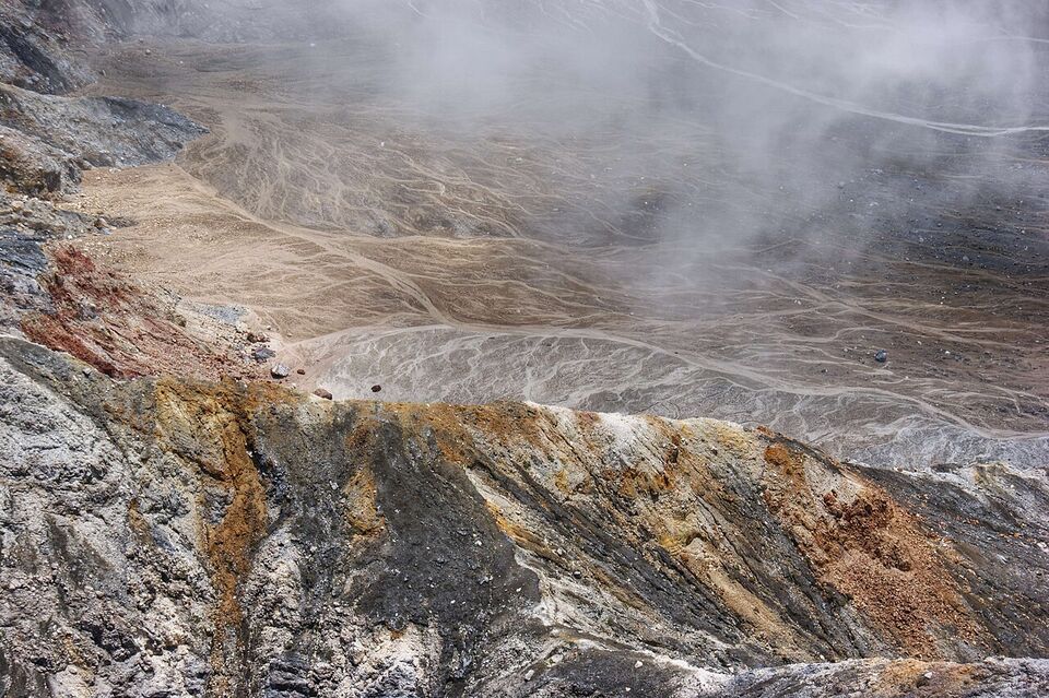
- Poás Volcano: open as of November 12, 2026, but with a limit of 1,064 visitors a day and helmets required on the main trails since August 28. See the Central Valley page.
- Park tickets: many parks, including Poás, Irazú, Manuel Antonio and Tenorio (Río Celeste), sell timed tickets online through the SINAC system, with cards only at the gate.
- Manuel Antonio: closed on Tuesdays, with online tickets only.
- Monteverde Cloud Forest Preserve: timed online entry since March 2026.
- Corcovado: a certified guide is required for every visitor, and daily capacity limits have changed several times this year.
- Marino Ballena: the Piñuela sector closed on November 9, 2026 for about six months; the Uvita, Colonia and Ballena sectors stay open.
- Rincón de la Vieja: the active crater trail is closed, and the Las Pailas sector is open Tuesday to Sunday.
Our national parks guide has the booking steps for all of these.
Combining regions in a week or two
The most common mistake is trying to see everything. A good rule is one base per two to three nights, and no more than three or four bases in a trip. The three outlines below are starting points, not schedules. Our trip planning page has more route ideas, and the trip builder helps you test the timing.
- One week, north loop
Arenal, Monteverde, Guanacaste
Fly into SJO and drive or shuttle to La Fortuna for three nights (about 2.5 hours). Cross to Monteverde for two nights by road or by the boat-and-shuttle route across Lake Arenal (about 3 hours). Finish with two nights on a Guanacaste beach and fly out of Liberia, about 2.5 hours from Monteverde. This route works well in the dry season, and a Río Celeste stop fits between Arenal and Guanacaste.
- One week, Pacific
San José, Manuel Antonio, Uvita
Spend one night in San José or Alajuela after you land, then travel about 3 hours to Manuel Antonio for three nights. Continue south for two nights near Uvita or Dominical (about 1 hour to Dominical), and plan a long drive back to SJO of about 4 to 5 hours. It is a beach-and-wildlife week with less driving than the north loop.
- Two weeks
Four bases, one big loop
Start with a night in San José and one day trip to the volcanoes. Continue to La Fortuna (3 nights) and Monteverde (2 nights), then Guanacaste or the Nicoya Peninsula (4 nights). Spend the last days at Manuel Antonio (3 nights), then return to SJO or fly home. If you want Osa or the Caribbean, drop one of these bases rather than adding a fifth.
Save money
Shared shuttles between popular stops run roughly US$40 to US$70 per person, and private transfers roughly US$200 to US$400 per vehicle, according to travel-cost blogs and shuttle booking pages. Flying a short domestic hop costs more but saves a day. Compare the cost of a rental car, plus mandatory insurance, against shuttles for your specific route.
Practical tips for every region
- Money: US dollars are widely accepted for tourist services, and the local currency is the colón. This guide uses a rate of ₡445 to US$1, and restaurant bills usually add 13 percent tax and a 10 percent service charge. See money.
- Safety: the State Department rates Costa Rica Level 2, "exercise increased caution," mainly for petty crime. Keep valuables out of sight in rental cars. See safety.
- Book ahead for: Christmas and New Year hotels, Manuel Antonio and Poás tickets, Monteverde night walks, Corcovado, and rental cars in the dry season.
- Where to sleep: see where to stay for how to choose between hotels, lodges and rentals in each area.
- Wildlife and activities: our wildlife and adventure guides help match a region to what you want to see and do.
Pick your first and last region, then fit the middle around the driving time. When two regions look about the same on the map, choose the one that is easier to reach from your airport.
Add it to a route in the trip builder, or ask us to plan the hotels, transfers and guides for you.