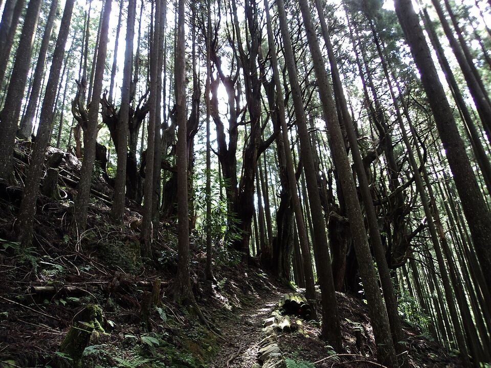
Overview: hiking and the outdoors in Japan
About two-thirds of Japan is mountain and forest, and the country has well-marked trails, reliable transport to trailheads and, in most places, a bed and a hot meal at the end of the day. The challenge for Americans is not finding a trail but matching the season, the booking system and the hazards to your plans. Spring and autumn suit the lowland pilgrim trails, summer suits the high Alps, and many popular routes need reservations for lodging or permits.
This page covers the walking and cycling routes visitors ask about most, how to book huts and inns, beach and dive basics, and the safety issues that matter in 2026: bears, heat, typhoons and mountain weather. For skiing, see Skiing in Japan. For Mount Fuji, which has its own fees and rules, see Mount Fuji. For the national parks in Hokkaido and the north, see Hokkaido and Tohoku.
Different from home
Japanese trails often run through villages, past shrines and between inns, so you may not need a tent or a stove. Do carry your own trash out, and expect to pay for toilets at huts. Hikers also file a climbing plan (tozan todoke) for many mountains, and rescue services expect it.
Kumano Kodo: the Nakahechi route
The Kumano Kodo is a network of pilgrimage routes on the Kii Peninsula in Wakayama Prefecture, part of a UNESCO World Heritage listing, and the Nakahechi is the one most visitors walk. It leads through cedar forest and small villages to three grand shrines: Hongu Taisha, Hayatama Taisha in Shingu and Nachi Taisha. Together with Spain's Camino de Santiago it forms the "Dual Pilgrim" program, which offers a pilgrim stamp book.
A typical route
Most walkers start at Takijiri-oji, a bus ride of about 40 minutes from Kii-Tanabe Station, and walk to Hongu Taisha, about 24 miles (38 km) away in three or four days. Short itineraries use buses to skip sections. The days are physically demanding because of the up and down terrain (hills, steps and stone paths), but not technical. Typical overnight stops include Takahara, Chikatsuyu, Hosshinmon-oji, and the Yunomine or Kawayu hot spring villages. Bring rain gear, since wet stone is slippery.
Booking lodging
The Tanabe City Kumano Tourism Bureau runs an English booking system, Kumano Travel. Reservations are a two-part process: submit a request, then pay to finalize it, and availability is not secured until staff confirm with the inn. Book about six months ahead for peak seasons in spring and fall. Reservations close 20 days before check-in. Packages by number of days and difficulty level cannot be modified, and changing dates means cancelling and requesting again. Many places are traditional inns and family guesthouses (minshuku), and dietary requests are harder to meet in the smaller ones, so say what you need when you book. A night with dinner and breakfast typically falls in the $ to $$ range, but check the current rates on the site.
Luggage
You can send your suitcase ahead between inns booked through Kumano Travel, and the daily luggage shuttle must be booked at least 20 days in advance. Same-day booking is not possible once you arrive in Tanabe. Alternatively, ship a bag with Yamato (takkyubin) or Japan Post's Yu-Pack from a convenience store at Kii-Tanabe Station, at roughly ¥940 to ¥2,510 (about $6 to $16) depending on size; prices may change. You can store a bag in Tanabe for ¥500 (about $3) a day at the tourist information center, or use station lockers at ¥400 to ¥700 (about $3 to $4) a day, with a three-day limit. Keep your day pack light.
Insider tip
The same route can be done in a long weekend if you take the bus to Hosshinmon-oji and walk the final stretch to Hongu Taisha (about 4 miles, or 7 km, and roughly 3 to 4 hours; check current trail conditions). Start there if you only have one or two days. Walking the full pilgrimage is more satisfying but needs the six-month booking.
The Nakasendo and the Kiso Valley
The Nakasendo was a mountain road linking Edo and Kyoto in the Edo period, and the best-preserved stretch runs between the post towns of Magome and Tsumago in Nagano Prefecture. The walk is about 5 miles (8 km) and takes roughly 3 hours at an easy pace, with some climbing at the Magome end and bear bells at points along the path. From Nakatsugawa Station on the JR Chuo Line, a local bus reaches Magome in about 25 to 30 minutes, and Nagiso Station is near Tsumago. Many walkers go from Magome to Tsumago because it is mostly downhill.
You can have your bag forwarded between the two towns for a small fee, and the tourist information offices at both ends help with this (the price is typically around ¥1,000 a bag, but we did not confirm it for 2026). A bus links the two towns, but only a few run each day, so check the timetable before you set out. Longer options continue to Narai-juku and Kiso-Fukushima. The hiking season runs from April to November; midsummer is hot and humid, and snow can close sections in winter. See The Japanese Alps and Day Trips from Tokyo for how this fits with Nagoya, Matsumoto and Takayama.
Yakushima
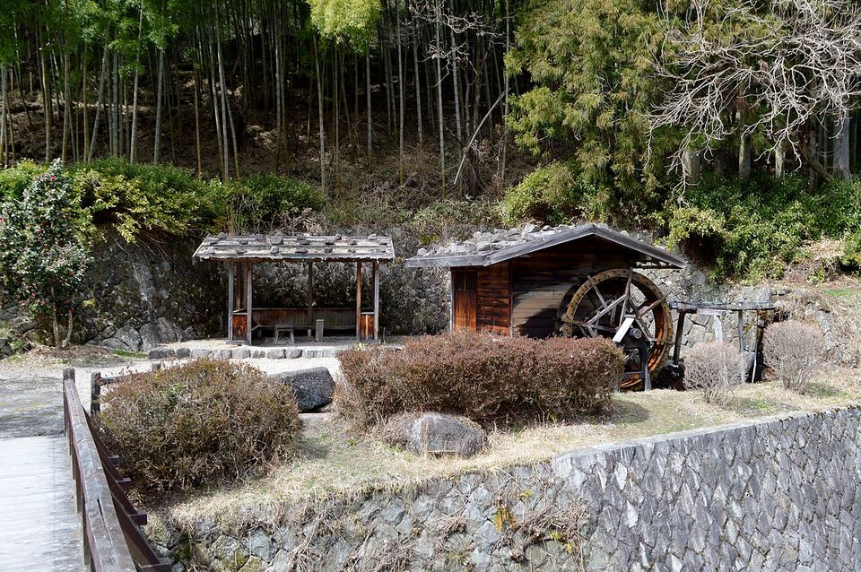
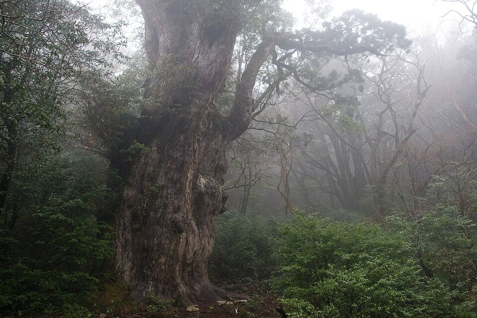
Yakushima, a mountainous island south of Kyushu, is a UNESCO site known for its ancient cedars. The Jomon Sugi day hike is about 14 miles (22 km) round trip from the Arakawa trailhead and takes 9 to 12 hours, with a shuttle bus to the trailhead (reported at roughly ¥1,400 to ¥2,000, or about $9 to $13, round trip; confirm the fare locally) and a ¥1,000 (about $6) mountain conservation contribution. In autumn 2026 the trail council recommended going with a guide because of storm damage after a September typhoon, and some toilets and the Shiratani Unsuikyo walk were out of service. Check conditions with your lodging before you go. Full details, ferry options and the weather are on Kyushu.
The Japanese Alps and hut season
The Northern Alps (Hida Mountains) hold the country's classic high-altitude routes: Kamikochi, the Yarigatake and Hotaka ridges, and Tateyama. The snow-free season is short. Most huts open between late April and early July and close in early November, with the high ridges usually clear from July to the end of September. In 2026, Yarigatake Sanso, Karasawa-goya and Hotakadake Sanso ran from April 27 to November 3, and Minamidake-goya from July 11 to October 11; dates for 2027 are normally published in winter, so check each hut's website.
How the huts work
- Reserve each hut directly. There is no central booking system. Hut companies open reservations in late winter or spring. Some huts take bookings through English-friendly platforms, so check each hut's own page.
- Prices: about ¥13,000 to ¥15,000 (about $83 to $96) per night with dinner and breakfast, and about ¥9,000 (about $57) for a bed alone, where offered. Private rooms cost extra.
- Arrive by 4 p.m. Dinner is at 5 or 6 p.m., lights go out around 8:30 p.m. and breakfast is before 5:30 a.m. Phone the hut if you will be late.
- Cancellation fees commonly start about a week out: roughly 20 percent at 7 to 3 days, 50 percent at 2 days, 100 percent on the day. Check each hut's terms.
- Bring cash, including some ¥10,000 notes; many huts take no cards. Budget ¥30,000 to ¥50,000 (about $190 to $320) for a three-day traverse. Bring a sleeping bag liner.
- Carry out all trash. Huts have no bins for hikers' waste.
Kamikochi is a car-free valley reached by bus or taxi from Matsumoto (the nearest bases are Shinshimashima station and the bus terminal at Matsumoto). A flat riverside walk of a few hours is a good first step before you commit to a ridge. Fuji is a separate case: in 2026 the climbing season ran from July 1 or 10 to September 10, with a ¥4,000 (about $25) fee, so see Mount Fuji for the details.
Cycling the Shimanami Kaido
The Shimanami Kaido is a 43-mile (70 km) route across six islands and nine bridges in the Seto Inland Sea, linking Onomichi in Hiroshima Prefecture with Imabari in Ehime. A blue line on the pavement marks the way, and the dedicated bicycle lanes keep you away from most traffic. Experienced riders can finish in about 4 hours; most people need 6 to 10 hours with stops, or break it into two days with a night in Omishima or Oshima.
Renting a bike
There are 10 rental terminals, five on the Onomichi side and five on the Imabari side. Rentals are by the calendar day. A cross bike costs ¥3,000 (about $19) for an adult and ¥1,000 for a child. Electric bikes cost more; the official rental site listed ¥8,000 (about $51) for an e-bike with a limited number available, which often sell out first. You can pick up at one terminal and drop at any other, which makes a one-way ride possible. Terminals open from 8 a.m. to 7 p.m. at the main stations (6 p.m. from December to February) and 9 a.m. to 5 p.m. at the others. Late returns carry a fee. Reservations are optional but wise in spring, autumn, Golden Week and Obon, and same-day bikes are first come, first served.
Practical points
- Ride on the left. Since April 1, 2026, police can issue on-the-spot "blue ticket" fines to cyclists, for example ¥12,000 for phone use while riding.
- Alcohol and cycling do not mix: the limit is 0.03 percent, with penalties of up to three years or ¥500,000.
- Bring water, sun protection and a rain jacket. The bridges are exposed to wind.
- Check ferry times for shortcuts between islands, and note that a typhoon can stop all ferries and close the bridges' cycling lanes.
Onomichi is about 1 hour 30 minutes from Hiroshima by train and Imabari is reached from Matsuyama; see Hiroshima and Miyajima and Shikoku for the surrounding region.
Oirase Gorge and the north
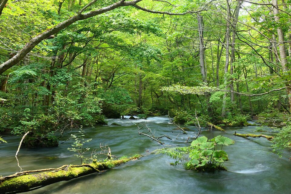
The Oirase Stream in Aomori Prefecture, part of Towada-Hachimantai National Park, is a gentle walk of about 9 miles (14 km) from Nenokuchi to Yakeyama near Lake Towada, taking around 4 hours on a flat path beside waterfalls and moss-covered rocks. It is best in autumn, when the leaves usually peak in late October, and is also popular in May and June for fresh green. Access is by seasonal bus from Aomori or Hachinohe, and winter closes the road. Buses are the main way back, so check the timetable before starting.
The area is near the Hakkoda Mountains, where a fatal bear attack in June 2026 led to trail closures until August 1. Check closures with the local tourist office, hike in daylight in groups, and carry a bell. Tohoku also has hot spring villages worth combining with the walk; see Tohoku and Onsen and Hot Springs.
Beaches, diving and kayaking
For beaches and reefs, Okinawa is the best choice (see Okinawa). The Kerama Islands, Ishigaki's reefs and manta sites, and the Blue Cave near Cape Maeda on the main island are the best-known dive and snorkel spots. A certified diver should bring a card from a recognized agency such as PADI, and a first-timer can take an introductory dive with a licensed operator; a one-dive guided trip commonly costs roughly ¥8,000 to ¥12,000 (about $51 to $76), though prices vary by site and season. Look for operators that give a safety briefing in English and carry oxygen.
Swim at lifeguarded beaches within the nets. From roughly April to October box jellyfish and other stinging species enter Okinawan waters, and on the mainland, jellyfish increase after the Obon holiday in mid-August, when many beaches end their official swimming season. Do not touch sea snakes or cone shells. Rip currents occur on Pacific beaches, and typhoon swells arrive days before the storm. On the mainland, beaches near Kamakura and Shonan are popular but crowded in July and August, and the Izu Peninsula and Shirahama (Wakayama) have clearer water.
Sea kayaking and canoeing tours operate in Iriomote, the Seto Inland Sea and the lakes of Hokkaido. On Iriomote, Okinawa Prefecture has been bringing in guide requirements and daily visitor limits for protected sites, so book an authorized local operator and check the current rules (see Okinawa).
National parks
Japan has more than 30 national parks, from the subtropical Yambaru and Iriomote areas to the sub-Arctic Shiretoko and Daisetsuzan in Hokkaido. Entry to most is free, though some areas charge for parking, shuttle buses or access fees. Parks are not wilderness reserves: they include villages, roads, farms and hot spring towns, so you can mix walking with comfortable lodging. Parks worth considering include Fuji-Hakone-Izu, Nikko, Chubu-Sangaku (the Northern Alps), Setonaikai, Towada-Hachimantai, Daisetsuzan and Shiretoko. The Japan National Tourism Organization has an overview page for each (japan.travel/national-parks).
Hokkaido has brown bears, and in Shiretoko, special rules apply to walks near the Five Lakes, including guided-tour requirements in some seasons. Check the park's current guidance before you go.
Mountain safety, bears, heat and typhoons
Plan and sign in
Weather in the mountains turns quickly, and even popular trails have fatal accidents each year. File a climbing plan where required (many prefectures accept it online) and leave your itinerary with your inn. Carry a headlamp, rain gear, a map or offline map, a first-aid kit, extra food and a charged battery pack. Mobile coverage is patchy in valleys. Buy travel insurance that covers hiking and rescue, because search-and-rescue costs can be charged in some cases (see Health in Japan). In an emergency call 110 or 119, and for non-emergency information the JNTO Visitor Hotline is 050-3816-2787 (24 hours, in English).
Bears
Bears are a real hazard in 2026. Japan recorded 50,801 sightings in fiscal 2025 (preliminary figures), the most since records began in 2009, and 12,628 sightings from April to June 2026, at least 5,000 more than the same period a year earlier. A man died in a June 2026 attack in the Hakkoda Mountains in Aomori, two people were injured at Shomyo Falls in Tateyama in May, and Aomori's trails were closed for about a month before reopening on August 1.
- Check trail closures and recent sighting reports with the local tourist office or prefecture before you go.
- Hike in daylight, avoid dawn and dusk in forests, and travel in groups in Tohoku, Hokkaido and Nagano.
- Carry a bear bell; bear spray is sold in outdoor shops in Japan, but you cannot take it on a plane.
- Keep food sealed and do not leave food waste.
- If you see a bear, do not run; back away slowly and speak calmly.
Heat and typhoons
July and August are hot and humid, and heatstroke warnings are common. Start early, carry more water than seems necessary, take salt or electrolyte drinks (vending machines sell them) and rest in shade. Typhoon season runs roughly June to October and peaks in August and September. A typhoon can close trails, ferries and trains for one to three days, and rivers rise quickly. Do not hike when a typhoon is forecast within a few days, and leave a spare day before an international flight. See Safety in Japan and When to Go to Japan.
Watch out
Do not rely on a fixed itinerary in autumn 2026. Storm damage on Yakushima, volcano alerts on Aso and Sakurajima and bear closures in Tohoku have all forced route changes this year. Check the latest conditions the week before.
What to pack
Bring waterproof hiking shoes with good tread, quick-dry layers, a rain jacket and pants, a hat, sunscreen and insect repellent (leeches can be present on Kii and Yakushima trails in wet weather). Cash is essential in mountain areas. A small towel is useful for hut stays and hot springs; see Packing Checklist and Etiquette.
Add it to a route in the trip builder, or ask us to plan the hotels, trains and guides for you.